
Deb and I did a 6-day backpack into the Maze District of Canyonlands National Park May 9/14. Very cool place. We didn’t see any other people for the first three days, then only several others the rest of the time. The Maze is a very remote area accessible mainly by foot. There is a road that gets you into the heart of the area but is limited by number and for experienced 4×4 drivers only.
We decided to access the area by boat…
Day one…caught a jet boat at the Potash boat landing just outside Moab, UT. The boat picked us up at about 8:30am and dropped us off 2-hours later down the Colorado River at Spanish Bottom. This backpack started with full packs (water and food) with a 1200’ climb in a mile out of the Colorado drainage…Ugh! The scenery made up for it though… 2.5 miles into the route we found the Bear Panel pictographs, a really cool wall with ancient rock art. Our original plans were to camp near Clell’s Seep, a known water source…although when we got there we found the water was barely fit for filtering. Tired and a bit disappointed we knew there was water two more miles at Lou’s Spring. Sure enough, Lou’s Spring had some of the best water of the trip. We set up camp, filtered water, ate dinner, and went to bed…Day one: 10.2-miles
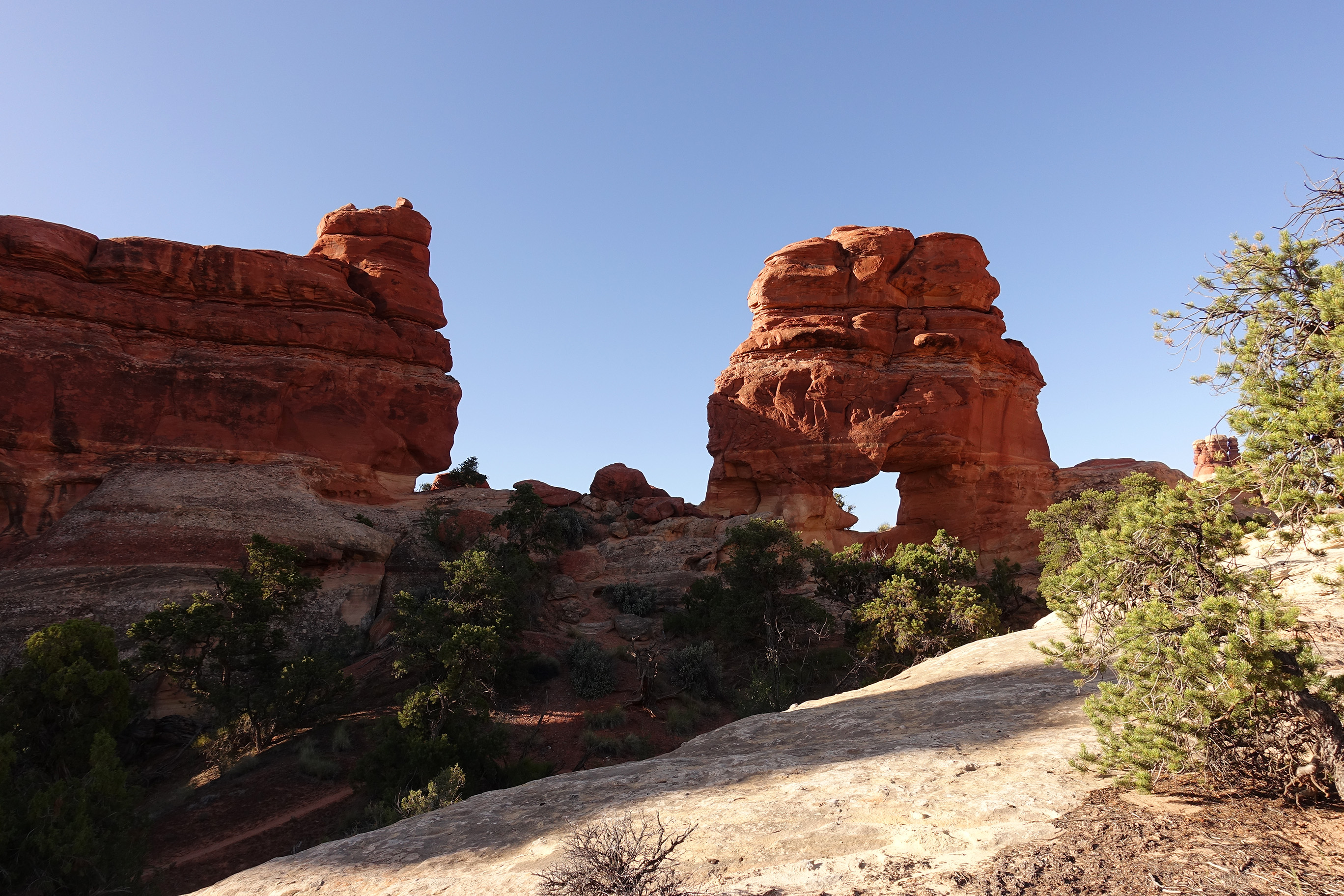
Day two…we originally planned on spending this day exploring The Fins, an area with many free-standing sandstone walls. Unfortunately after getting a taste of how big this place really was on day one…we decided to head up an unnamed canyon to see the Whitmore Arch. After spending time at the arch we continued up the canyon via ledges and slickrock slabs high above the canyon floor. Lots of scrambling. Fun Shit! Day two: 5.75-miles off trail.
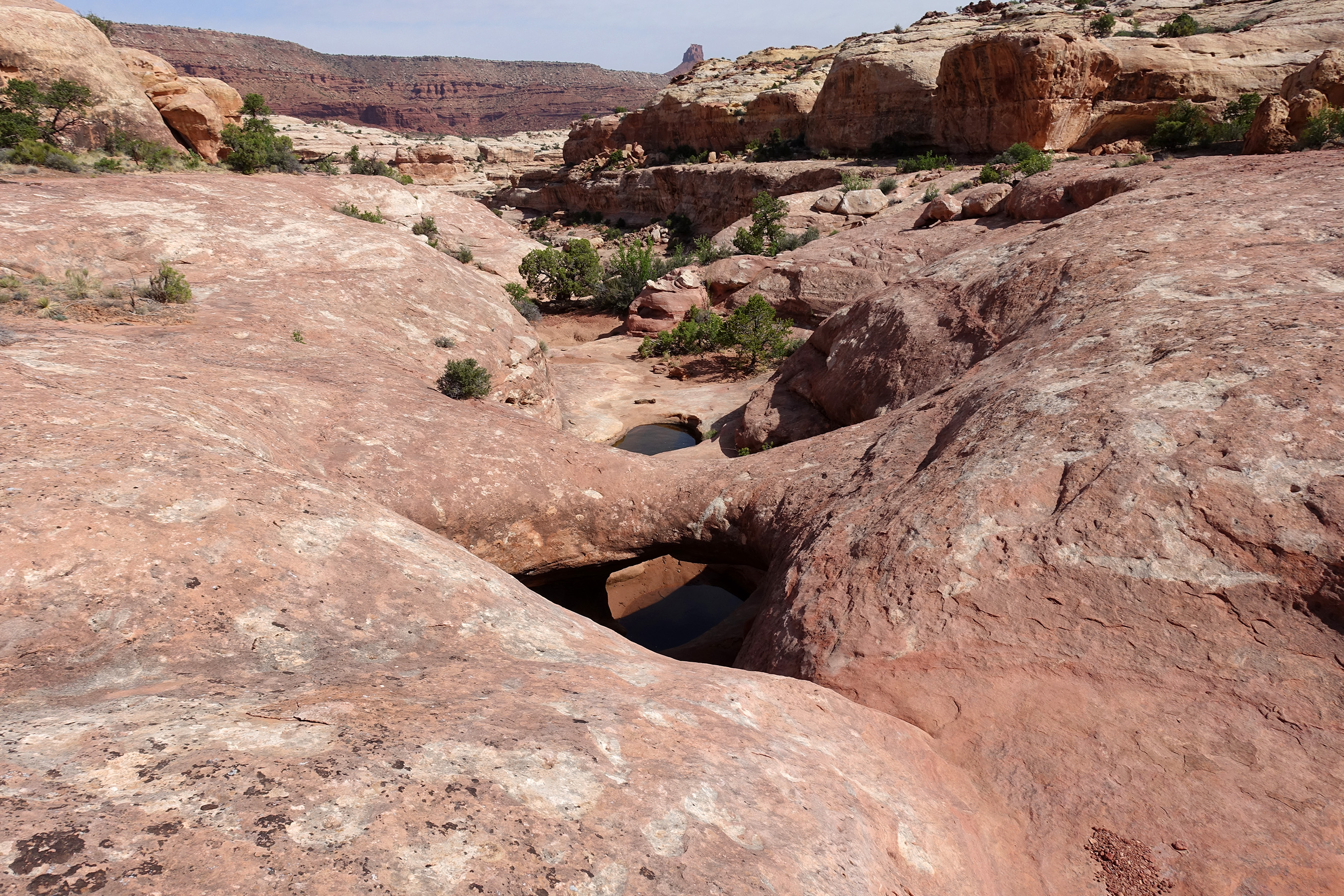
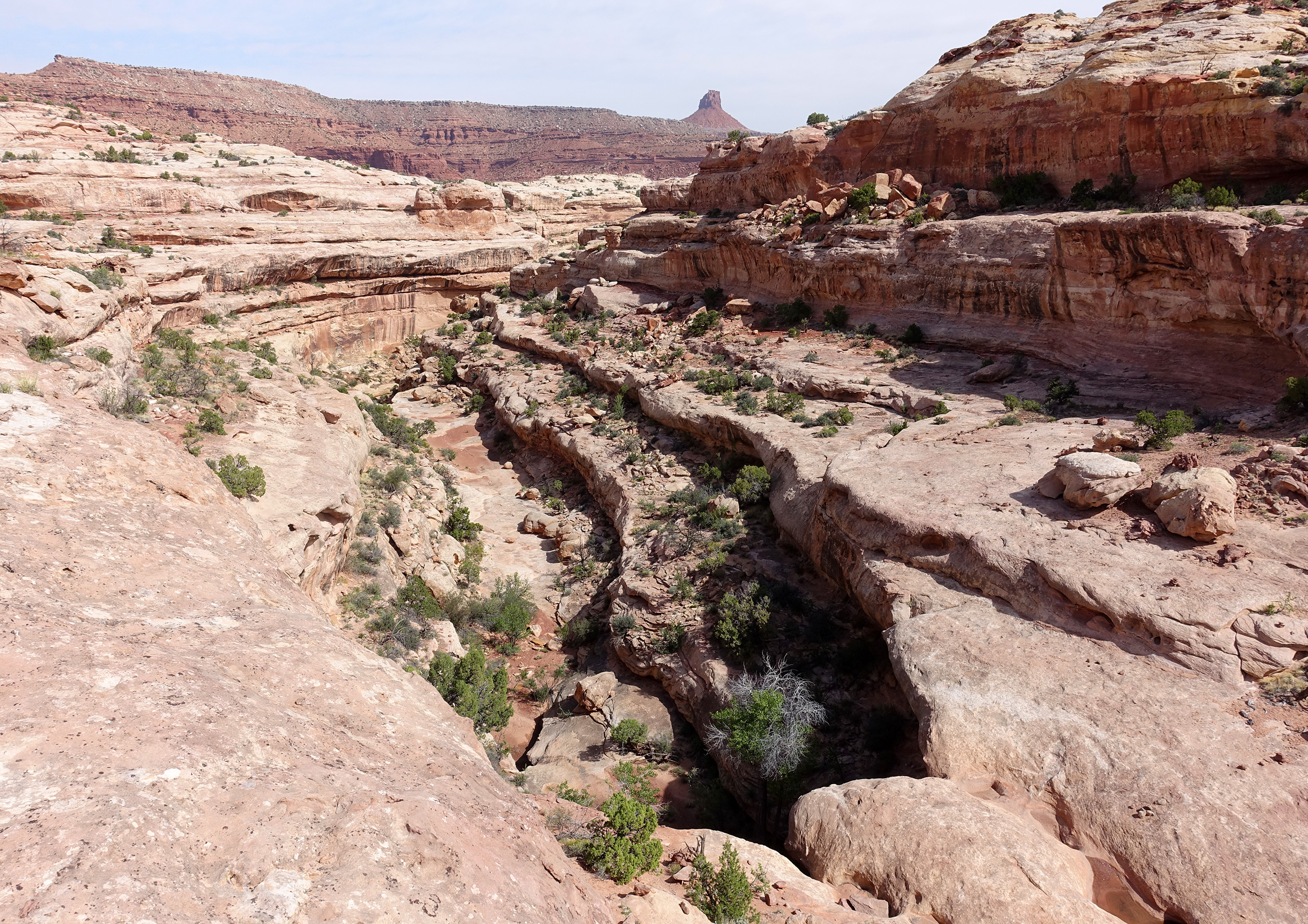
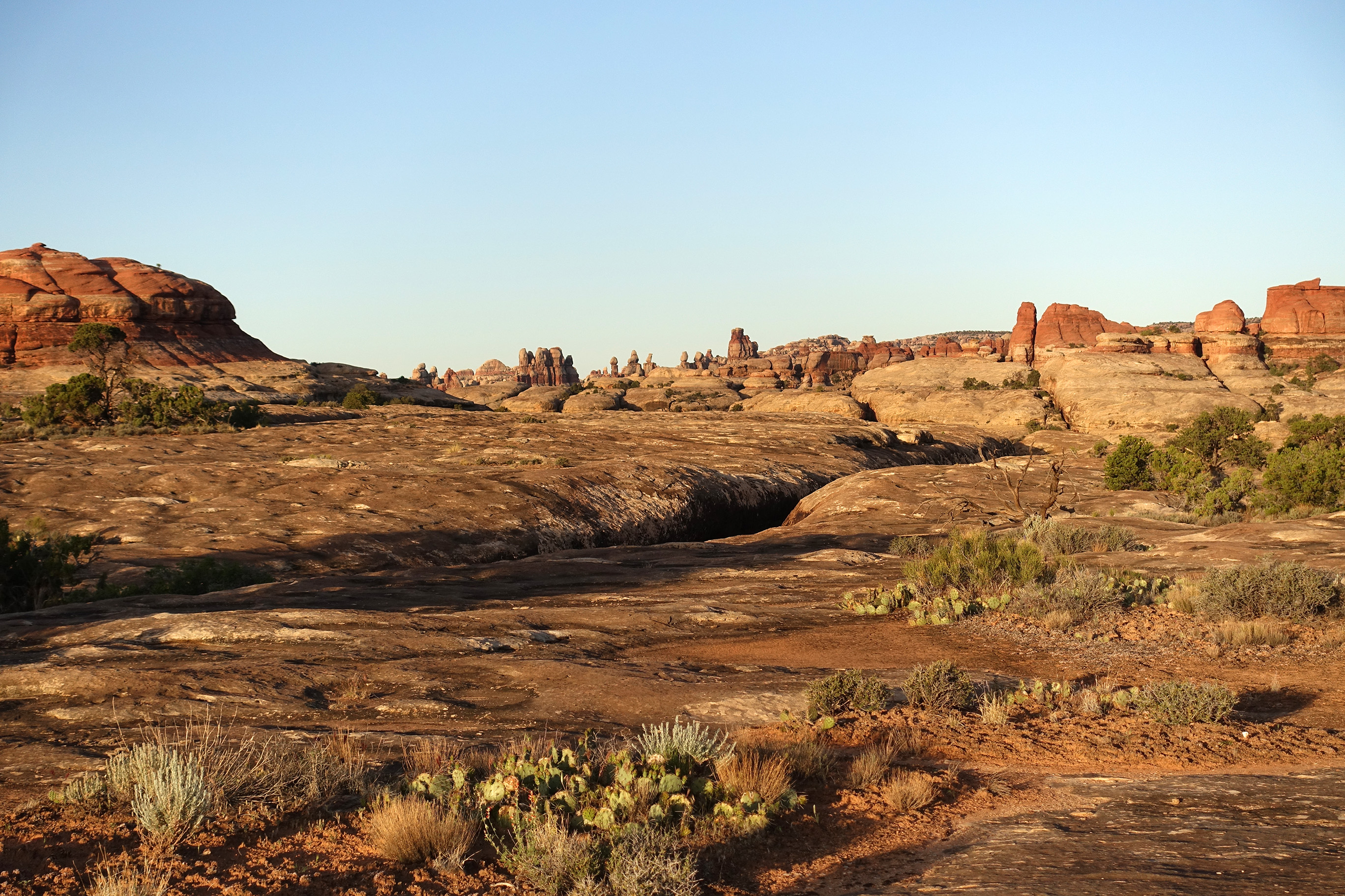
Day three…we knew this day was probably going to be the toughest day. We had a long way to go to our next water source. This route took us past the Mother and Child rock formation and onto the jeep road. We walked the jeep road for a while before dropping into South Fork Horse Canyon where we would be for the rest of the day. On a couple of occasions we passed by shallow springs where we could have filtered water…but we were already carrying enough water so we passed them by. South Fork Horse Canyon is a very scenic canyon. We knew we were getting close to or next water source and camp when high above the canyon floor we could see the Chocolate Drops, a named rock formation. We are still scratching our heads trying to figure out why the name. We saw this formation from multiple angles and they never did look like Chocolate Drops…? We finally got to the springs below the Maze overlook, and good springs they were. Happy and hydrated, we set up camp, ate and went to bed. Day three: 13-miles.
Day four…started with an early morning hike up to the Maze Overlook. This was a 2.5 mile up and back scramble climb out of the canyon to an overlook, overlooking the Maze area. This is also a popular spot at the end of the jeep road that 4×4 vehicles will park or camp. The views are spectacular! After taking in the views we dropped back into the canyon and back to camp. Back on route we took a side canyon to see the Triple Arch formation. Sure enough, three stacked arches…pretty cool! Back in the main canyon we took another side canyon, this time looking for a “Natural Bridge” that was shown on the USGS map. We couldn’t find it so we determined that it has fallen since the map was published. Our next stop was a really neat place called Harvest Scene, a long stretch of walls with lots of ancient pictographs. The rock art was all along a .3-mile stretch. Very interesting art. Back in the main canyon our next challenge was finding water and a camp spot. We passed by a couple more really shallow springs but decided to look for a pool that we had heard about. We knew the area had a pretty good rain a week prior so we were confident we’d find water in the pool. We headed up the side canyon to its end and sure enough…there was a pool…a pool of icky water. Already late we decided to filter water from the pool. Yikes! It took almost three hours to get the water we needed for the night and the next day. We ended up having to clean the filter cartridge after pumping every half liter. Very annoying…oh well, it couldn’t have happened in a more beautiful setting. Day four: 8-miles
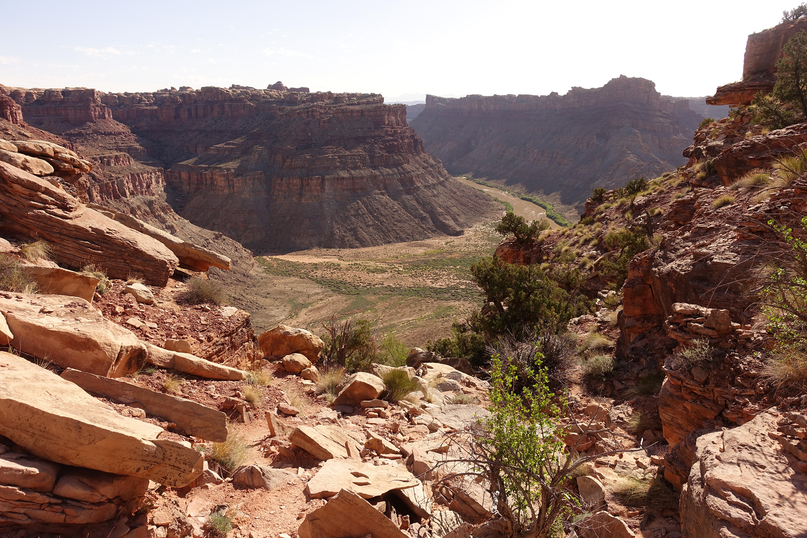
Day five…we climbed back out of the canyon onto the plateau to the base of the rock formation called Chimney Rock. This is also a popular spot on the jeep road for camping. Next we dropped into Shot Canyon…which the initial descent into the canyon was spectacular. After a few miles of Shot Canyon we again climbed out of the canyon and descended into Water Canyon…where we found the best water source of water of the trip. A large spring of crystal clear water…almost deep enough to dip in, although we didn’t. This was the last water so we stocked up for the rest of the day and the next day. Our next stop was camp near the Confluence Overlook. We found a nice camp spot, set up camp and took a short hike out to the confluence overlook where we could see the Green River and Colorado confluence…1200’ below. Day five: 11.2-miles
Day six…was all about getting back to Spanish Bottom to meet the boat at 10:30am. This was a short hike passing by the Beehive Arch and through The Doll House area, then down the steep trail to the boat landing. Day six: 5.2-miles
Fun adventure with my lovely wife, Deb. Looking forward to our next…
PS…This trip was successful because of the research done before the trip. Gathering beta in regards to the location of the water is crucial, and a call to the ranger station days before you leave confirming the water sources are in, is also very important.
Gear sorted and ready to put into the packs…

At the bus that will take us to the boat dock…

The jet boat that will take us to Spanish Bottom (2-hour boat ride)…

At Spanish Bottom…that’s the Colorado River.

On the steep trail climbing out of the Colorado River drainage…

Nearing the top, looking back at where we came up from…

First look at the area called The Doll House….


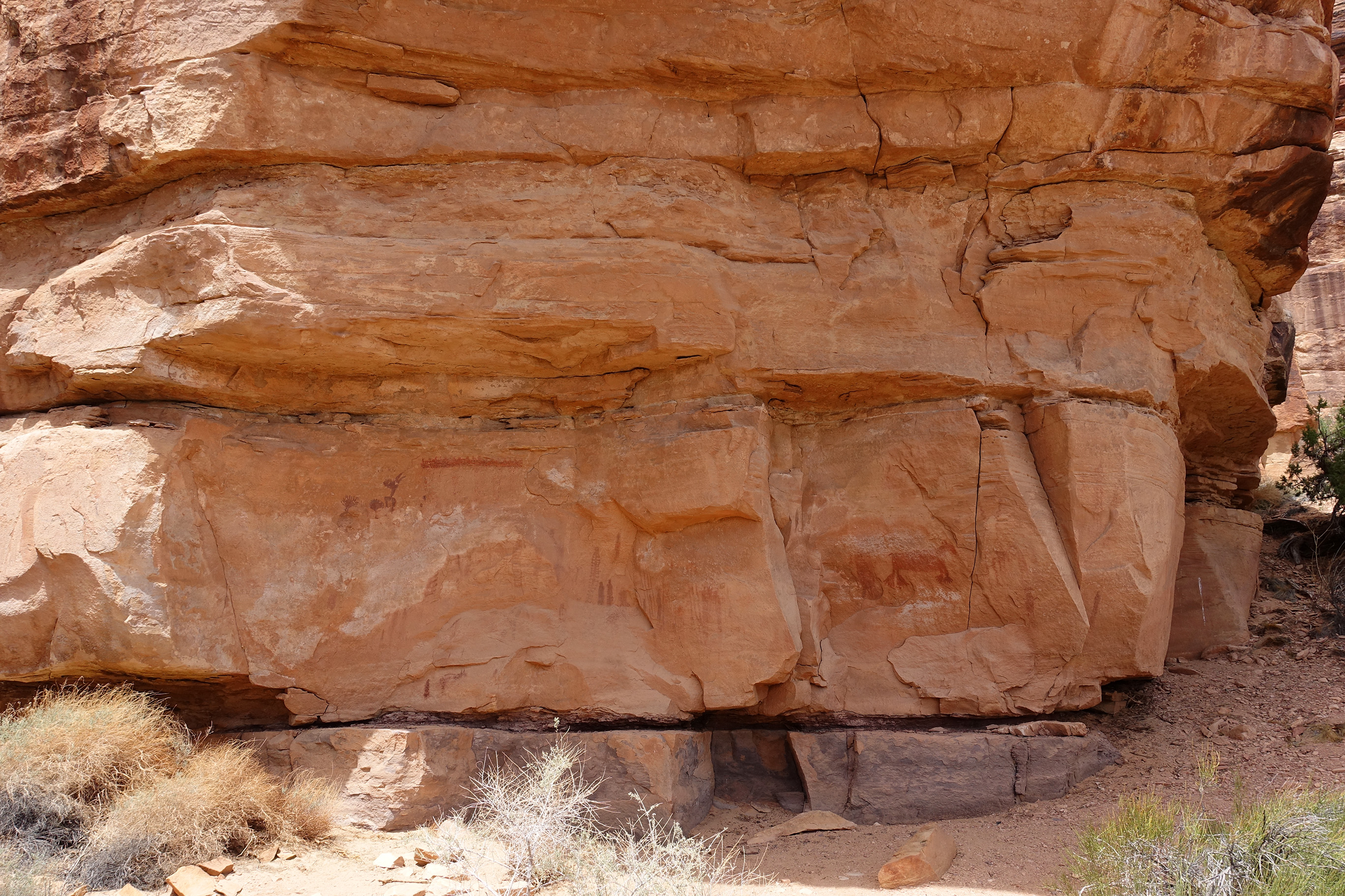
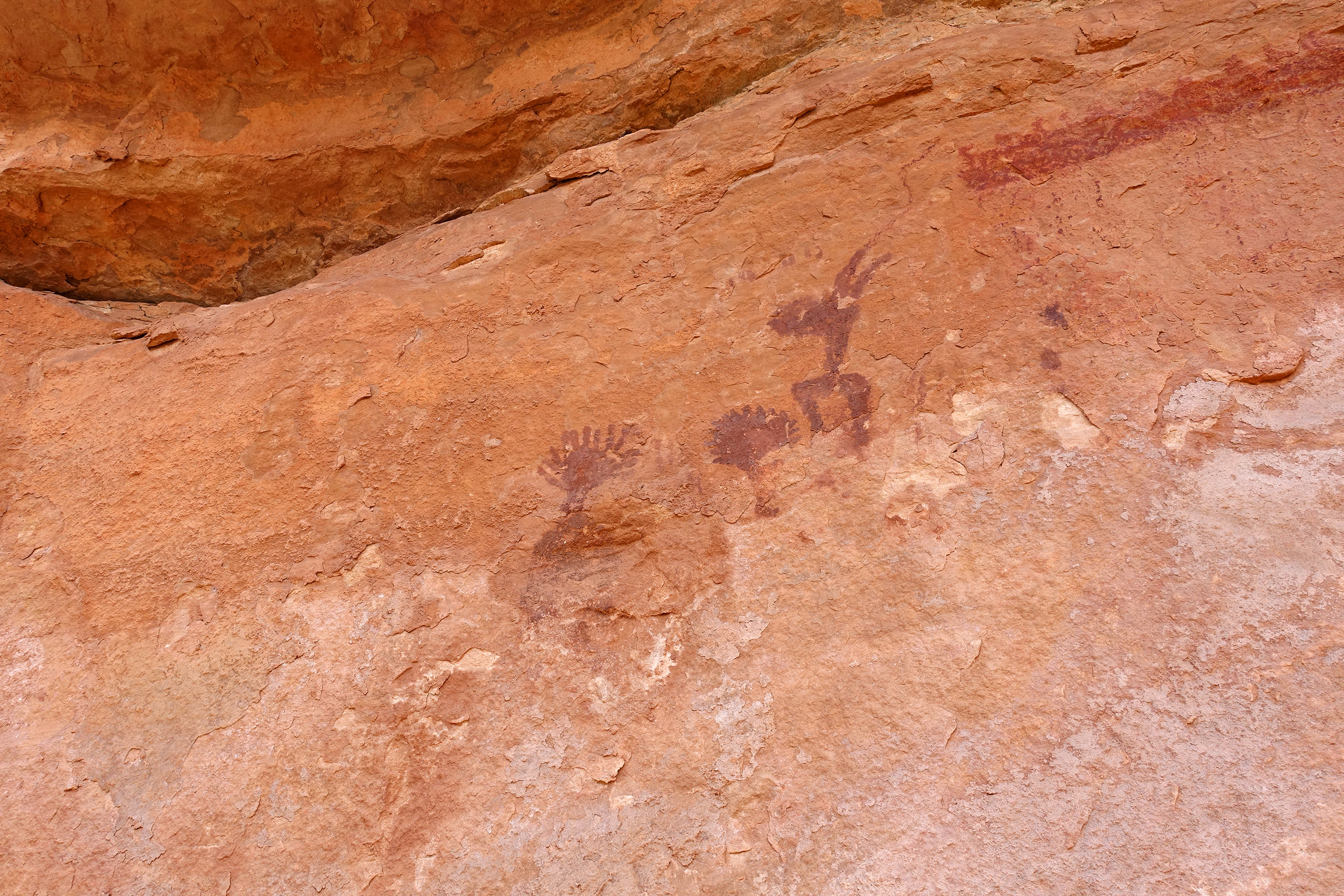
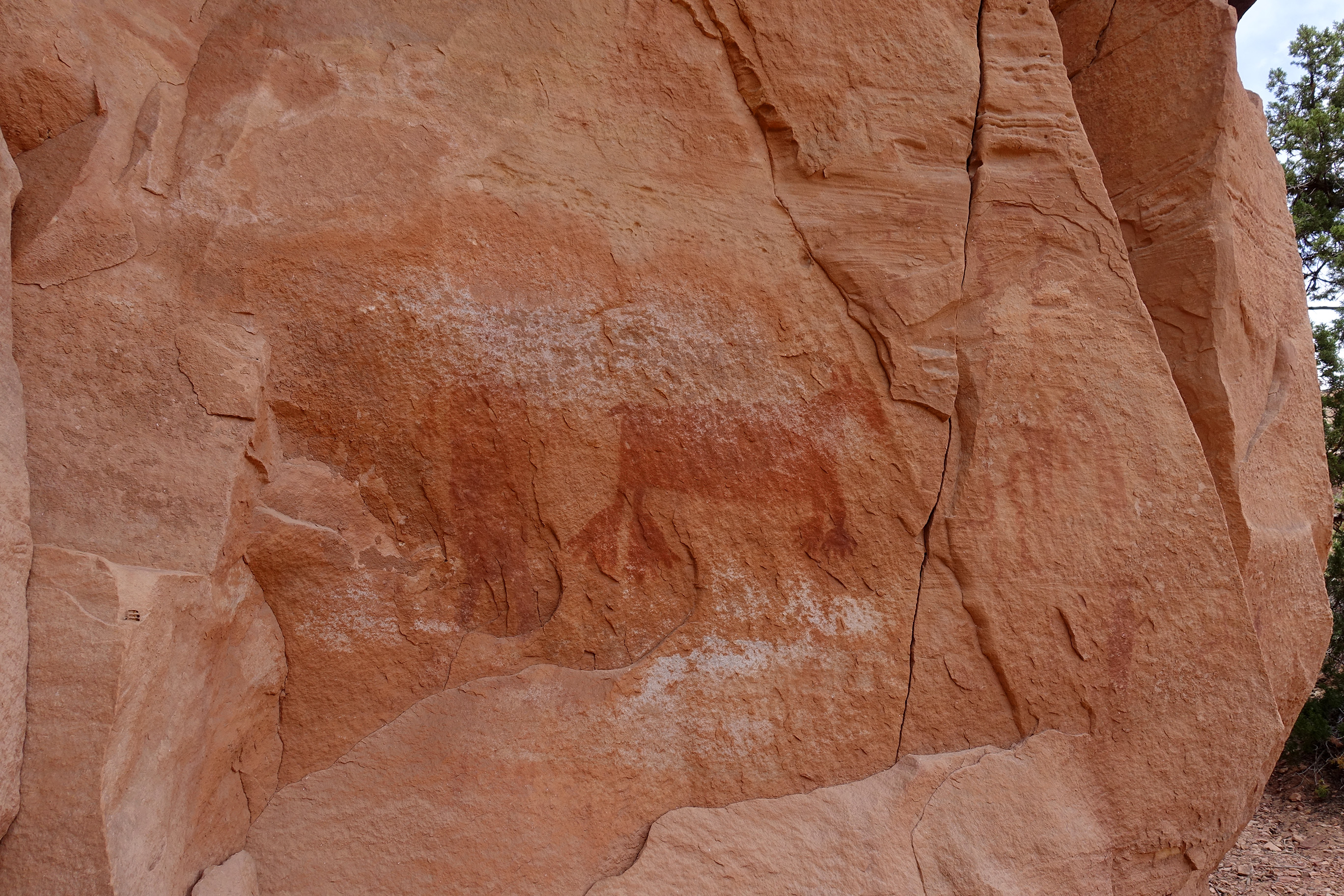
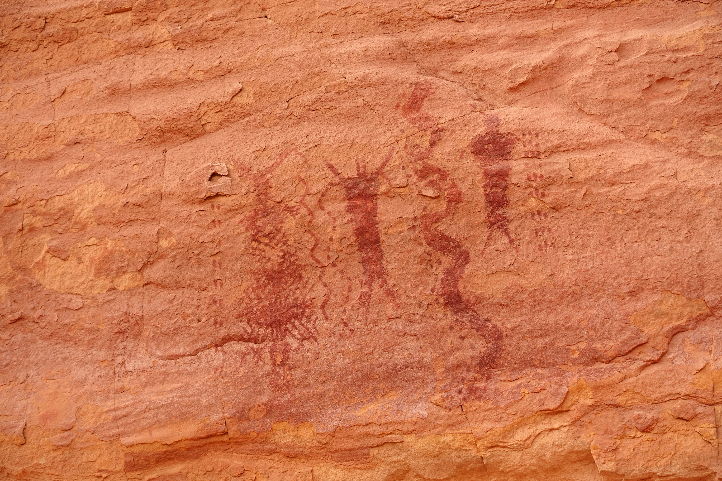
First stop was at The Bear Panel, a rock panel with ancient pictographs…pretty cool!
…then more walking along the sandstone structures…

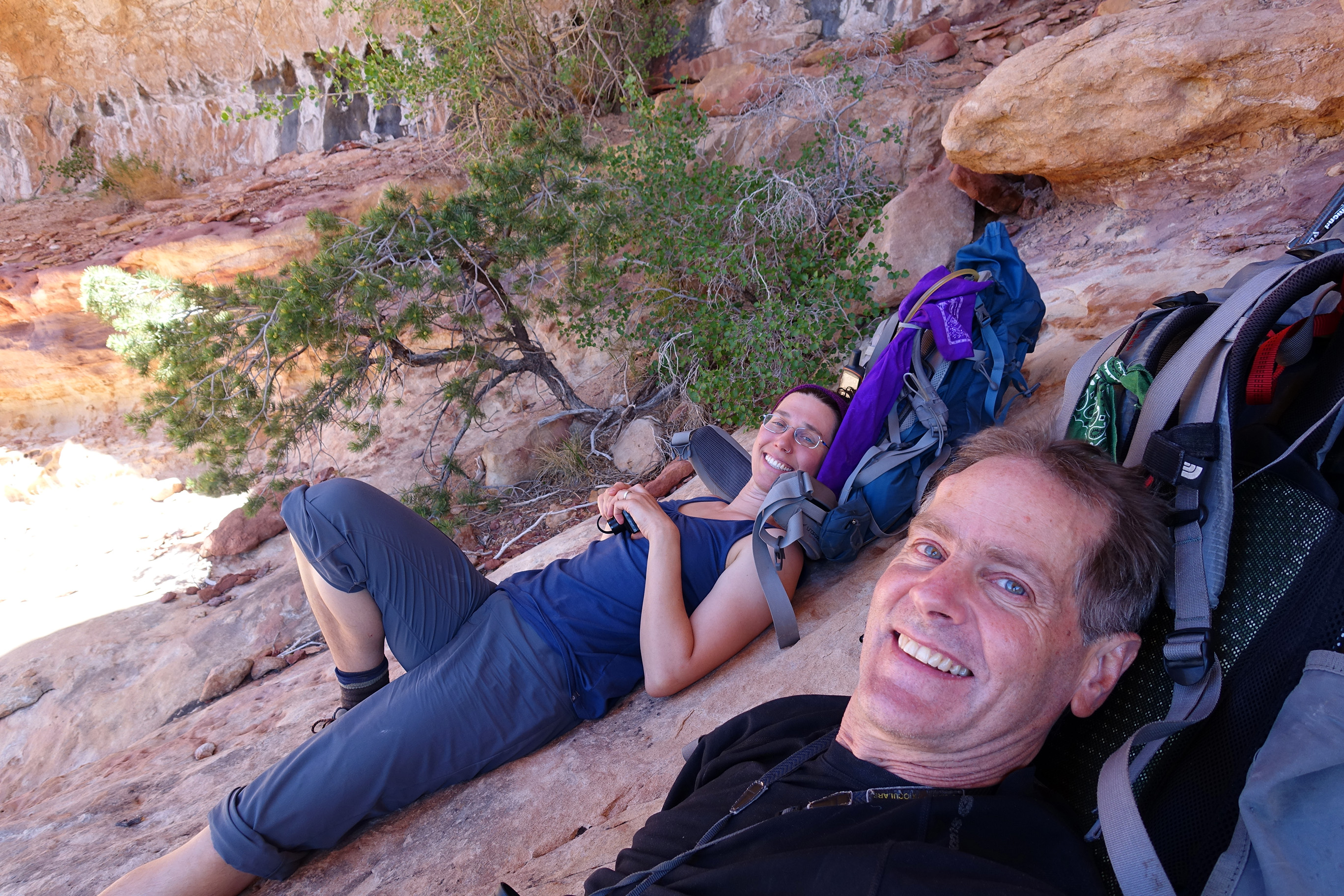
Camp night 1 & 2 (at Lou’s Spring)…Excellent Water!

Day two we decided to stay in the area and explore an unnamed canyon…

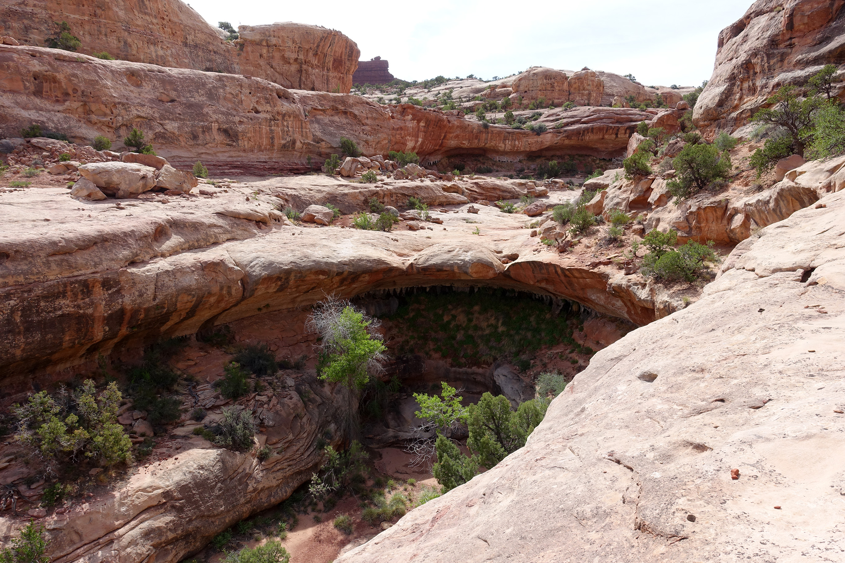
…which included finding the Whitmore Arch…

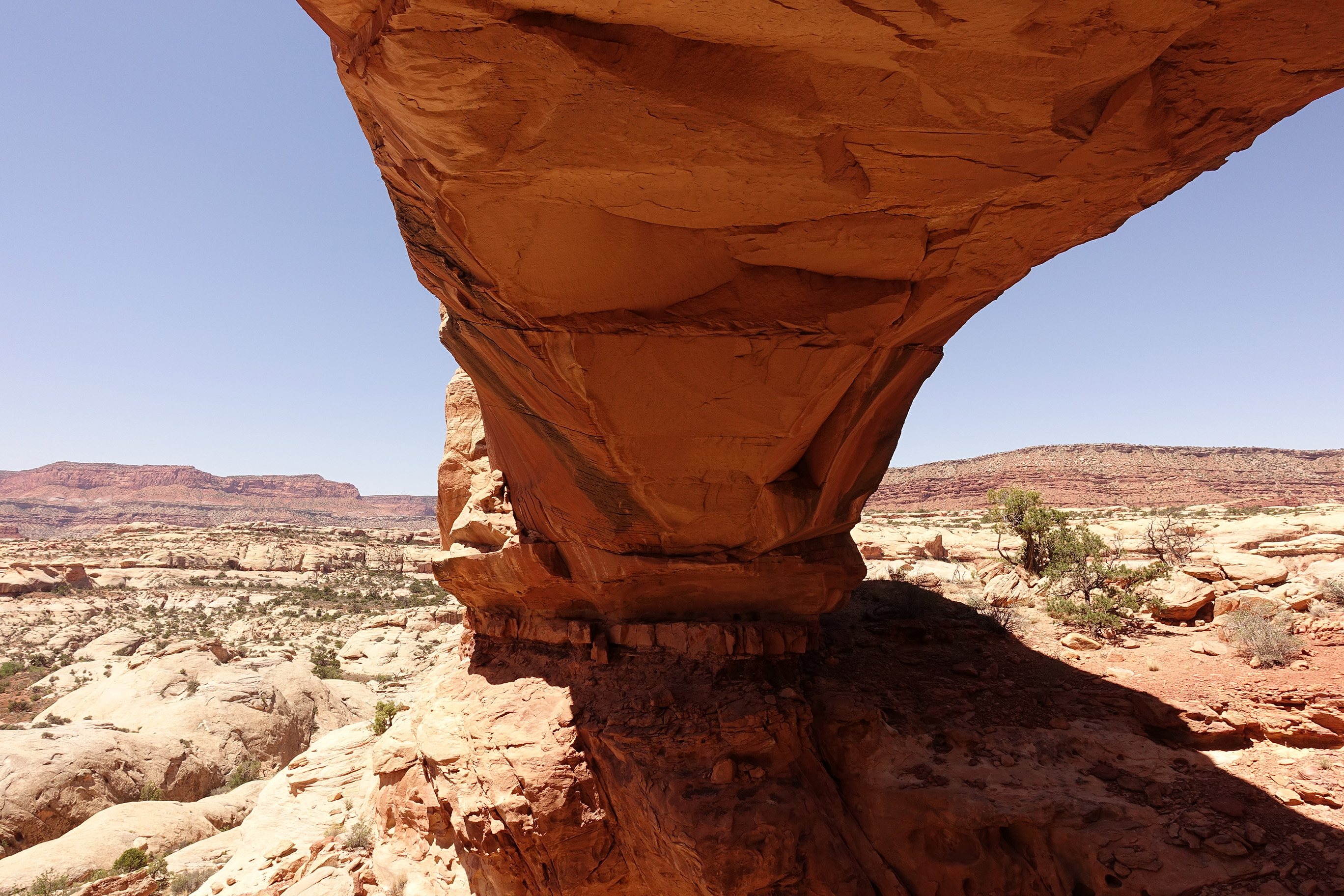
Finding a nice shady place to rest under the Whitmore Arch…


Nothing says “You’re So Special” like a dead mylar balloon in the remote backcountry… We packed it out.


Day three after hiking a bit we were on the old jeep road that is still used by vehicles. This is the road…

Passing by the formation called “Mother and Child”

Still on the road on the top of The Maze…

Off the road now, dropping down into South Fork Horse Canyon…
On the canyon floor…Hot!


Zoom in for detail…


First view of the formation called “Chocolate Drops”…Deb and I are still wondering why it’s called that…


Good water near camp night three…

Camp night three…

Next morning (day 4) took a side hike up to The Maze Overlook…there’s the Chocolate Drops again…

More ancient pictographs….No wait, that’s just our shadows…

On the way up, looking down at the canyon our camp is at…
Chocolate Drops, and off in the distance…Lizard Rock, Chimney Rock, Standing Rock, The Plug, The Wall,…where we’ll be in a couple of days.

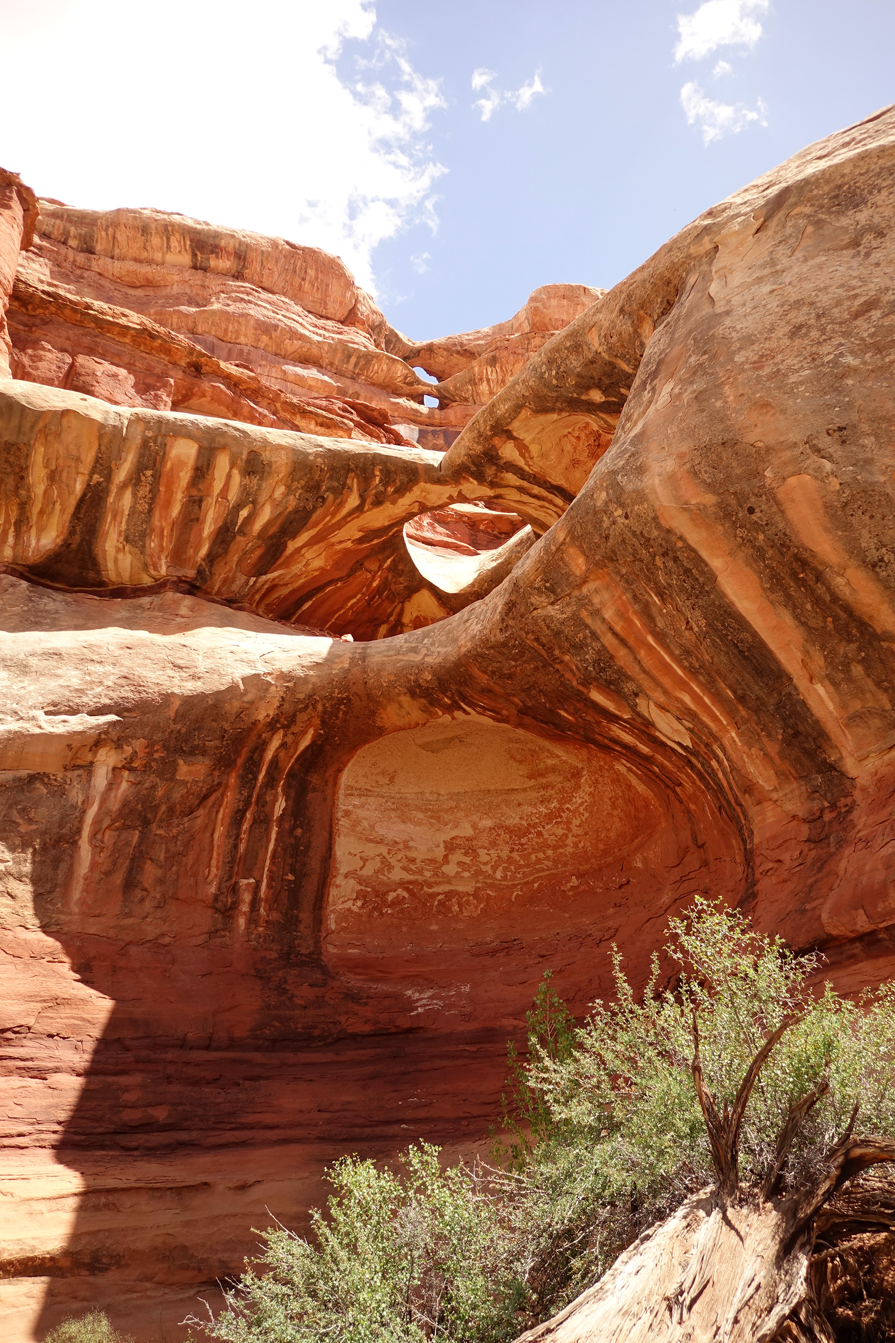
Back Down in South Fork Horse Canyon at Triple Arch…

Chocolate Drops again…can’t tell if we are looking at them, or are they watching us…

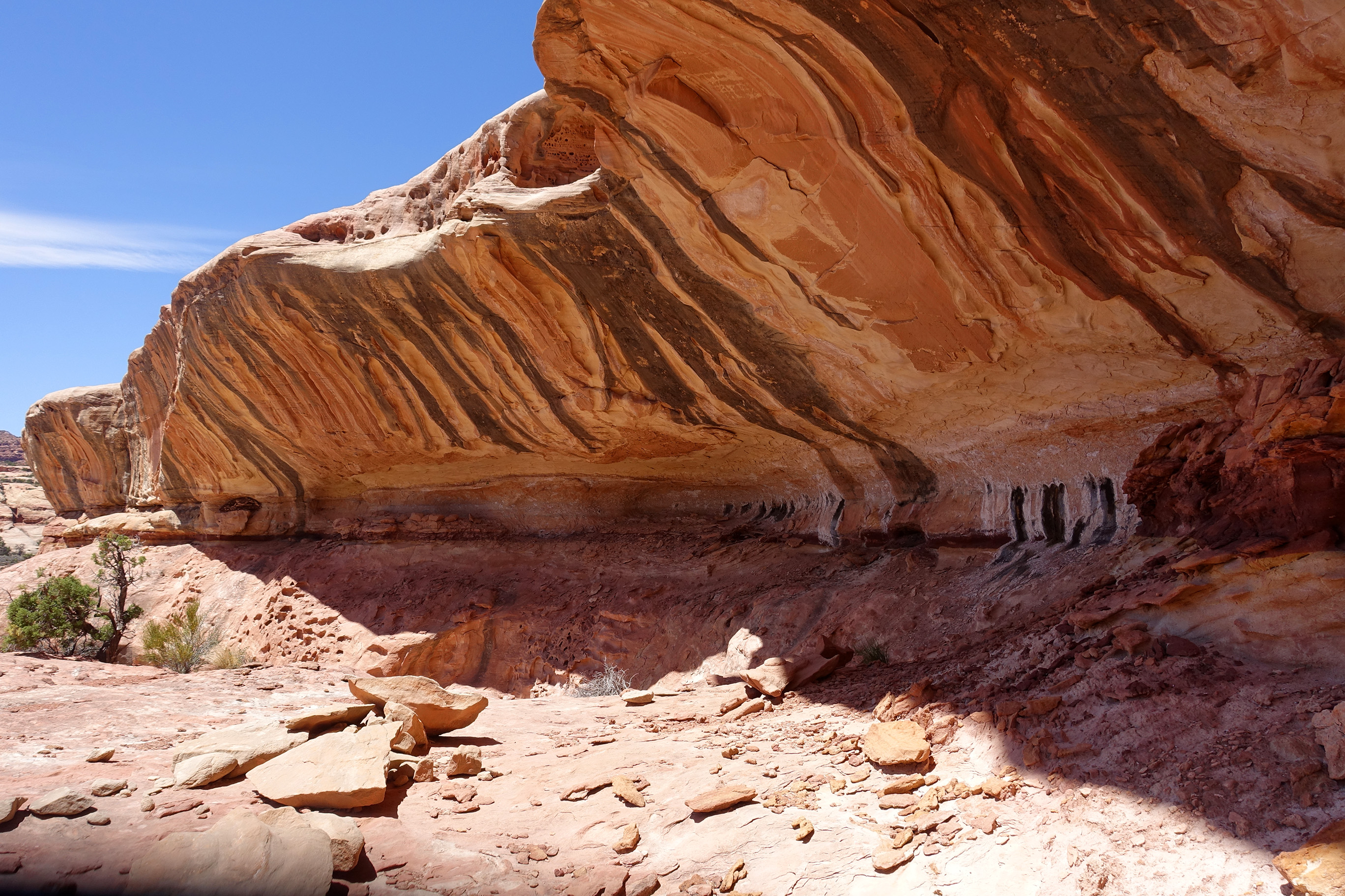
At the big pictogragh wall called The Harvest Scene…


Our water source for camp night four…
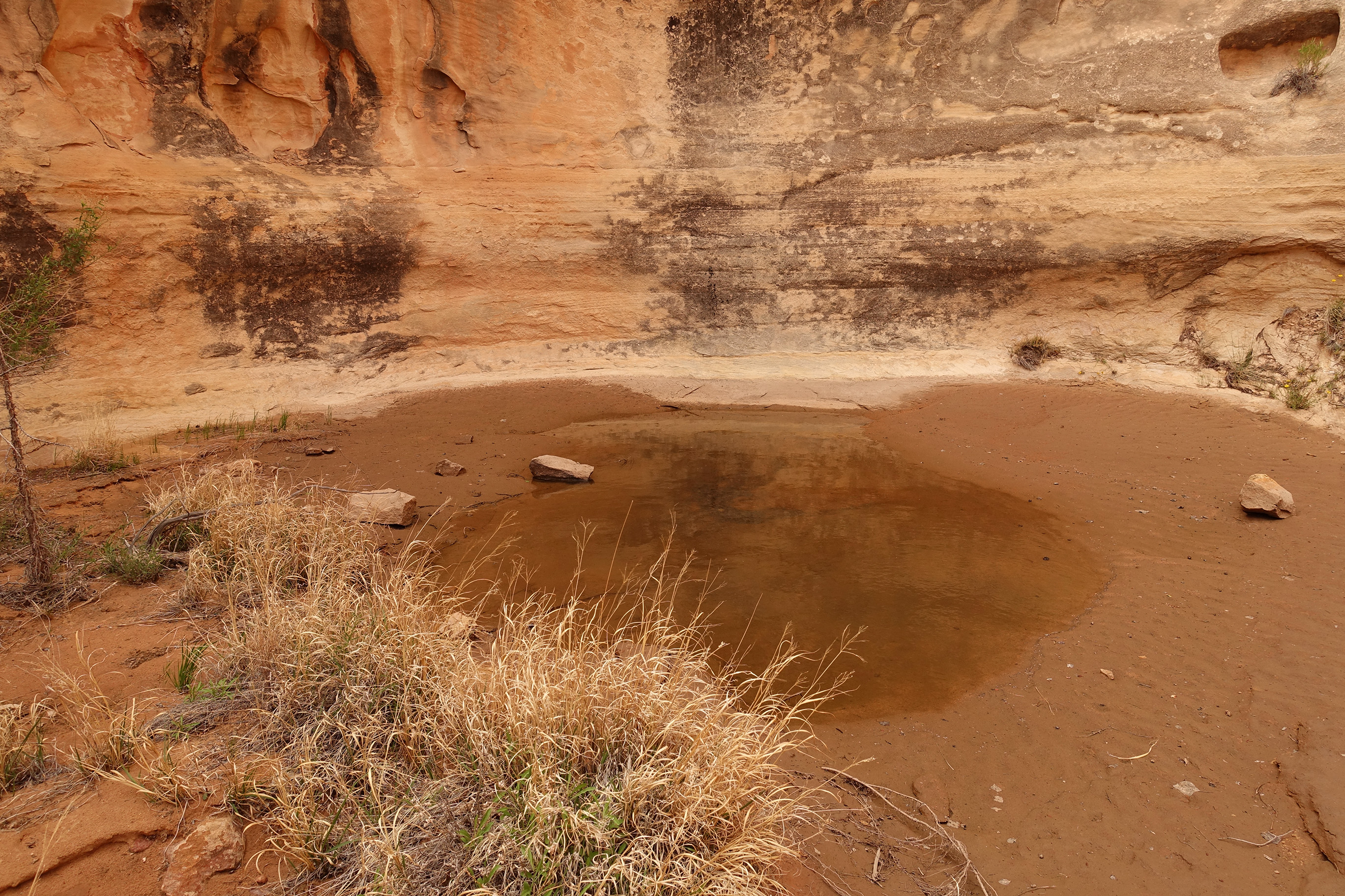
Stupid filter…this pond was not freshwater and was a real pain to run through the water filter…but we managed.

Camp night four…

Day 5 climbing in and out of canyons to the confluence overlook…

Chimney Rock

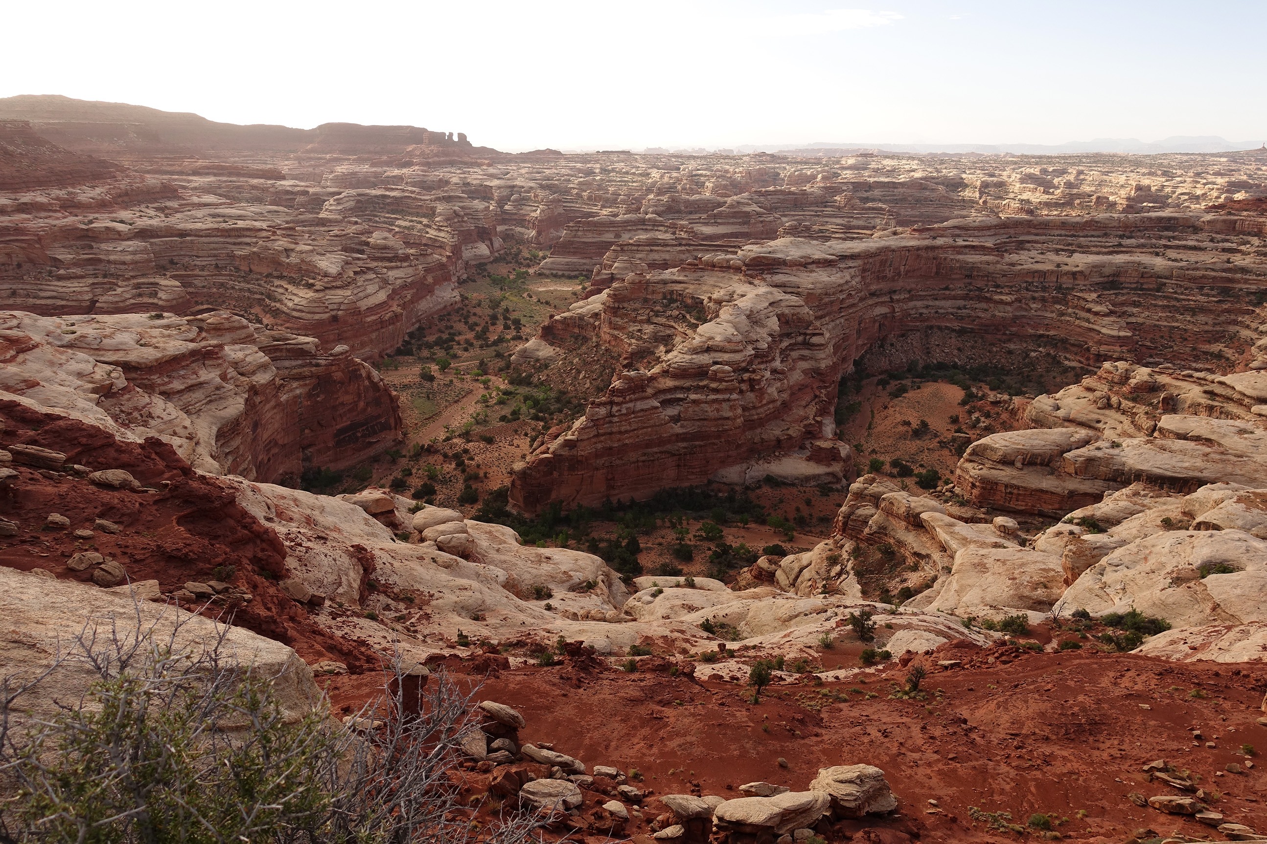
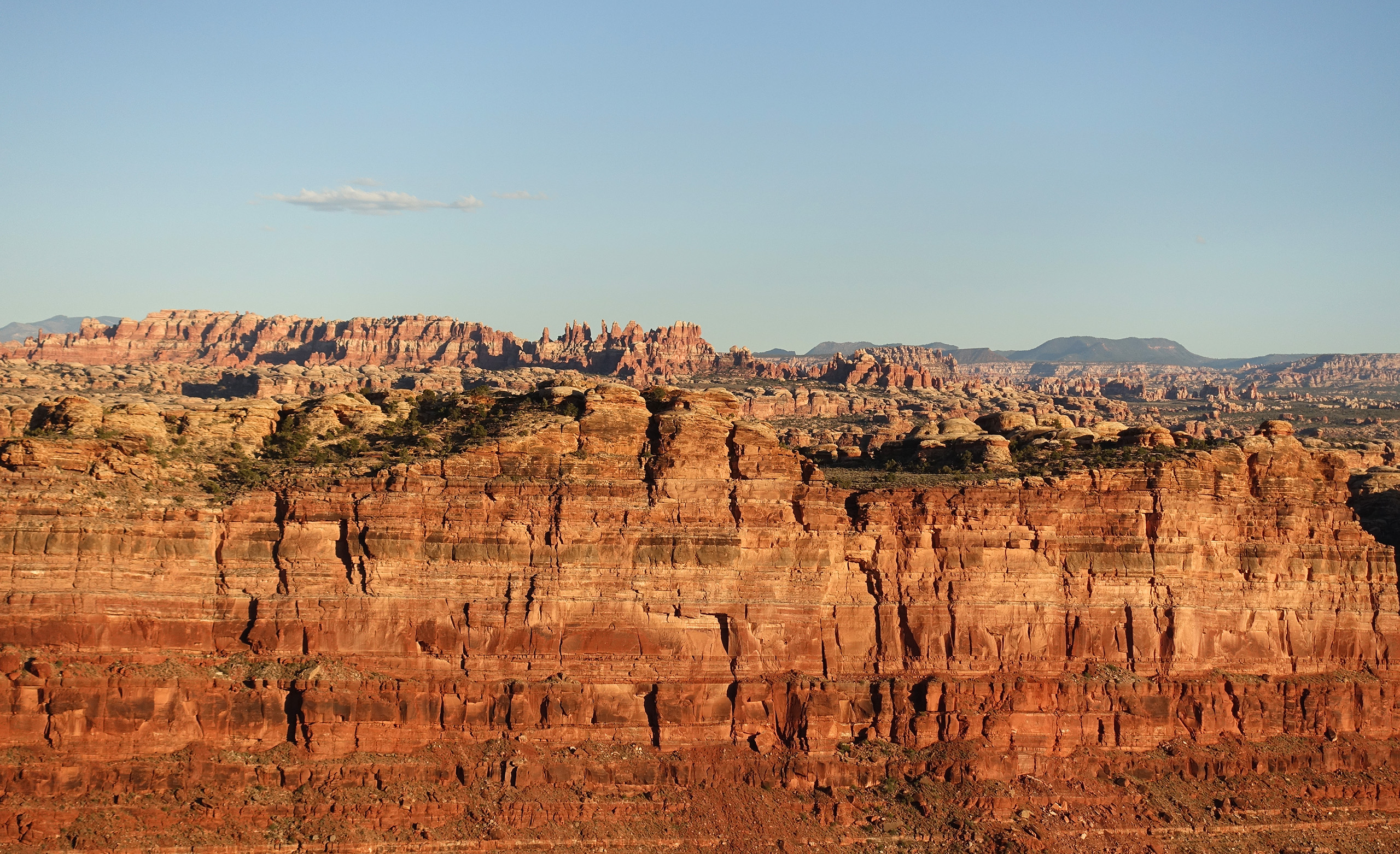
From Standing Rocks looking NE over The Maze…zoom in for more detail…

Looking down into Jasper Canyon (the closed one)…

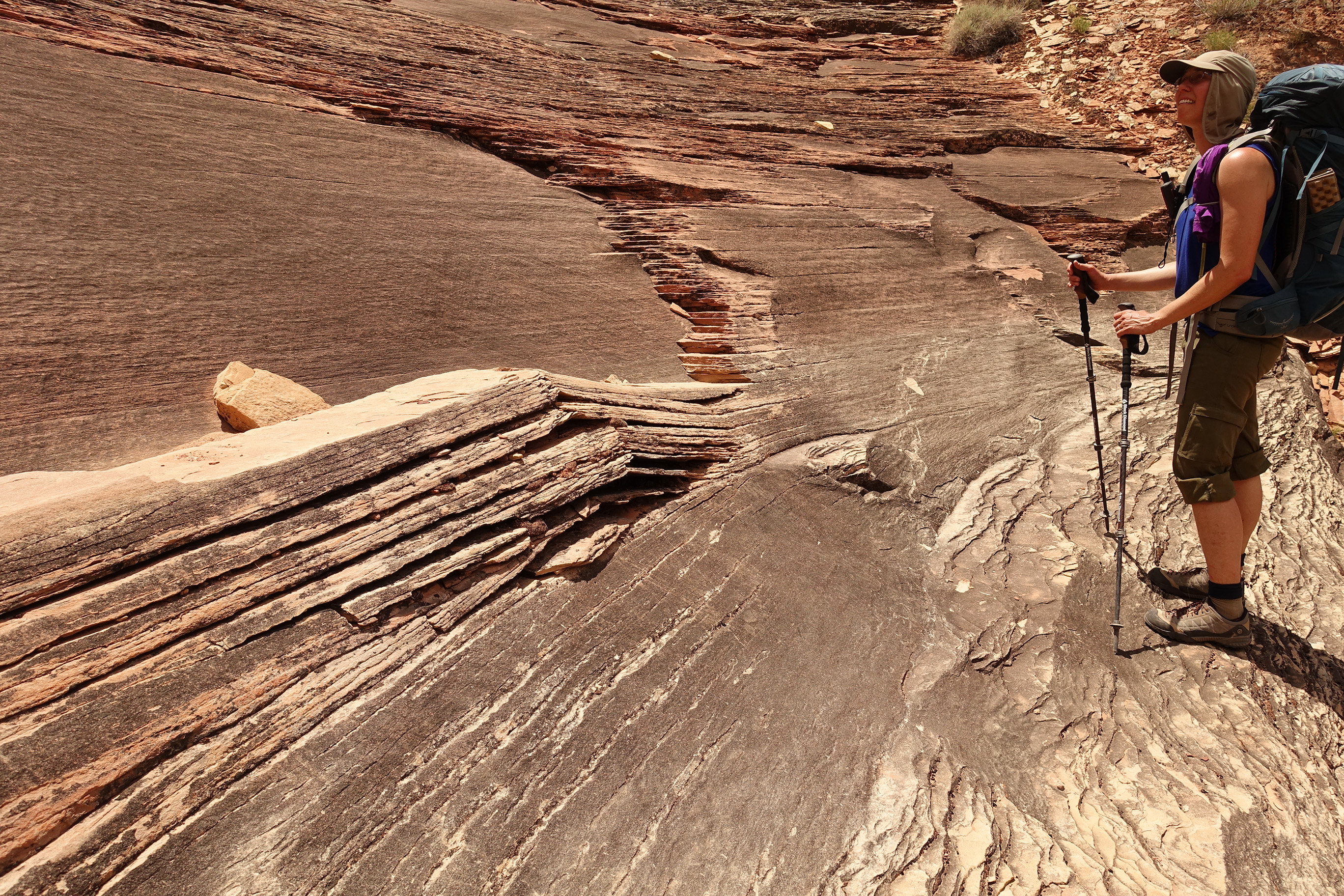
Really? We’re supposed to just walk down that stack of rocks that look like stairs….really?
Much easier than it looked from a distance…

Interesting layers buckled by movement…
By the fifth day of oatmeal, trail mix, power bars, and just add water dinners, this is what I was seeing…zoom in for detail.

Dropping into Water Canyon…


Best water of the trip…and a very beautiful spring…


At the confluence overlook…

The Green River directly below flowing into the Colorado River up ahead (right side)…

Looking across the Colorado at The Needles District of Canyonlands National Park…
Camp night five…

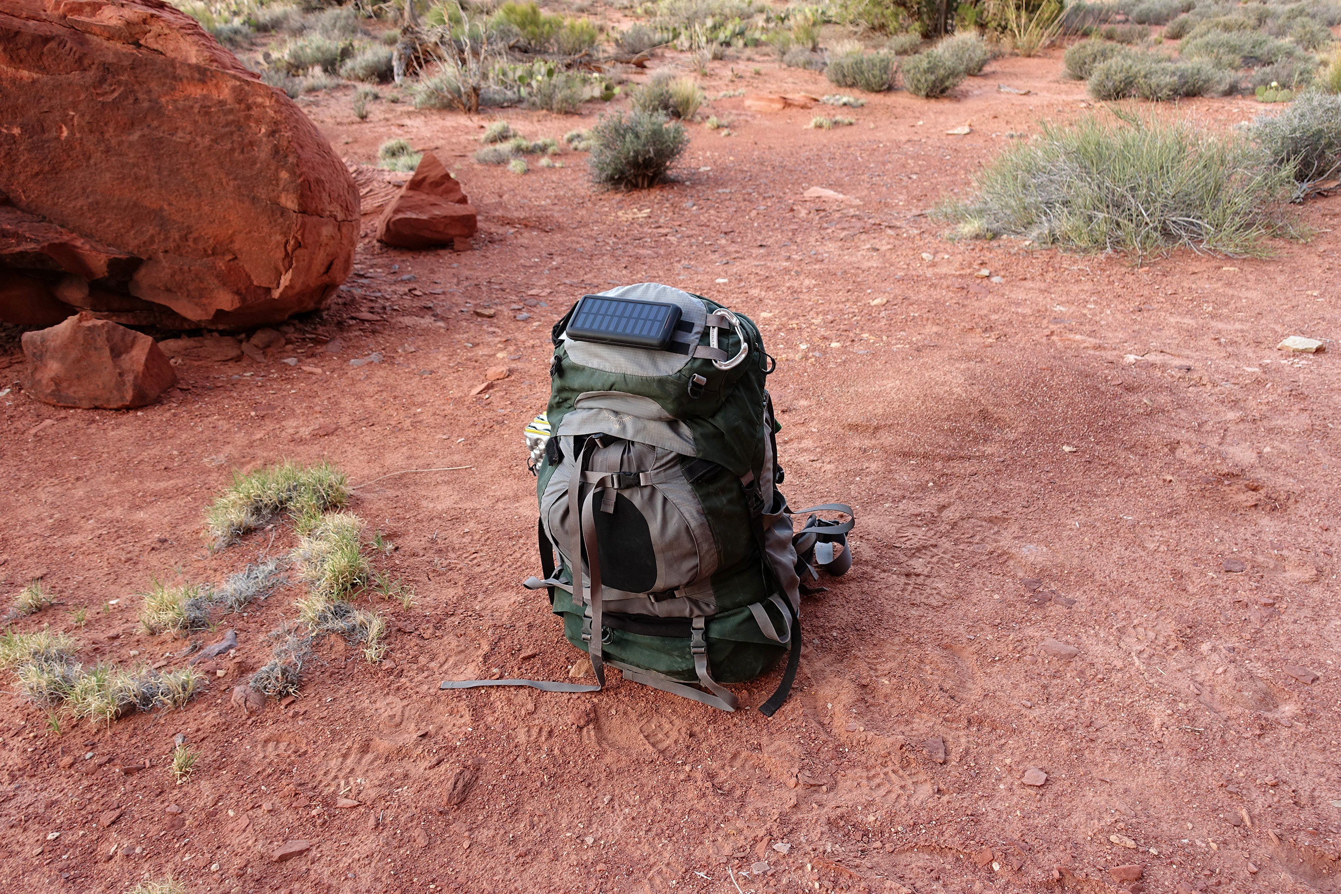
Worked ok…It kept our batteries charged.
Day 6…hiking back to Spanish Bottom to meet the boat that will take us back to Moab, UT.

Hiking in, out, and around rock crevasses…
The formation is called “Beehive Arch”…
Entering the Doll House area…

At the rim, looking down at our route back down to Spanish Bottom…
Our route…

More pics to come….Kidding 🙂