
Well, I had big visions of getting to Bear Butte…on the map it totally looked possible. In real life…It sucked…AND I had to bail before getting there. Sitting at the dining room table on a comfy chair I planned this cool route on my computer. I planned to take the Jefferson Lake trail in about 4 –miles, go off-trail across the lava flow, and then just climb the ridge heading west for a few miles until I get to Bear Butte…Riiiiiiight!
Instead, I hiked the Jefferson Lake trailhead for about 4-miles…through 6’-7’ tall overgrown Snowbrush (Ceanothus). This trail needs some major trimming…and not with a pair of pruners… A cordless hedge trimmer, with a couple spare batteries might do the trick. I was happy to finally go off-trail and head across the lava flow…DOH! Once I got half way across, I had to drop down, and then up across a deep canyon in the flow. As I got to the top of the other side…I was looking at the other half of the lava flow, covered with chest deep Snowbrush and Manzanita. Why did the chicken cross the road? I have no fuck’n idea, it just did…and so did I. I thrashed to the other side of the flow in the direction of what looked like the best way to access the ridge top…although when I started to climb the steep slope I also had to fight more of the brush. Every once in a while I was able to follow an animal trail.
I took so long thrashing across, and up to the ridge, it was nearly my turnaround time…and I still had 1.5 miles to go and a thousand feet to climb. I followed the ridge for a bit till I found a good place to take a break and assess. Wow, the view of Mount Jefferson was incredible; don’t see this side very often. And down below in the Jefferson Creek drainage….total burn. Able to see Bear Butte now, I could tell I wasn’t going to make it there today. Too far and not enough time. Also, it was hot…the heat along with the uphill thrash zapped my energy…time to go back. I took a slightly different line back down the slope and across the lava… no better, just as thrashy. ..UGH!
Got back to the trailhead, it was 94 degrees. The water in my truck was too hot to drink…
Still better than the best day at work 🙂
First look at Mount Jefferson from the Jefferson Lake trail…

The trail skirts the lava flow for miles…

At times the Snowbrush (Ceanothus) is tall and thick. This trail needs some serious maintenance.

Fuck’n shit…
Cougar Springs, 2-miles in…

Mount Jefferson and finally the ridge comes into view….

Off trail now, crossing the lava flow…heading for the ridge, all the while thinking about the line i’ll take up the steep slope.


After dropping in and climbing out of a deep lava canyon, I see the other half of the lava flow is overgrown with chest deep Snowbrush and Manzanita…Ugh!

Looking SW towards Sugar Pine Ridge…

Polynesian Tiki statue rock…looking SW at the rocky NW end of Sugar Pine Ridge, Forked Butte, and the east side of North Cinder Peak in the far distance.

Zoomed in shot of the rocky NW end of Sugar Pine Ridge…

Looking back down the lava flow I crossed. The green meadow looking terrain is actually chest deep Snowbrush and Manzanita…

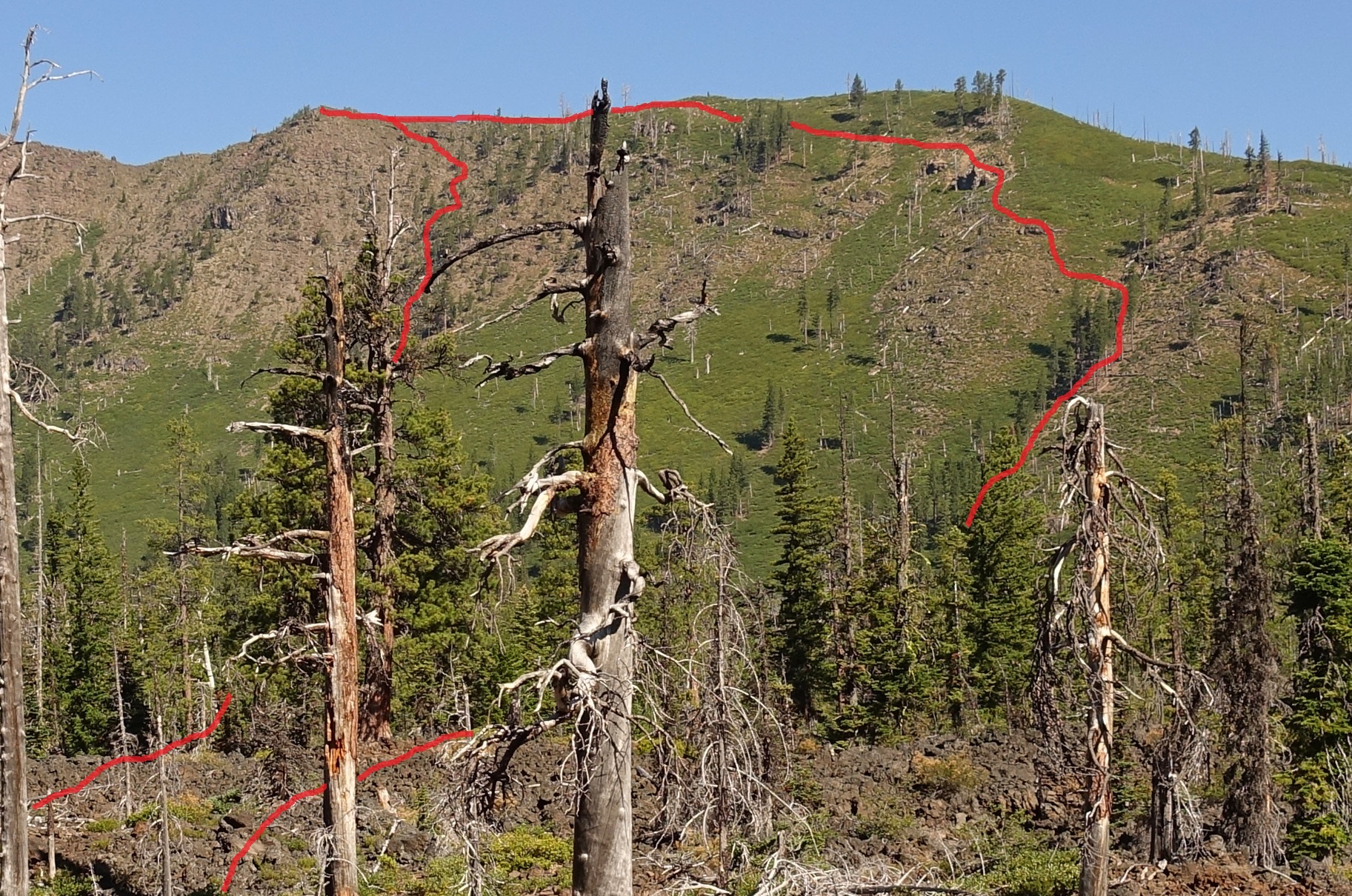
Finally gained the ridge, and this view was my reward…Awesome!

After hiking the ridge Bear Butte came into view…The sharp mound and point on the left… Too far and out of time, this is where I turnaround. I’ll have to find another way to Bear Butte…

Jefferson Creek below…

My route up and down…never again!
Bald Peter Butte…The metolius River is on the other side…

Final view of the majestic Mount Jefferson…

On my drive back out to civilization, I spotted this along the forest road…WTF? Some kind of memorial for a friend? Someone had a lot of time on their hands…

Today’s route…
