
GPS Tracks
Unlike many so called “tracks” you may find on the web, the GPS tracks I post are not tracings done at home on the computer screen! These are the actual tracks from where I walked, climbed, or thrashed.
You’re welcome to download and use them on your GPS. The files are in a format (.GPX) which can be used on all GPS units, or imported onto many different online map programs.
I post all my GPX tracks to CALTOPO.com
Maps
Most maps below are made from National Geographic Topo software. (Note: This software is no longer sold, but can be found used on Ebay, Craigslist, etc.)
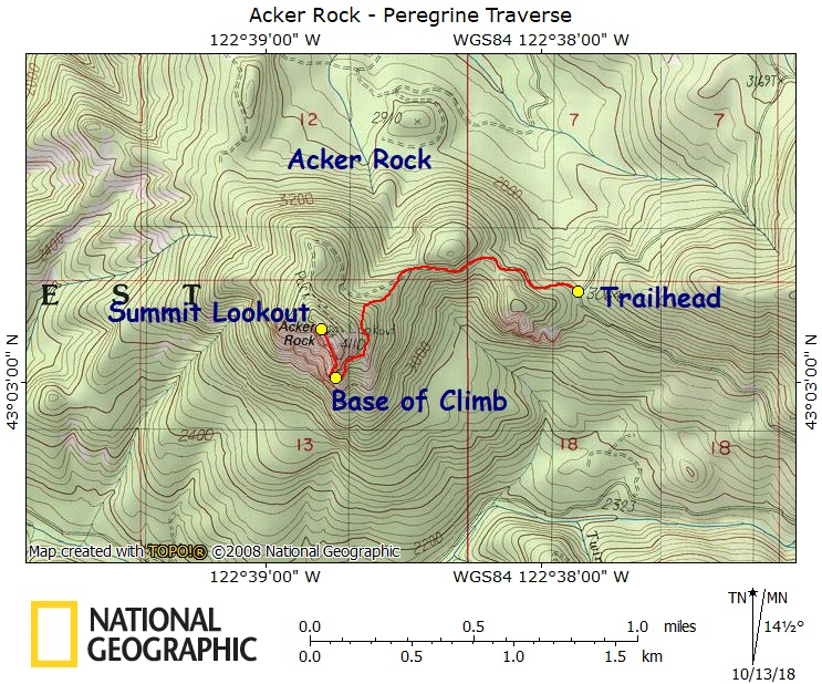
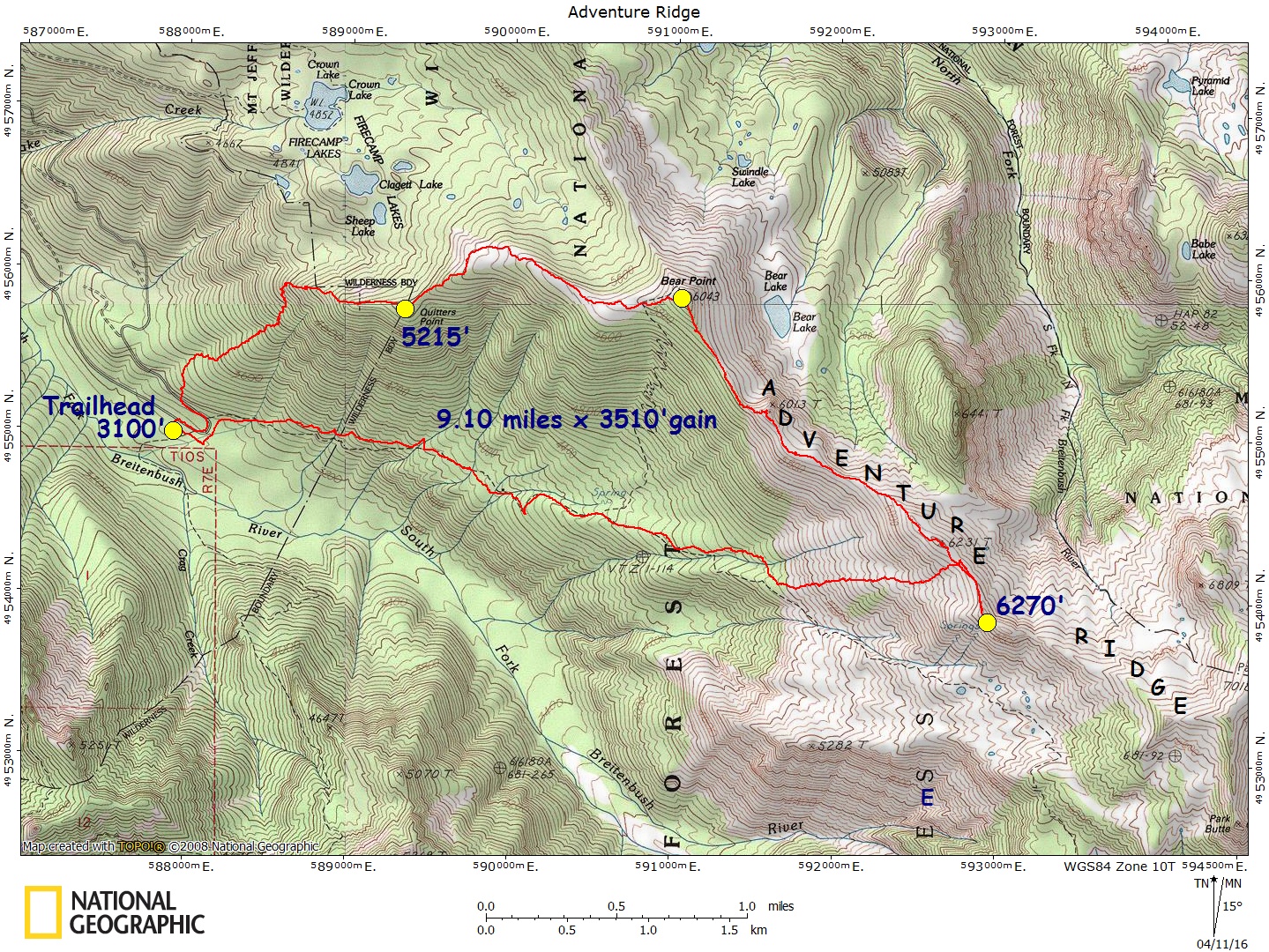
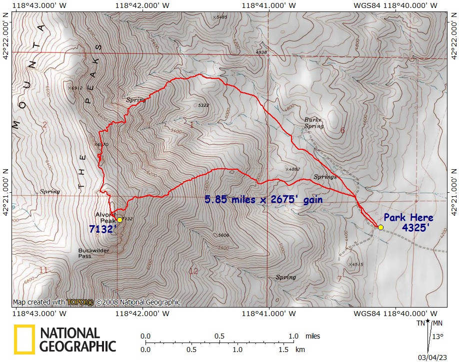
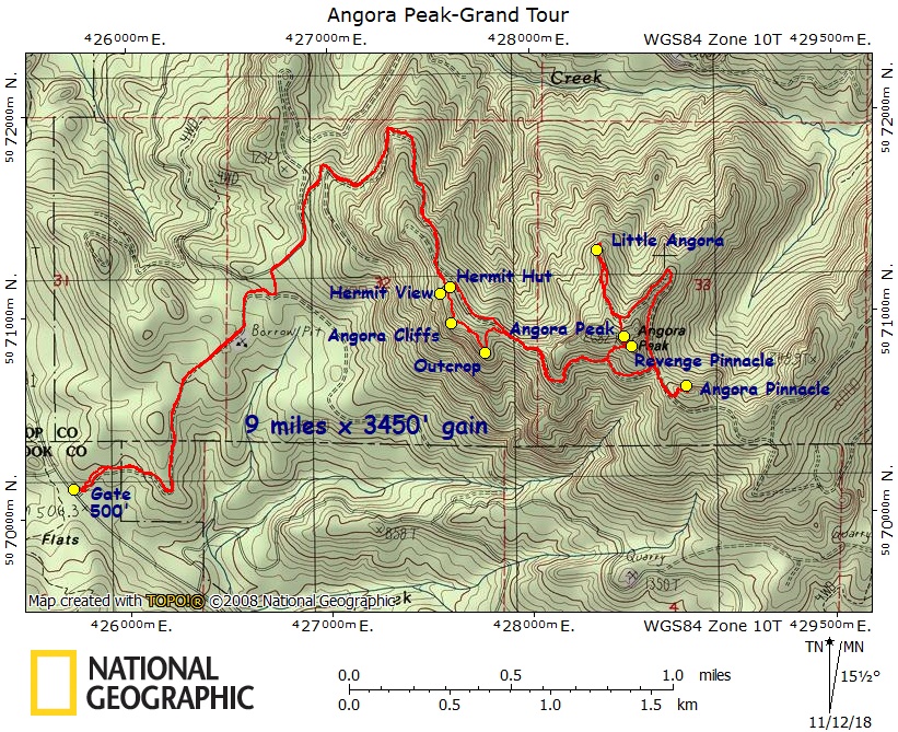
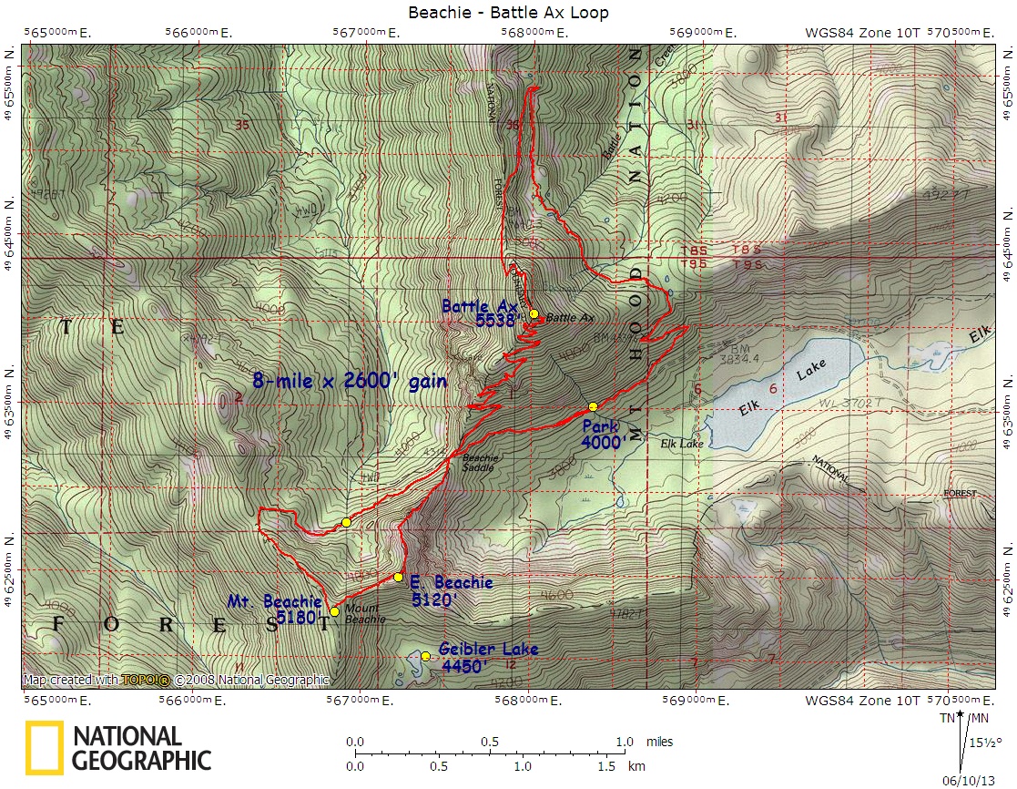
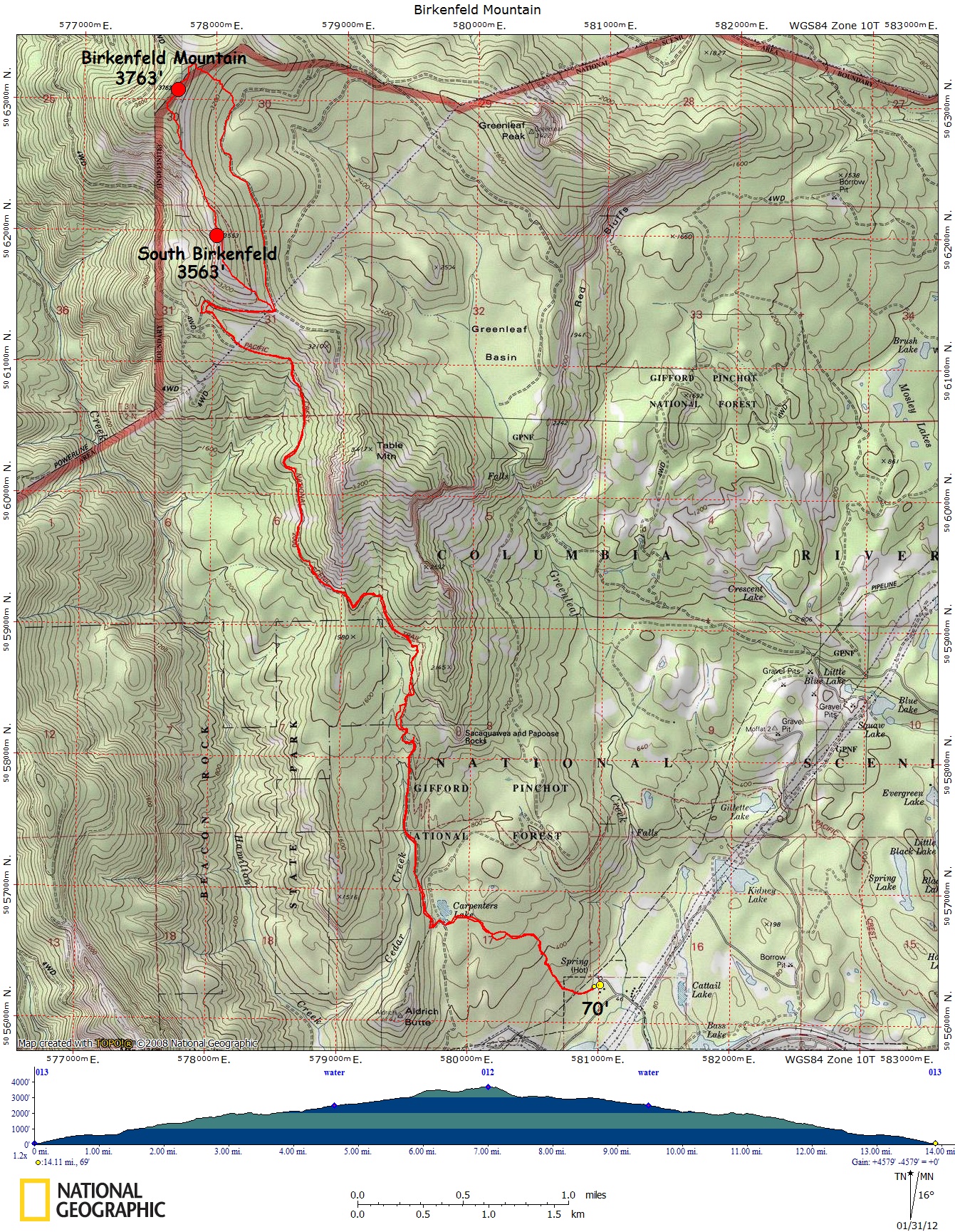
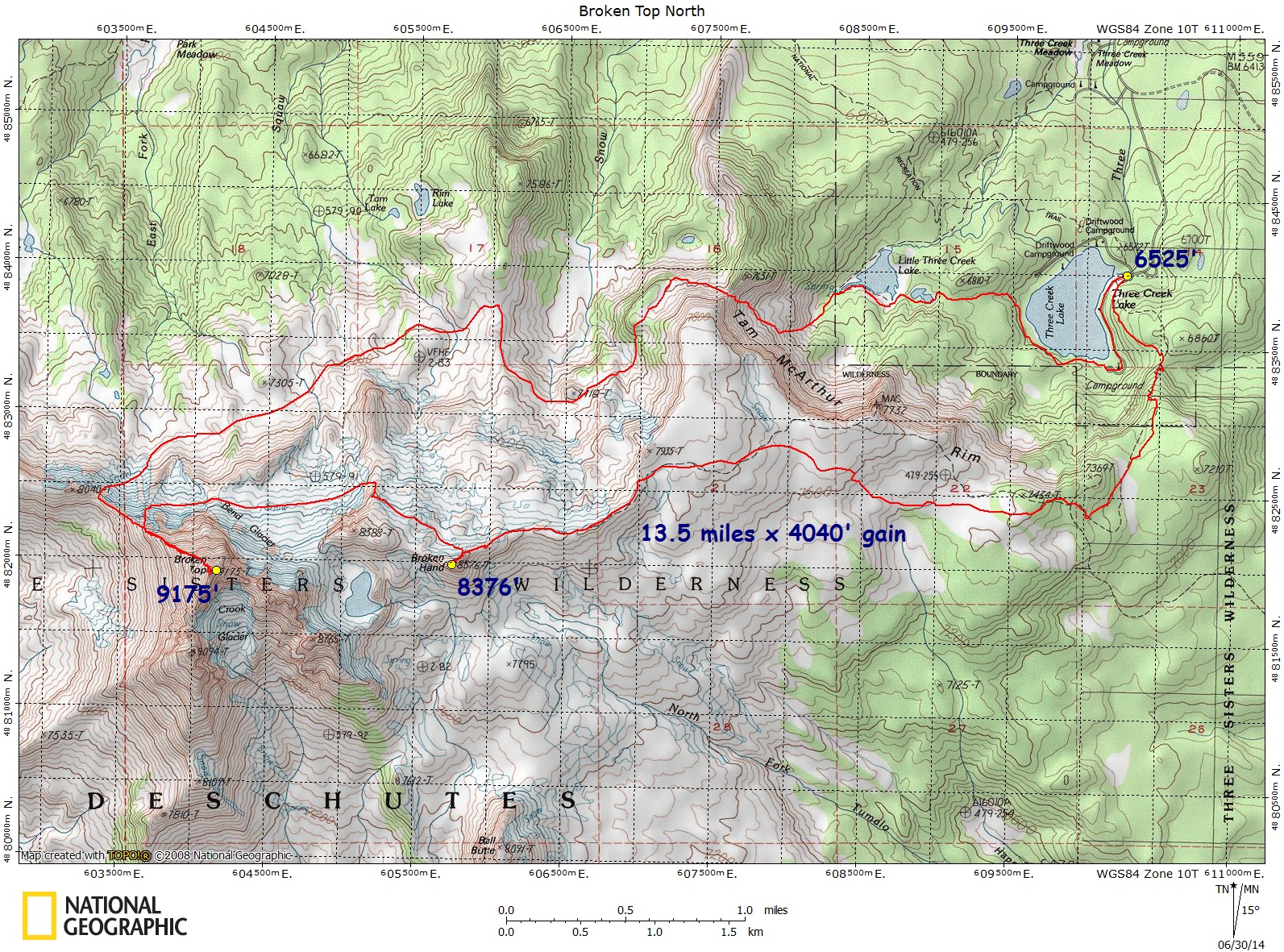
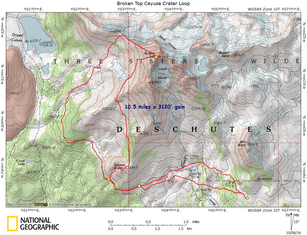
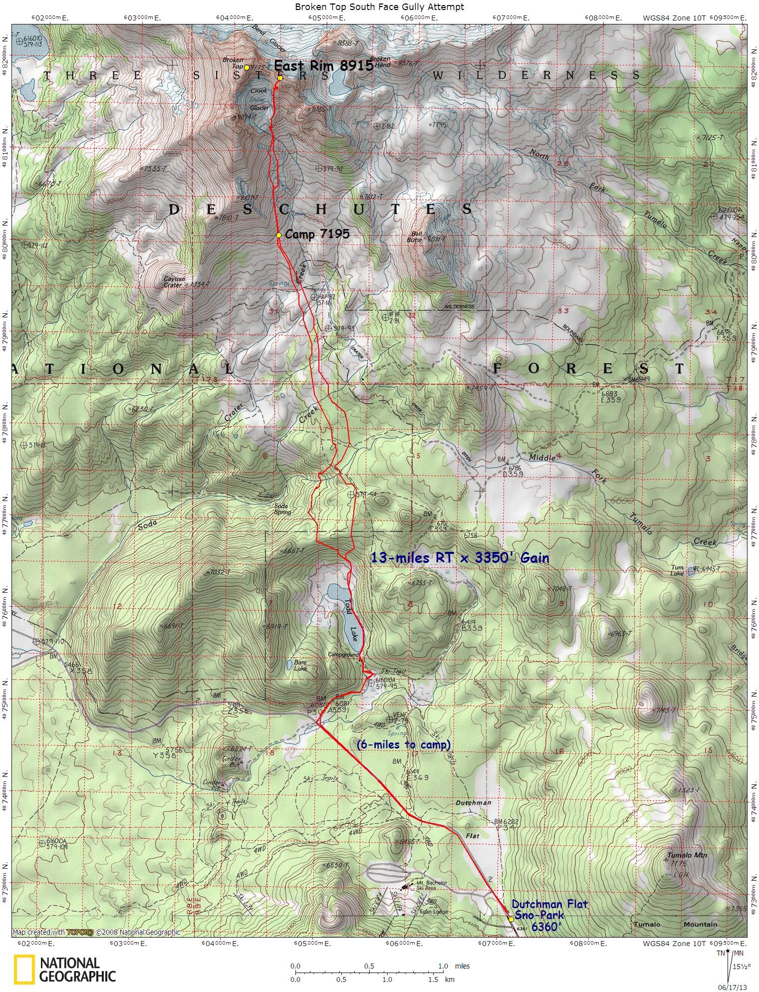
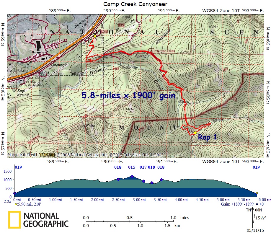
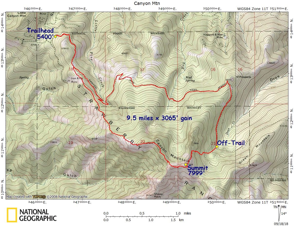
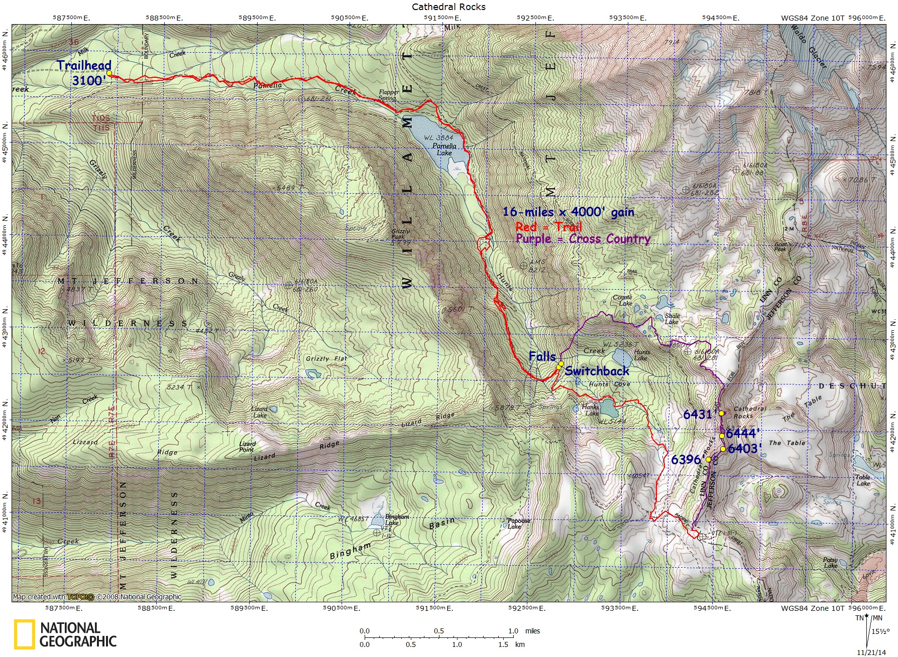
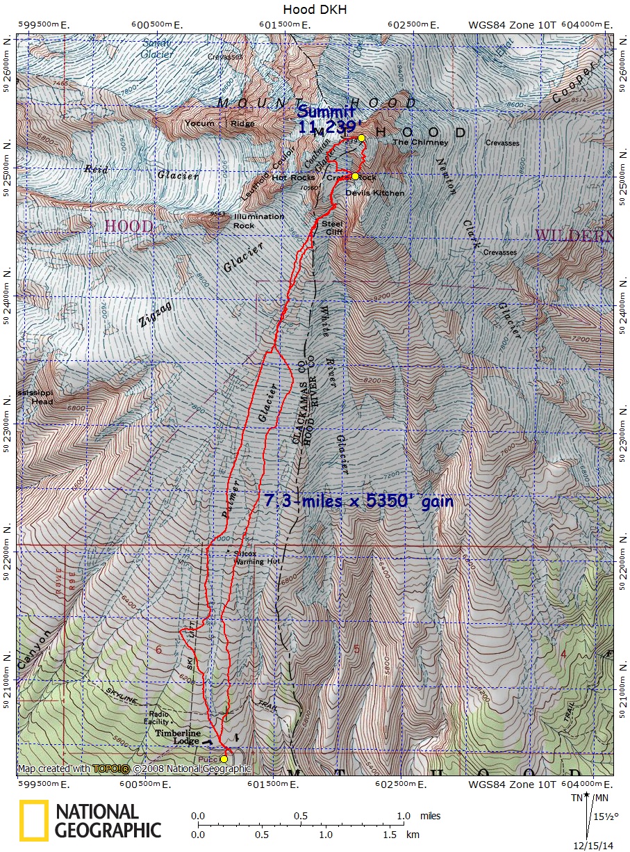
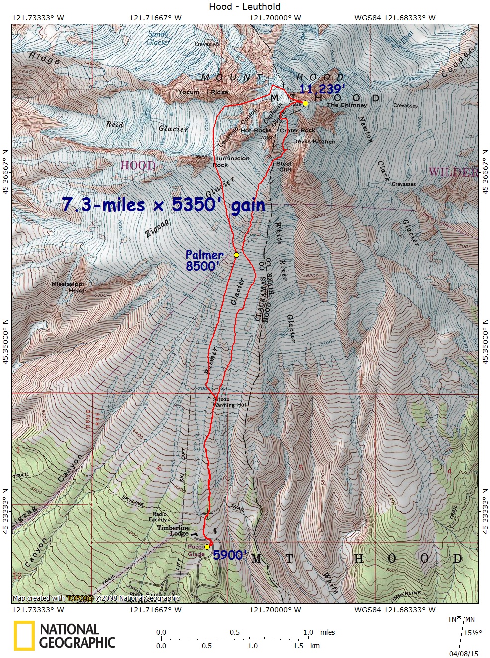
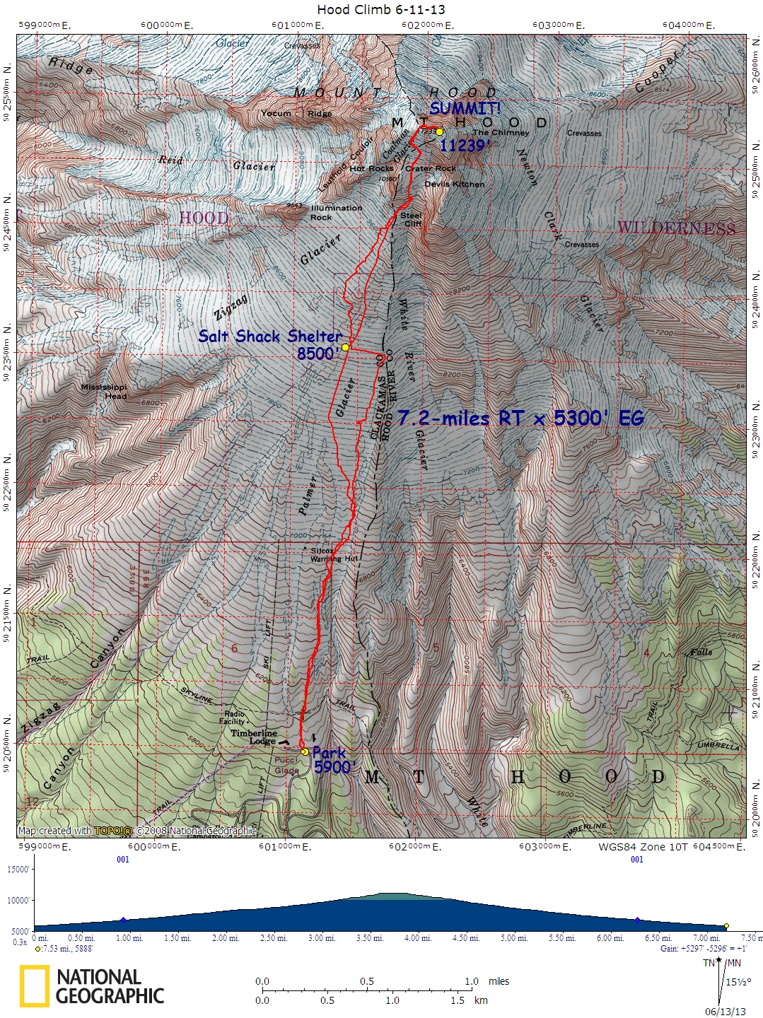
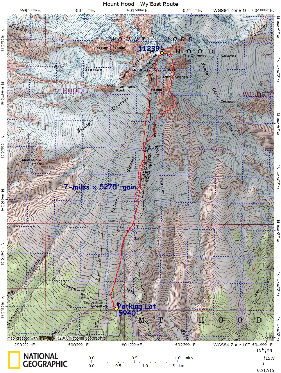
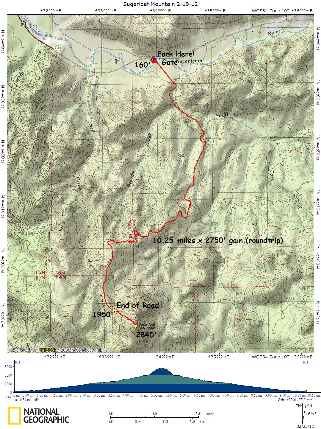
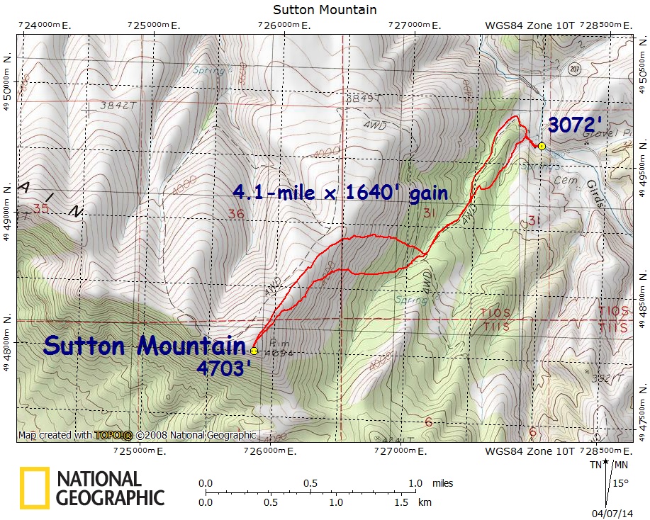
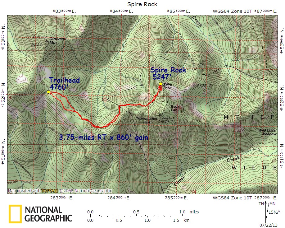
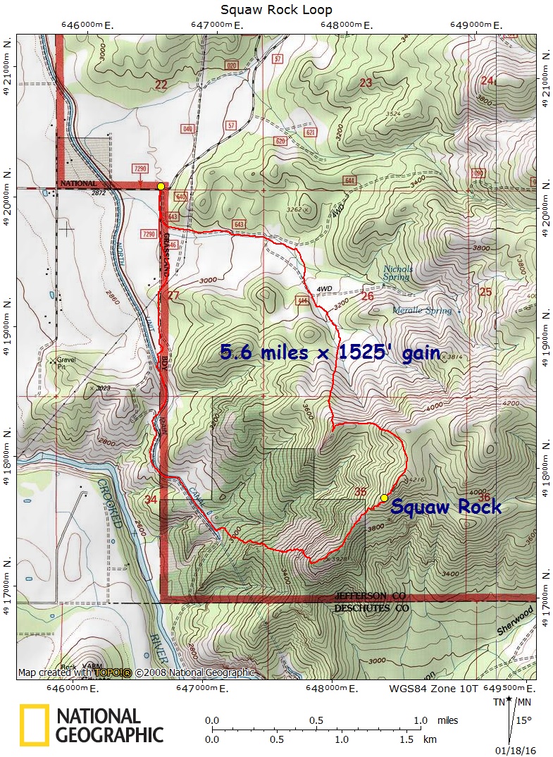
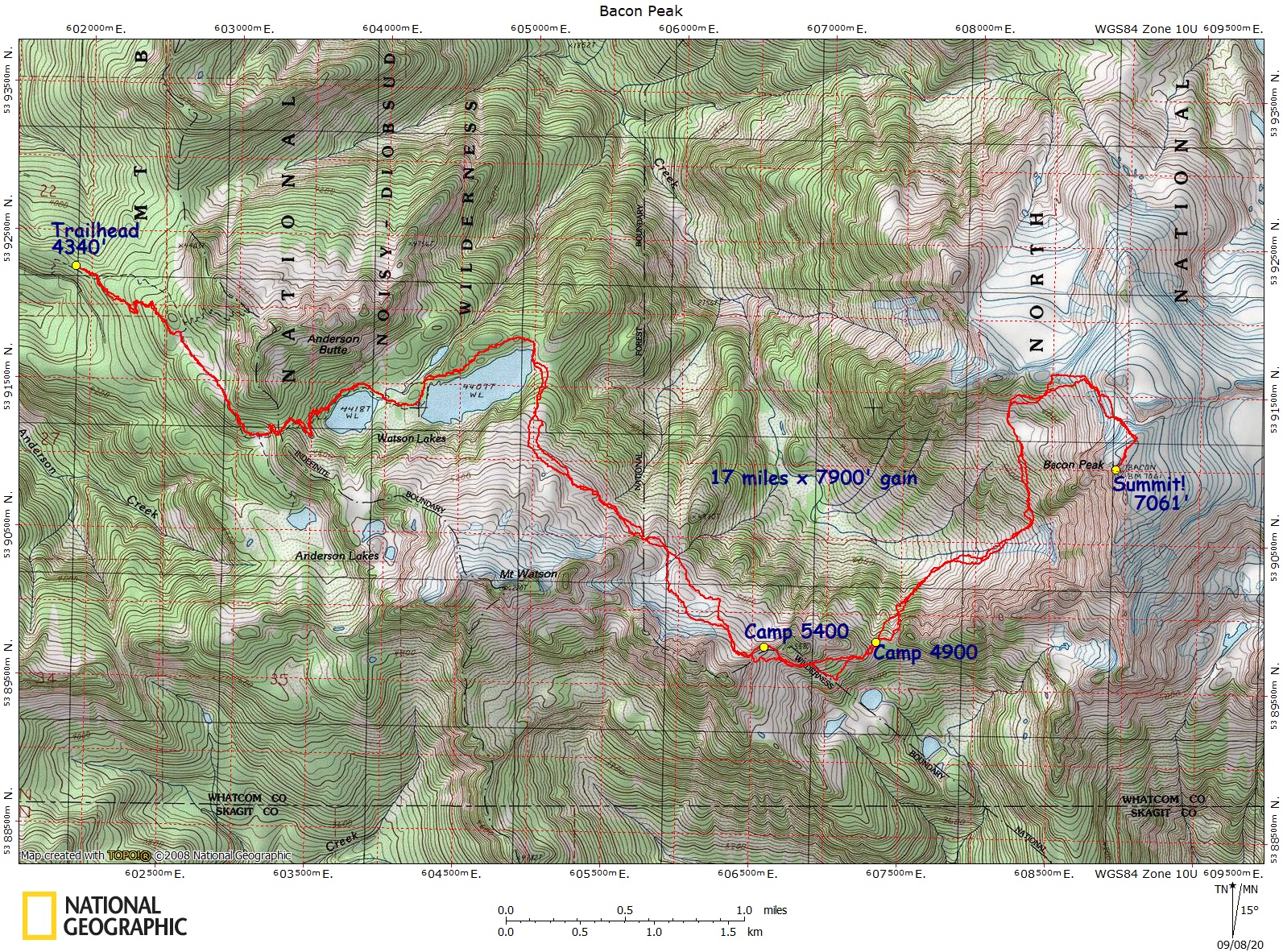
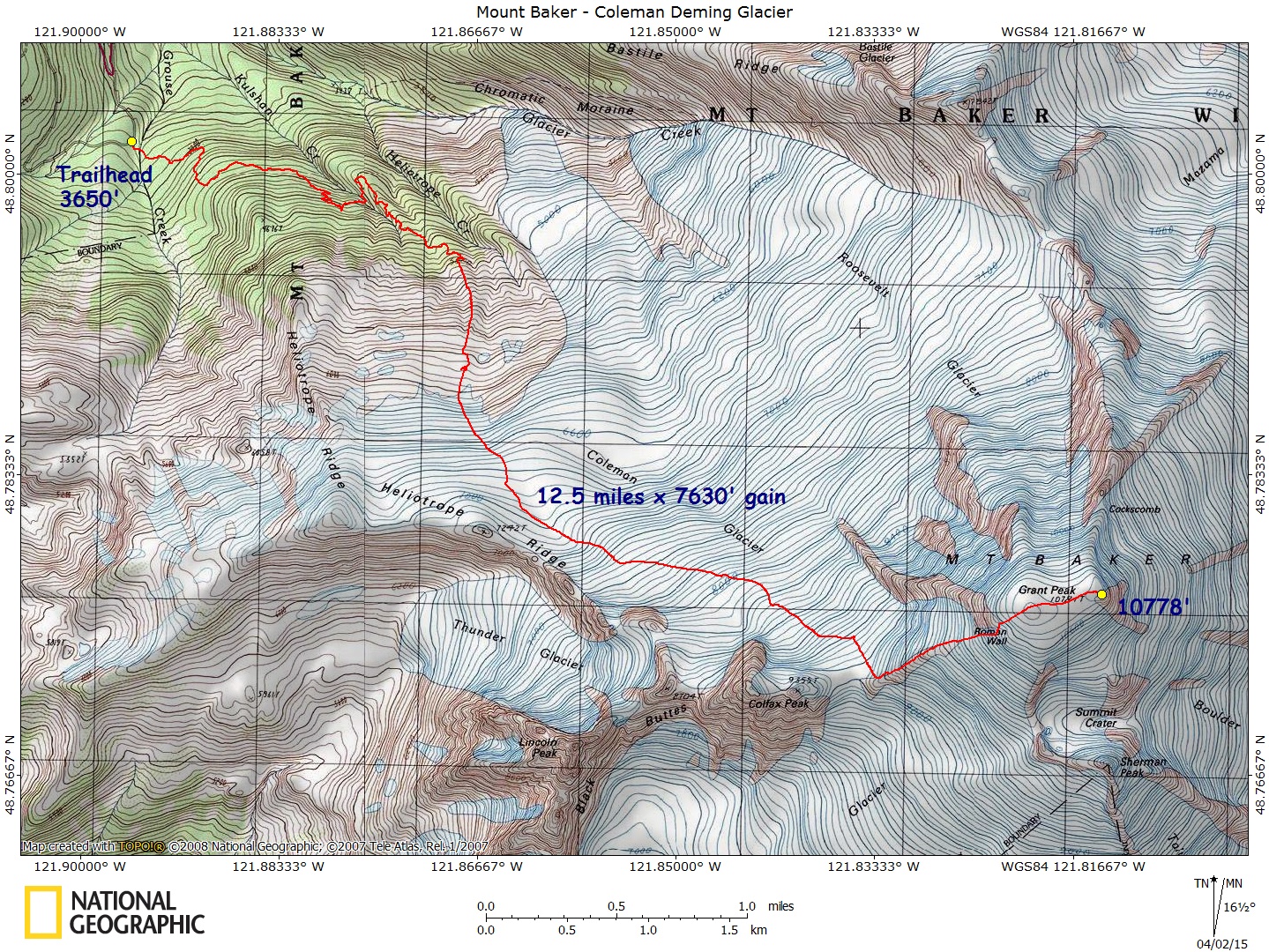
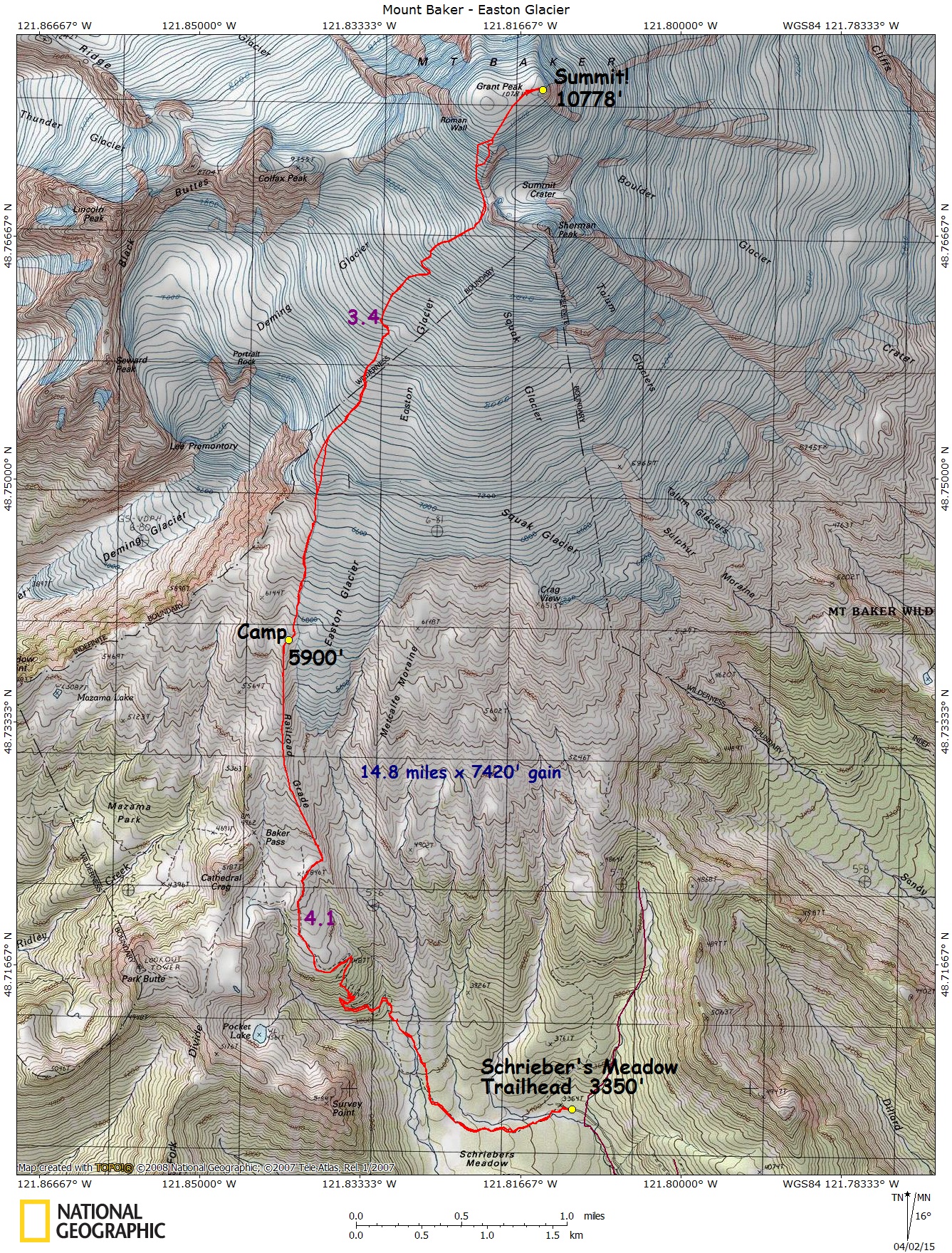
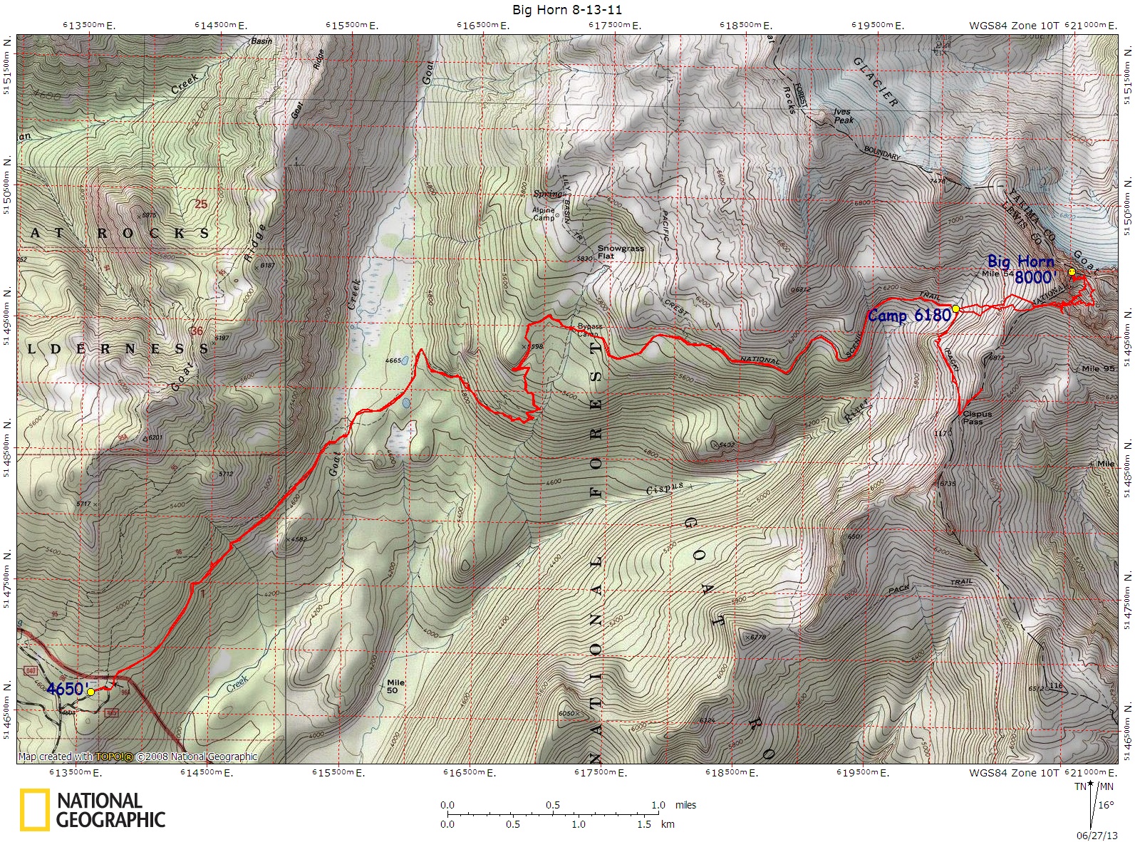
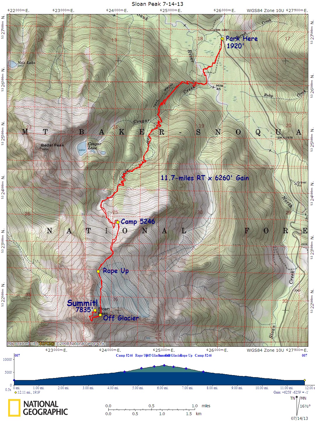
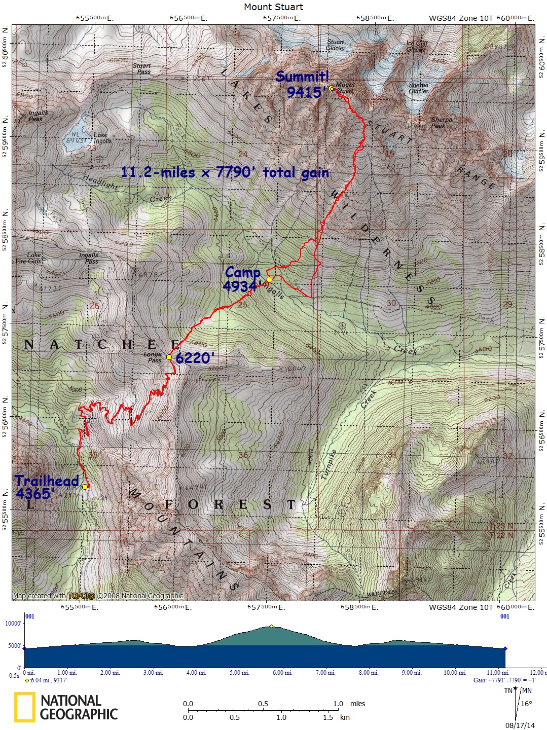
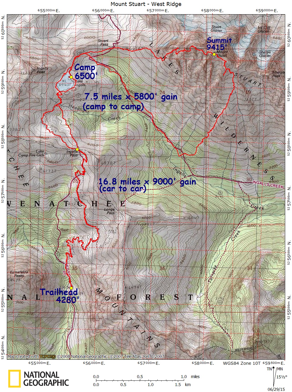
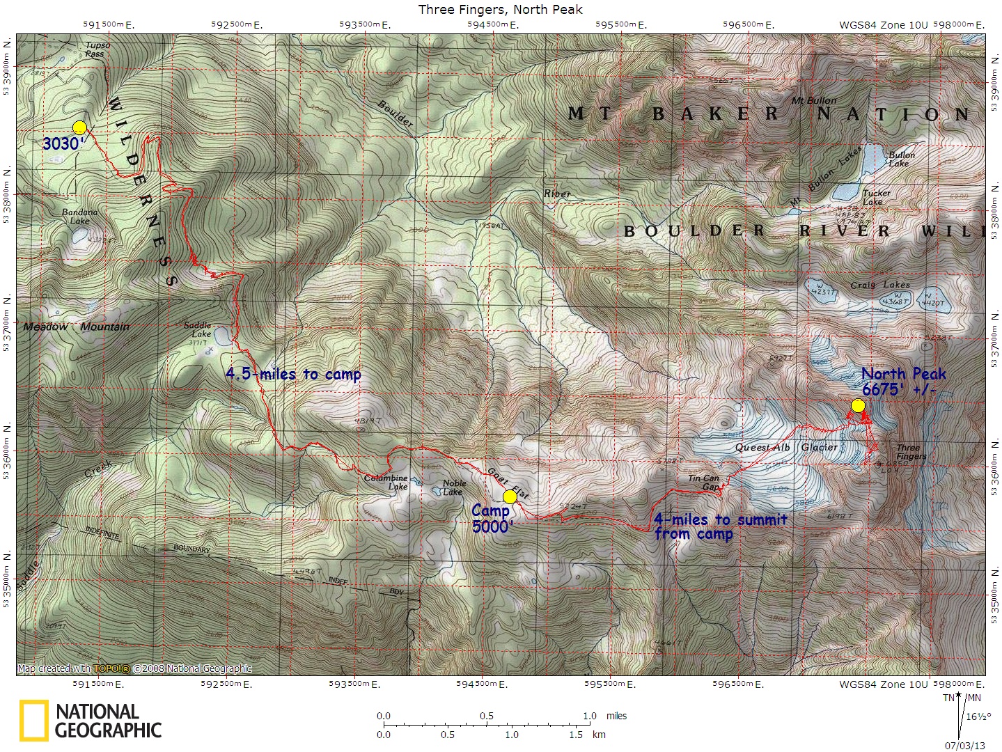
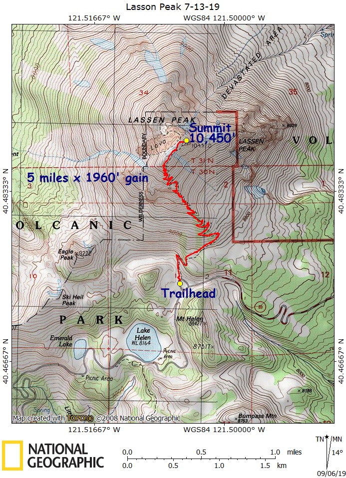
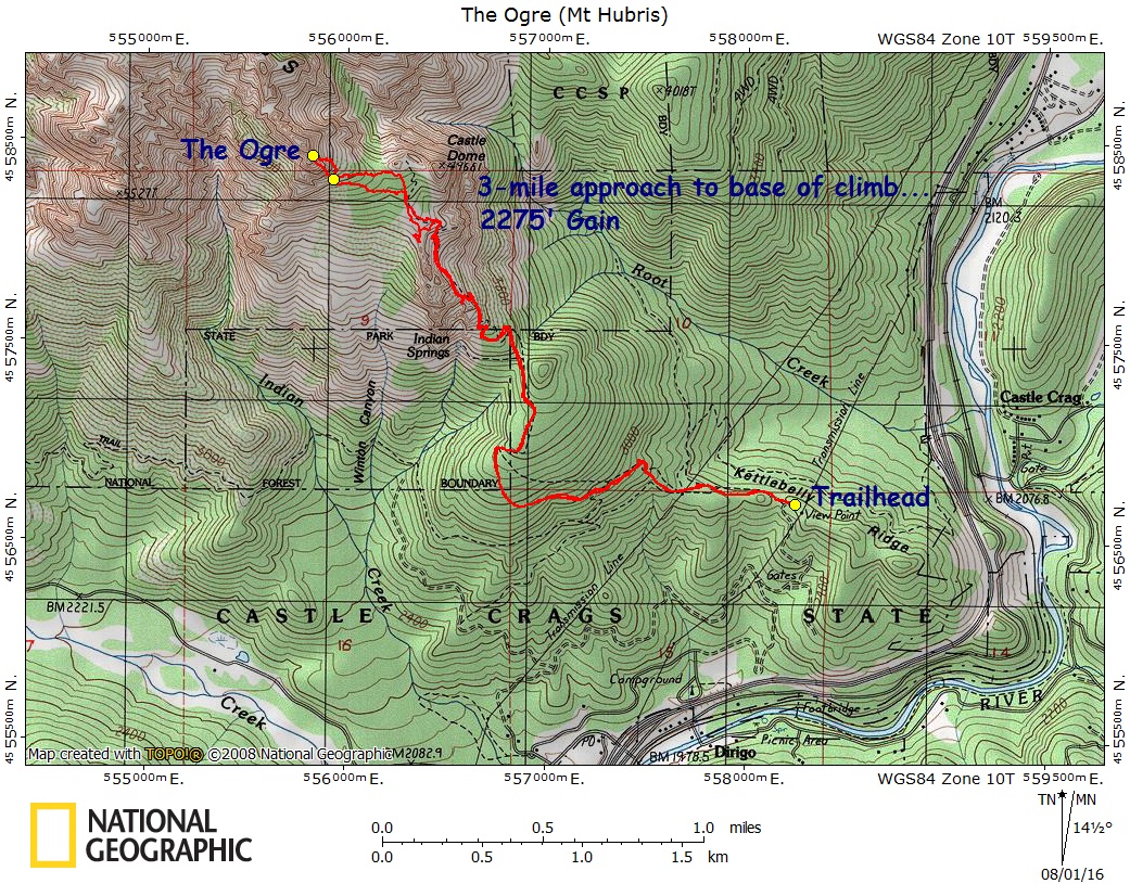
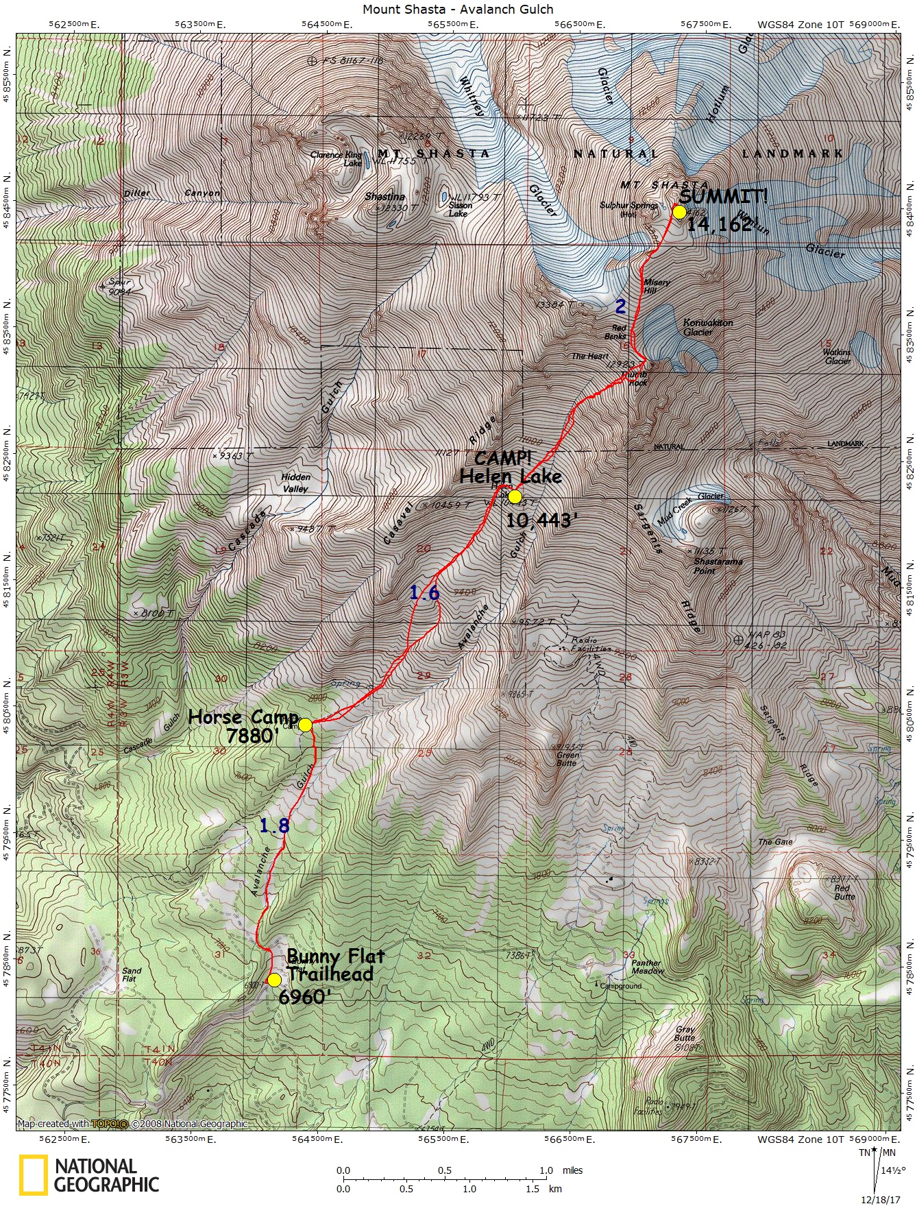
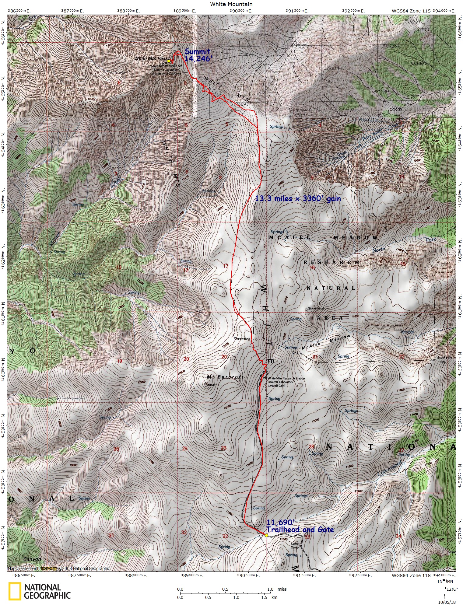
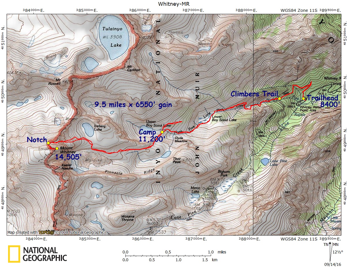
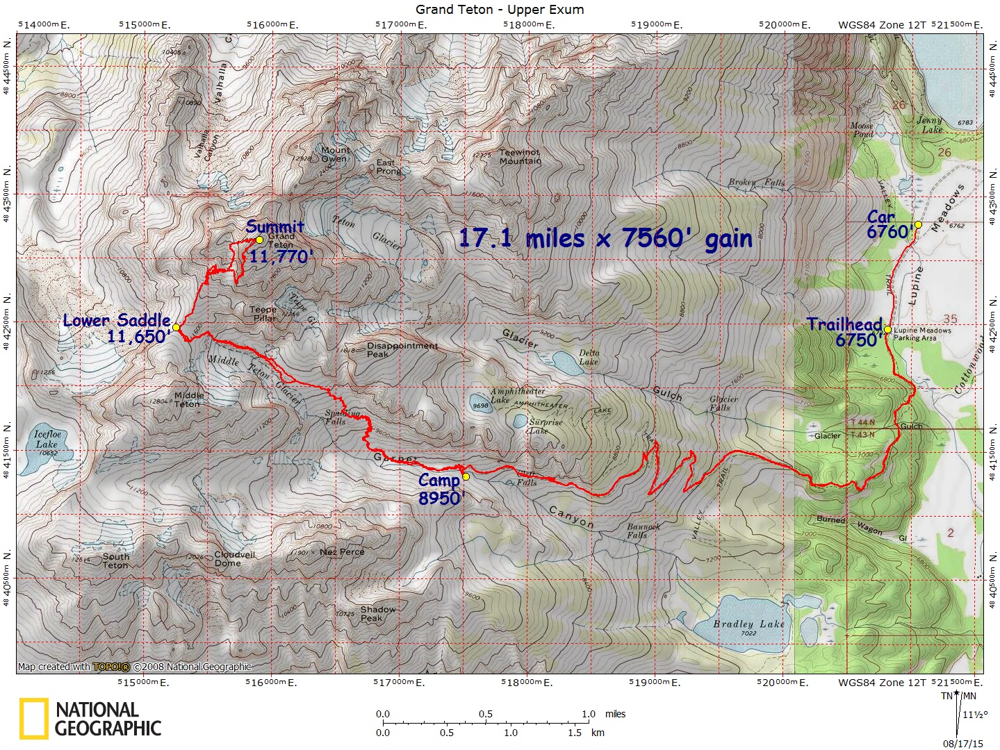
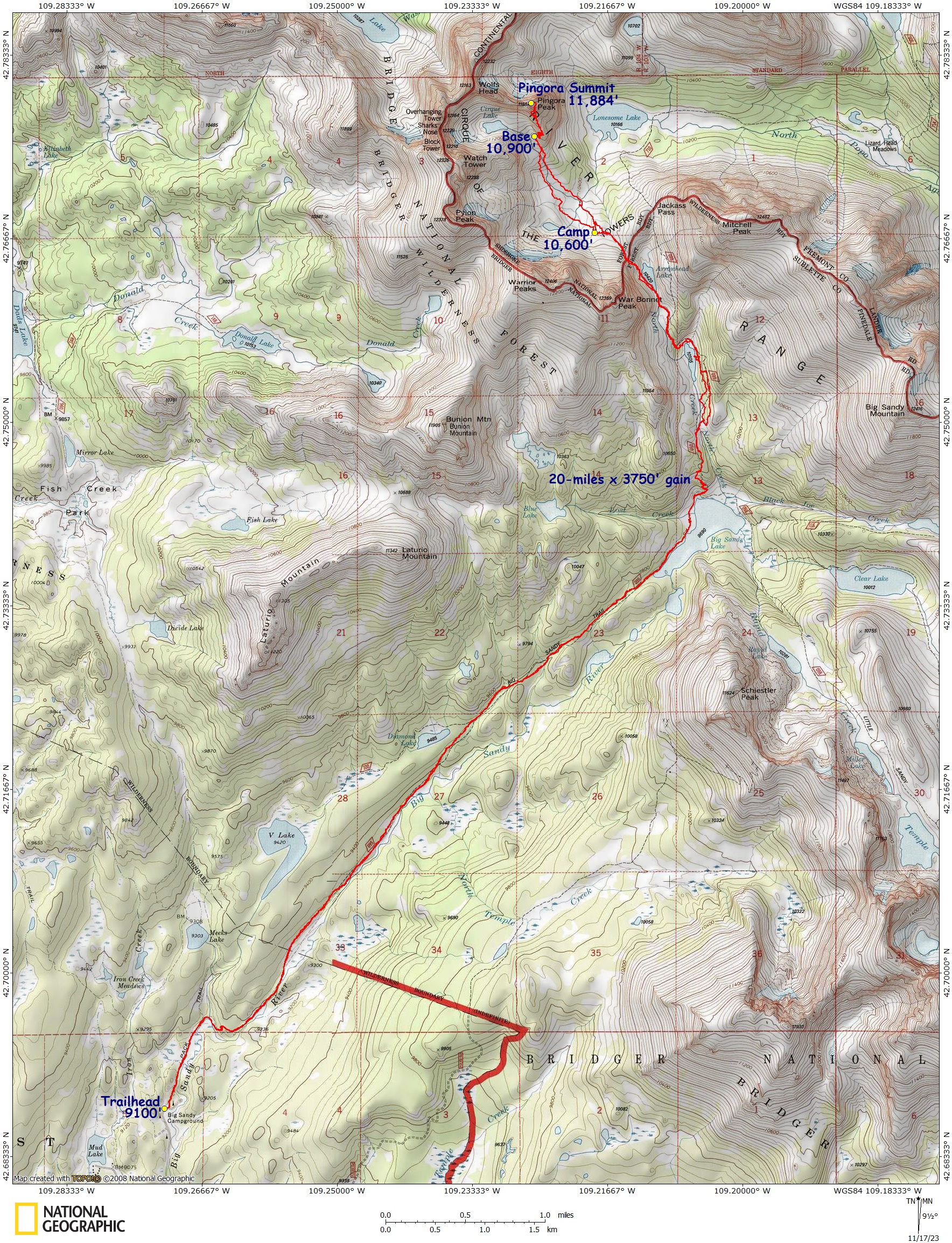
The red line route is the GPS track I recorded, and imported into the software.
To print them yourself, open the link. If the map looks good, then right click, select “Save Image/File As”, save to your hard drive (Under the directory “Awesome Maps by Karl =^), and then print.
Printing tip: Save the .jpg map files onto a thumb drive, take the drive to a Fed-Ex office store, and have them print it for you at the counter. The counter service normally gets you heavier weight paper than at the self-serve machines, and the print quality is a LOT better than you’ll get from your home ink jet printer.
And, if you find these maps or tracks helpful, feel free to buy me a beer from the link at the top. =^) Doing so will help me pay for web hosting and keep this resource free for everyone to use.
Enjoy,
Karl
DISCLAIMER: Along with these maps and tracks, remember to bring your common sense. If you get lost, mangled, etc. while using these maps or tracks, I have no responsibility for your actions or the result of your hike.
OREGON – Maps & Real GPS Tracks
Acker Rock, Peregrine Traverse – Map – GPS Track
Adventure Ridge Loop – Map – GPS Track
Angora Peak, The Grand Tour – Map – GPS Track
Angora Cliffs – Map – GPS Track
Beachie, Mt. / Battle Ax Loop – Map – GPS Track
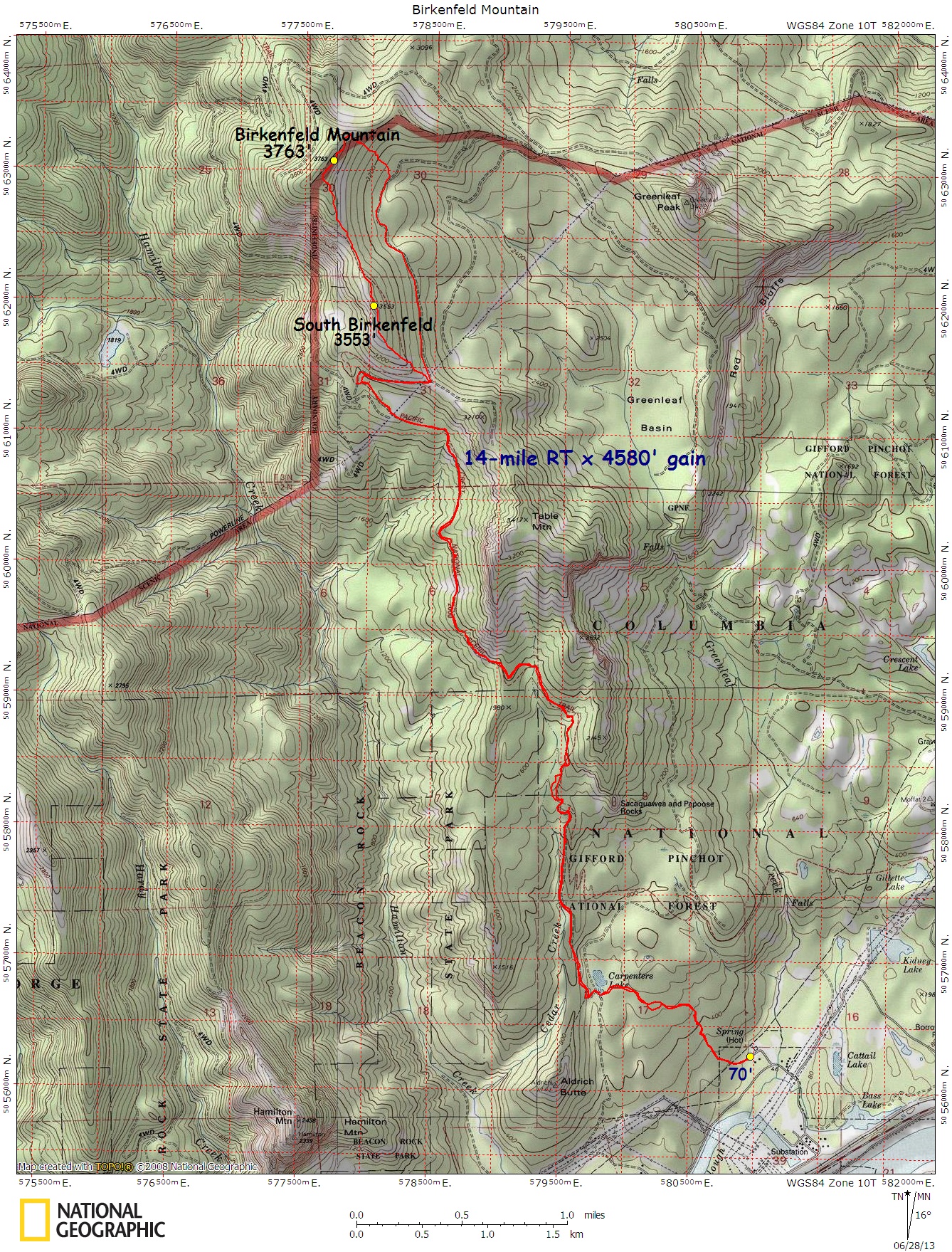
Birkenfeld Mountain – Map – GPS Track
Broken Top / Broken Hand – Northern Approach – Map – GPS Track
Broken Top Circumnavigation – Map – GPS Track
Broken Top / Cayuse Crater – Map – GPS Track
Broken Top, South Face Gully Attempt – Map – GPS Track
Camp Creek Canyoneer – Map – GPS Track
Canyon Mountain – Map – GPS Track
Cathedral Rocks, Mt. Jefferson via Pamelia Lake – Map – GPS Track
Cathedral Rocks, Mt. Jefferson via Bingham Ridge – Map – GPS Track
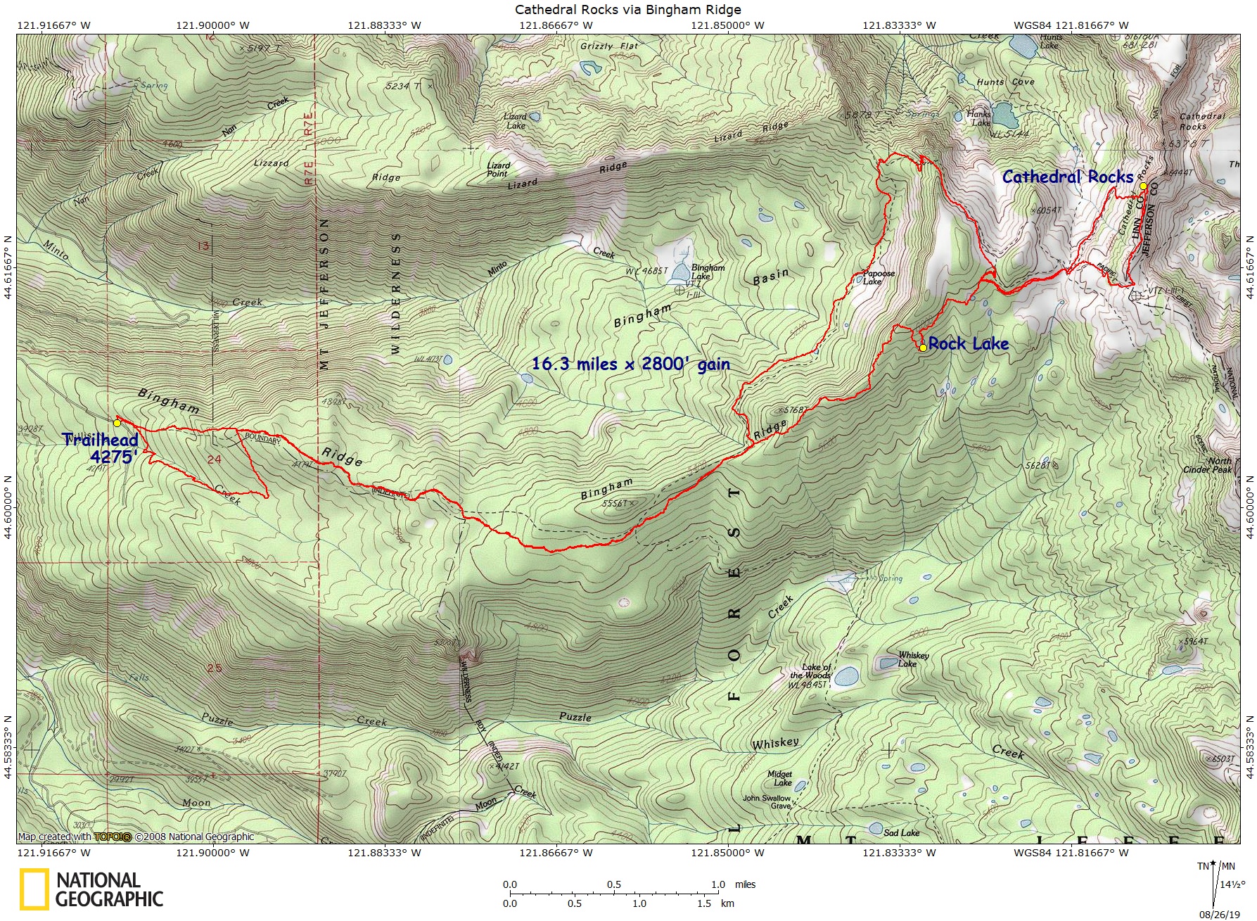
Cone Peak Iron Mountain Loop – Map – GPS Track
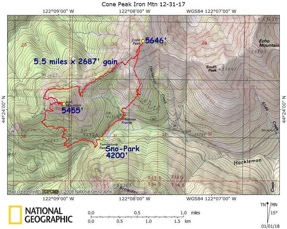
Defiance, Mount – Map – GPS Track
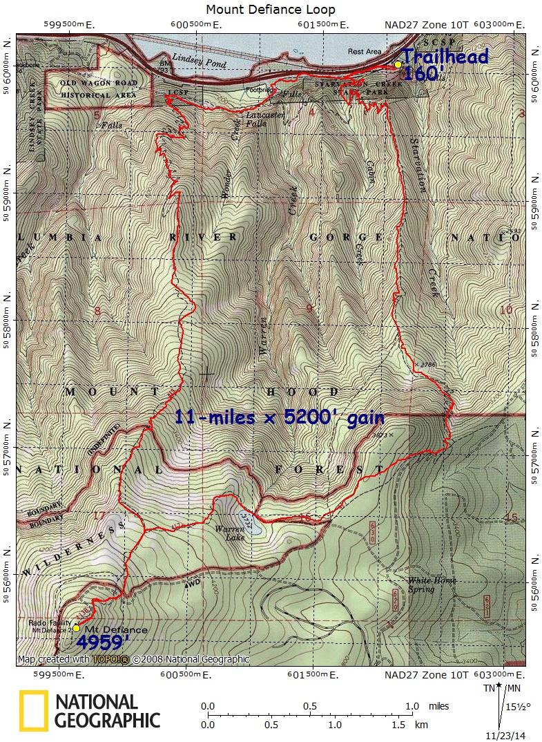
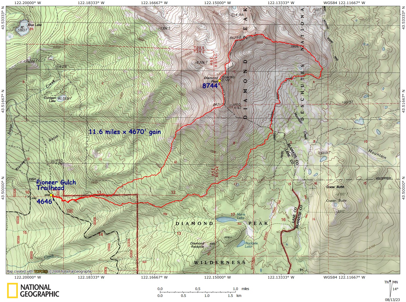
Diamond Peak, Standard Route – Map – GPS Track
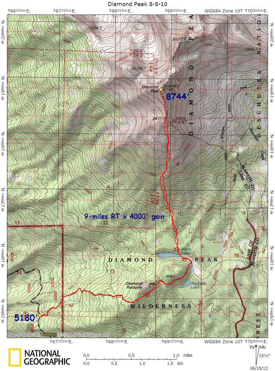
Diamond Peak – East Ridge Scramble – Map – GPS Track
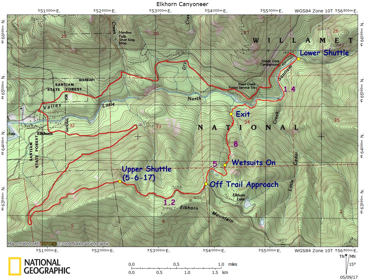
Elkhorn Canyoneer – Map – GPS Track
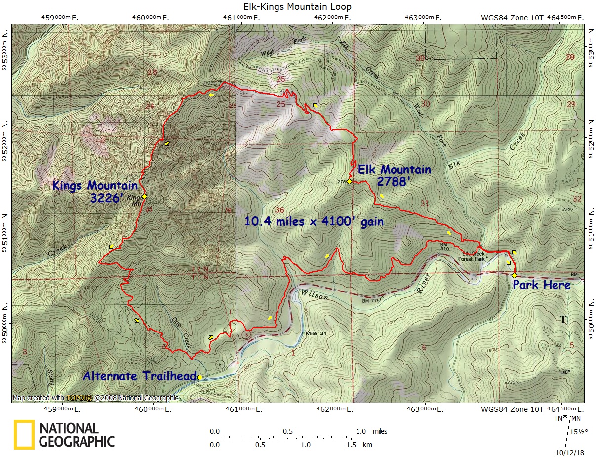
Elk-Kings Traverse – Map – GPS Track
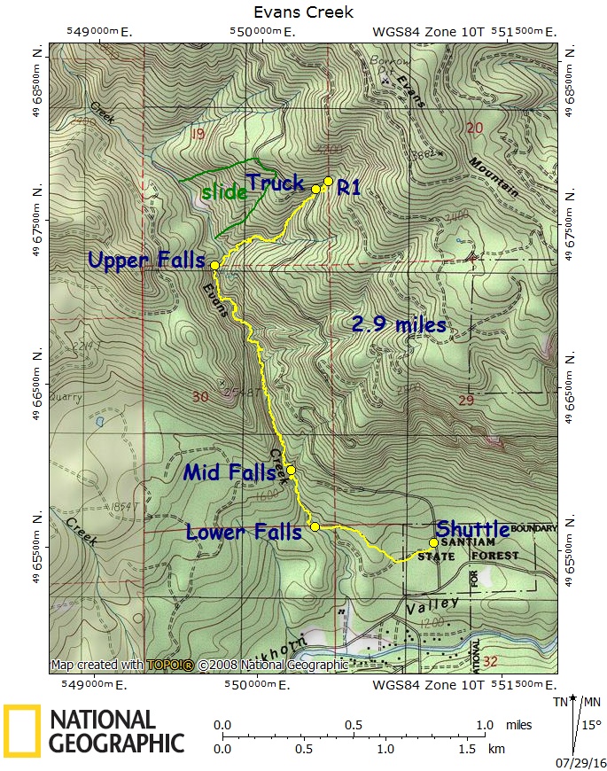
Evans Creek Canyoneer – Map – GPS Track
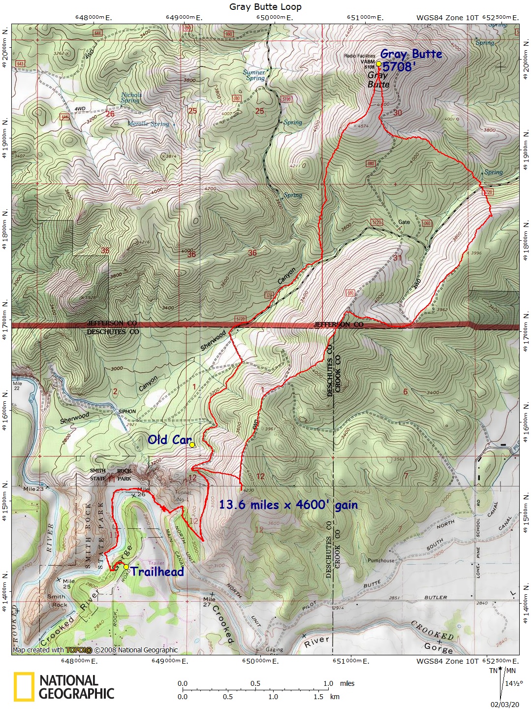
Gray Butte Loop – Map – GPS Track
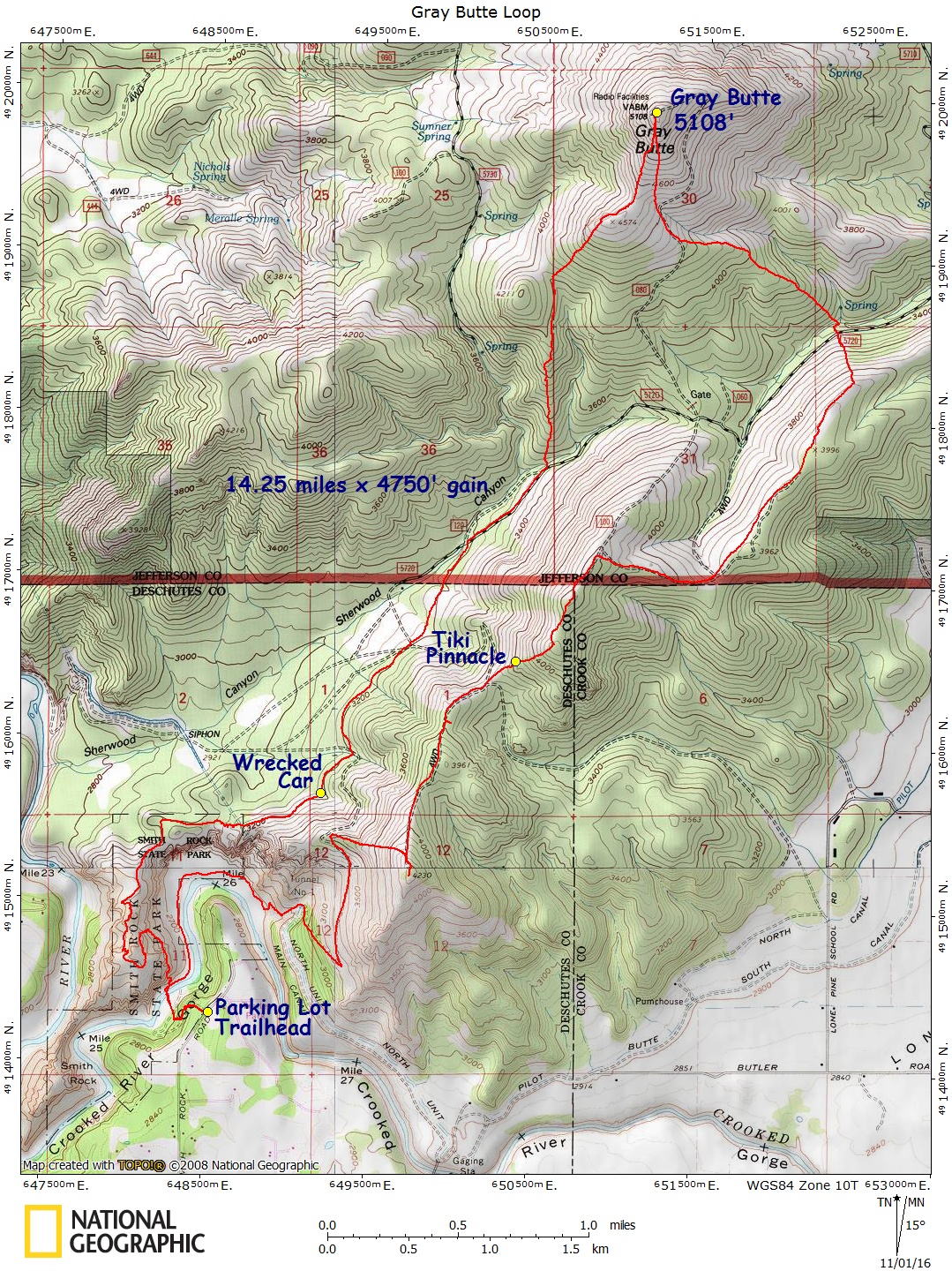
Gray Butte via Smith Rock Loop – Map – GPS Track
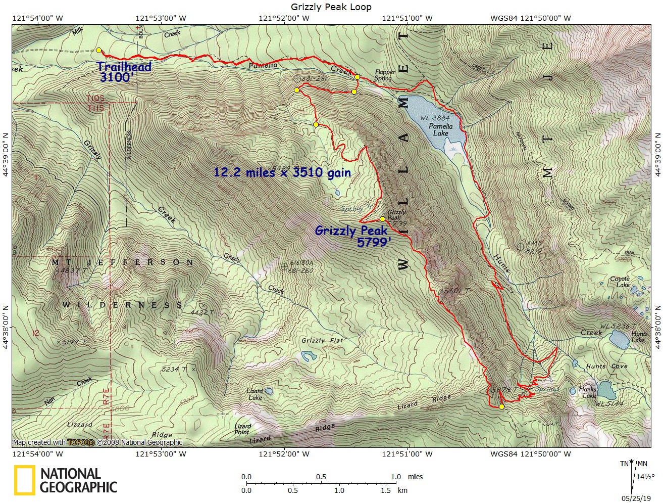
Grizzly Peak Loop – Map – GPS Track
Hood – Devils Kitchen Headwall, Left – Map – GPS Track
Hood – Leuthold Couloir – Map – GPS Track
Hood – South Side, Old Chute – Map – GPS Track
Hood – Wy’East – Map – GPS Track
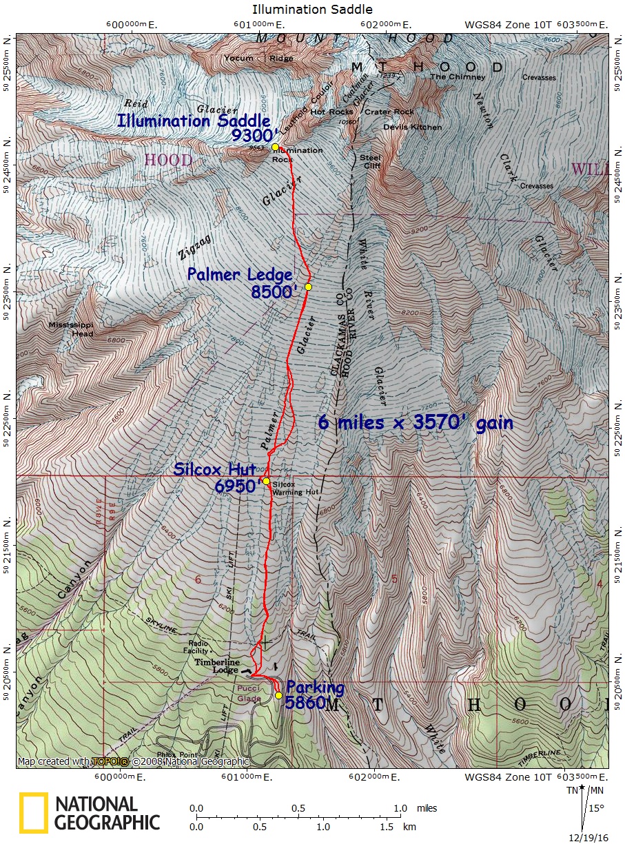
Illumination Saddle – Map – GPS Track
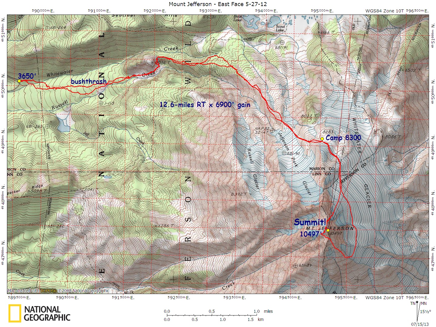
Jefferson, Mt., East Face – Map – GPS Track
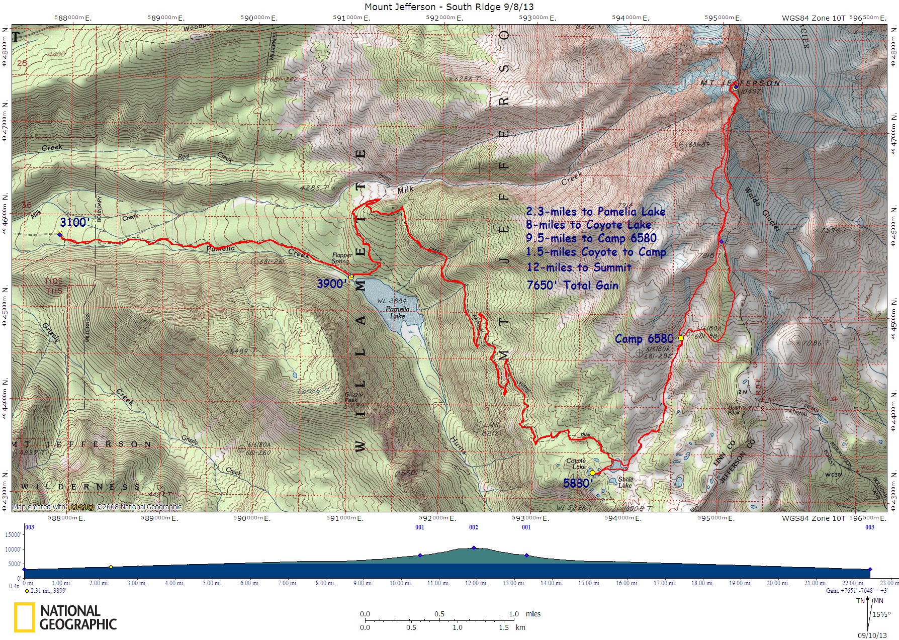
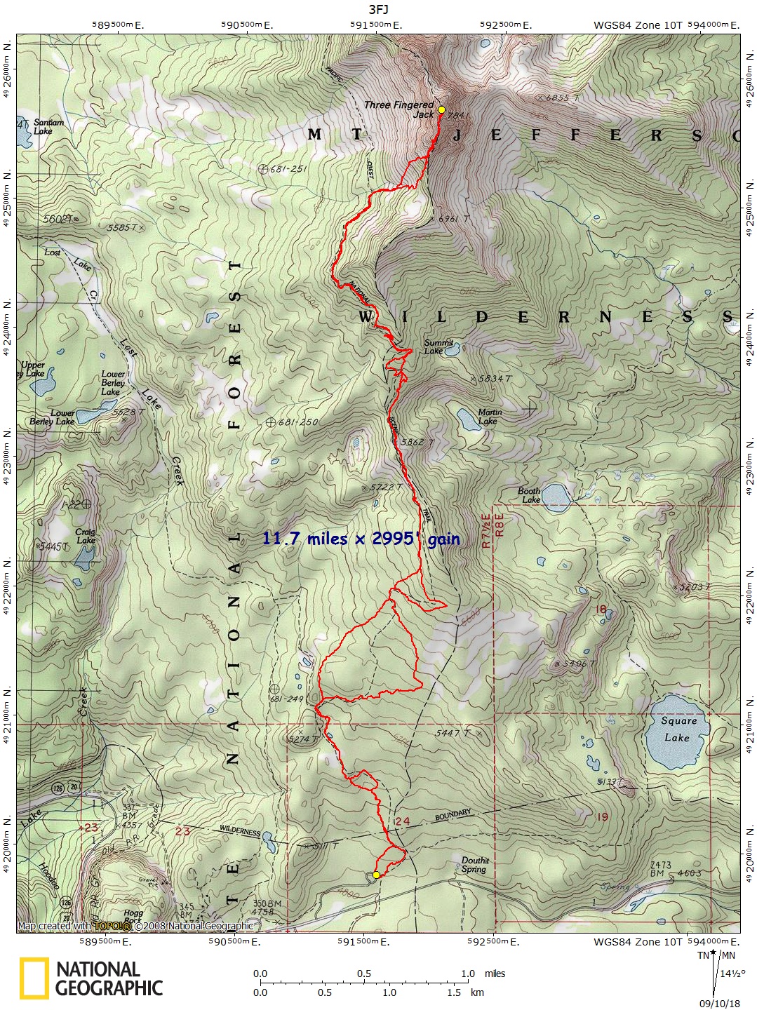
Jefferson, Mt., South Ridge – Map – GPS Track
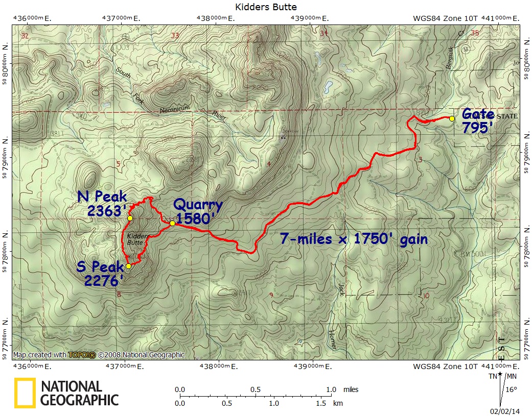
Kidders Butte – Map – GPS Track
Little Cougar Rock – Map – GPS Track
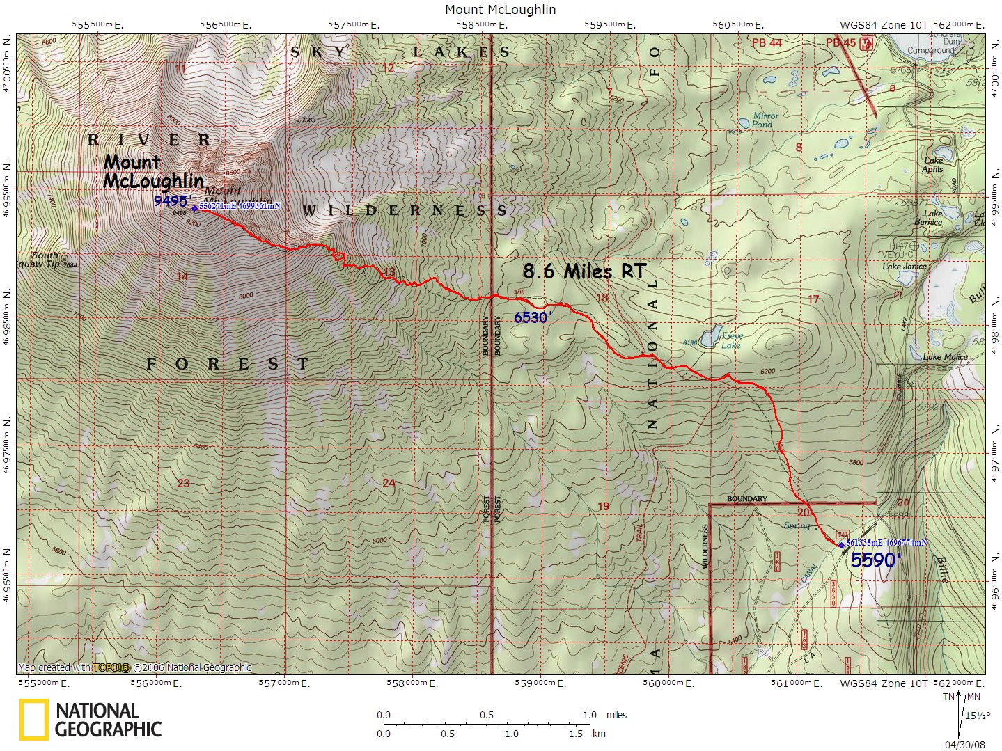
McLoughlin, Mt., Standard Route – Map – GPS Track
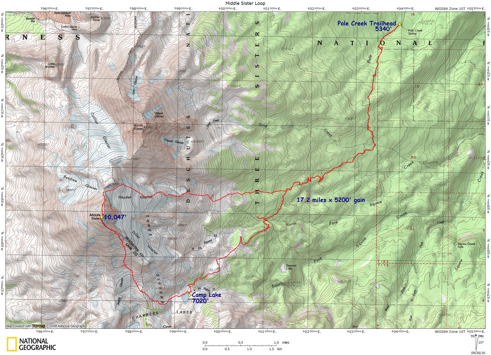
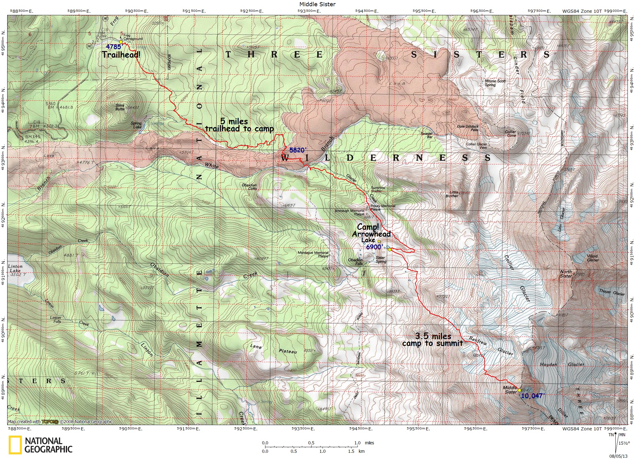
Middle Sister, Hayden/SE Ridge Loop – Map – GPS Track
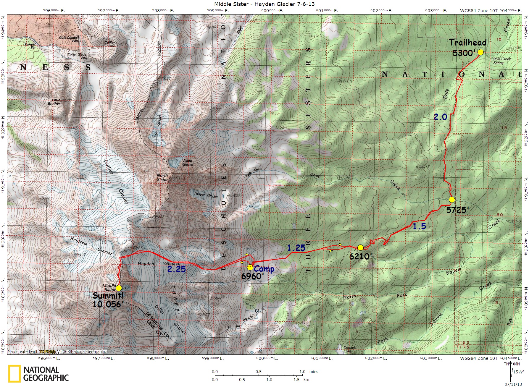
Middle Sister, Hayden Glacier – Map – GPS Track
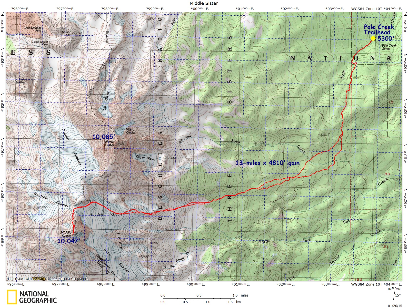
Middle Sister, Hayden Glacier, Winter Route – Map – GPS Track
Middle Sister, SE Ridge – Map – GPS Track
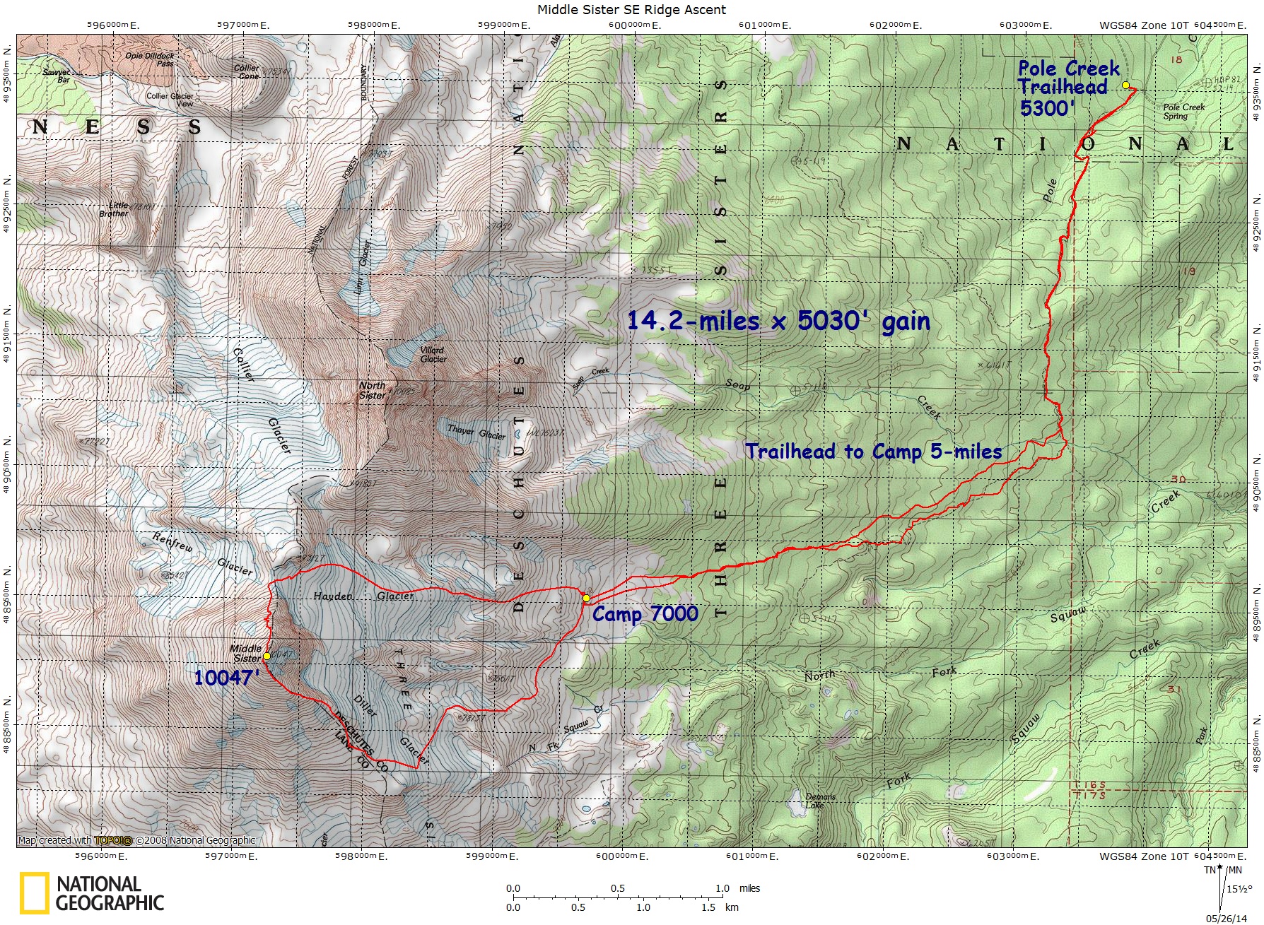
Middle Sister, West Face-Renfrew – Map – GPS Track
Mystery Trail, Gorge – Map – GPS Track
Nasty Rock Twofer – Map – GPS Track
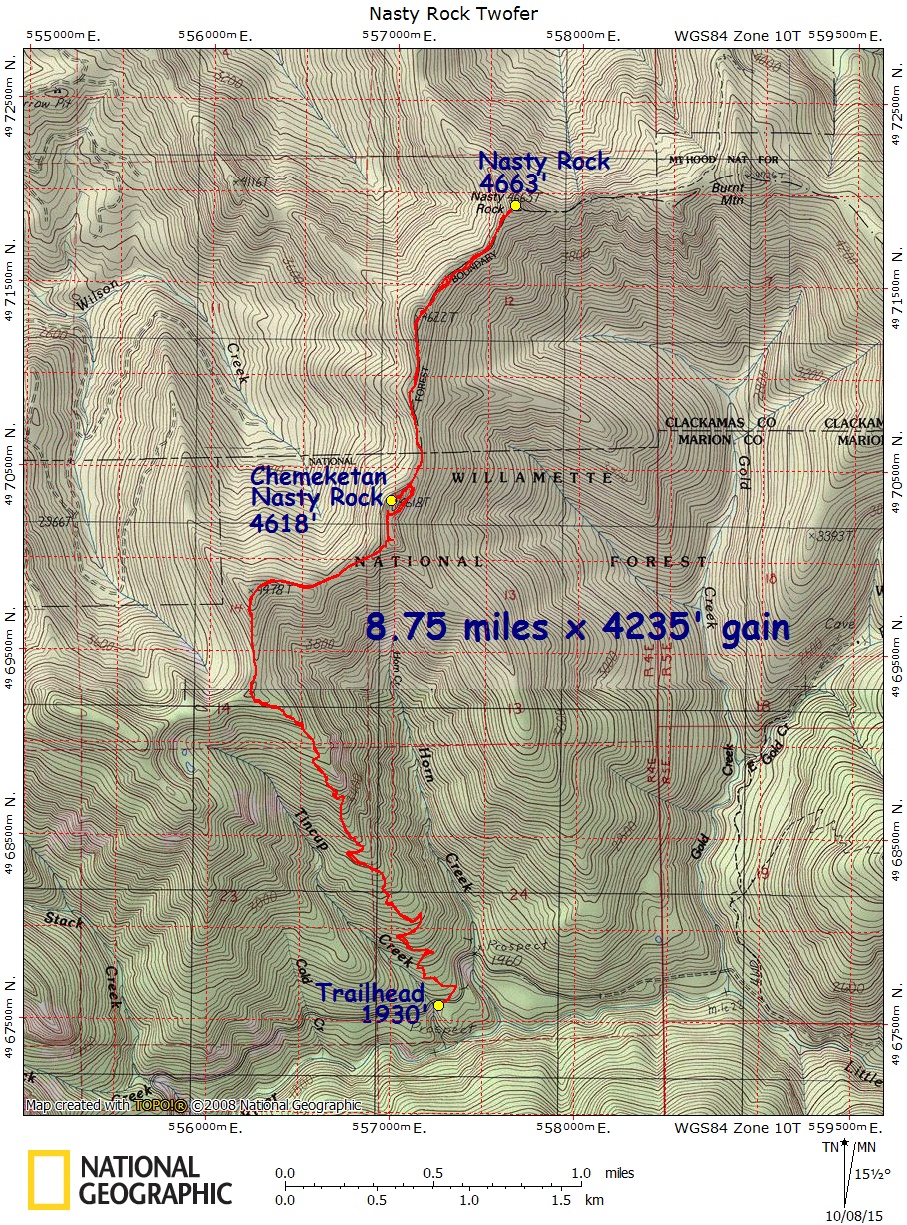
North Fork Breitenbush Cascades – Map – GPS Track
North Sister, Obsidian – Map – GPS Track
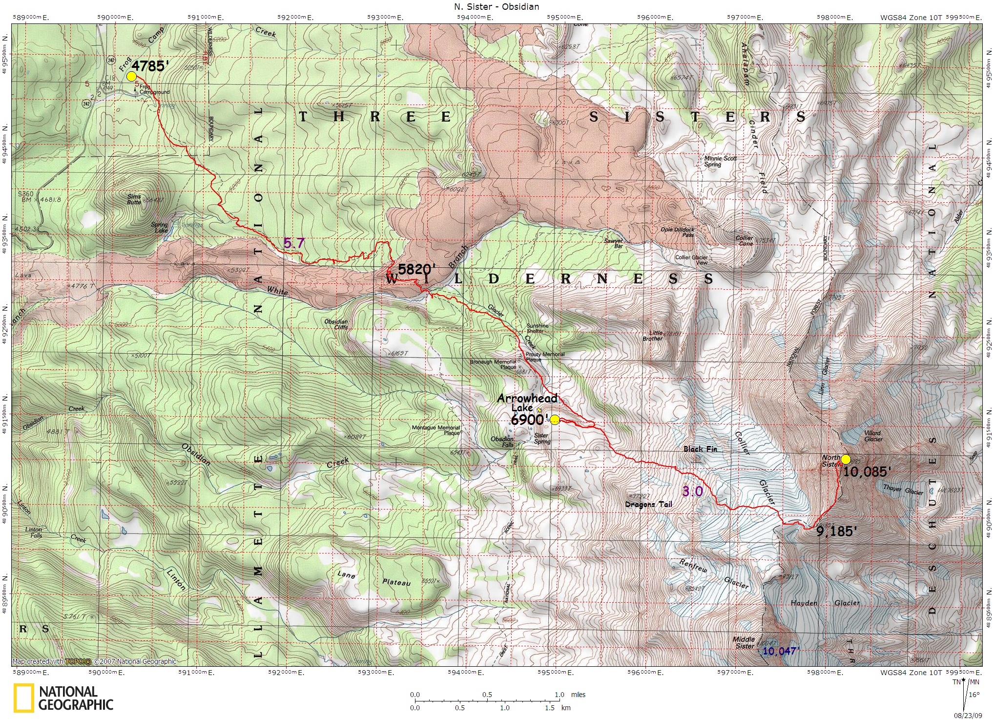
North Sister, Hayden – Map – GPS Track
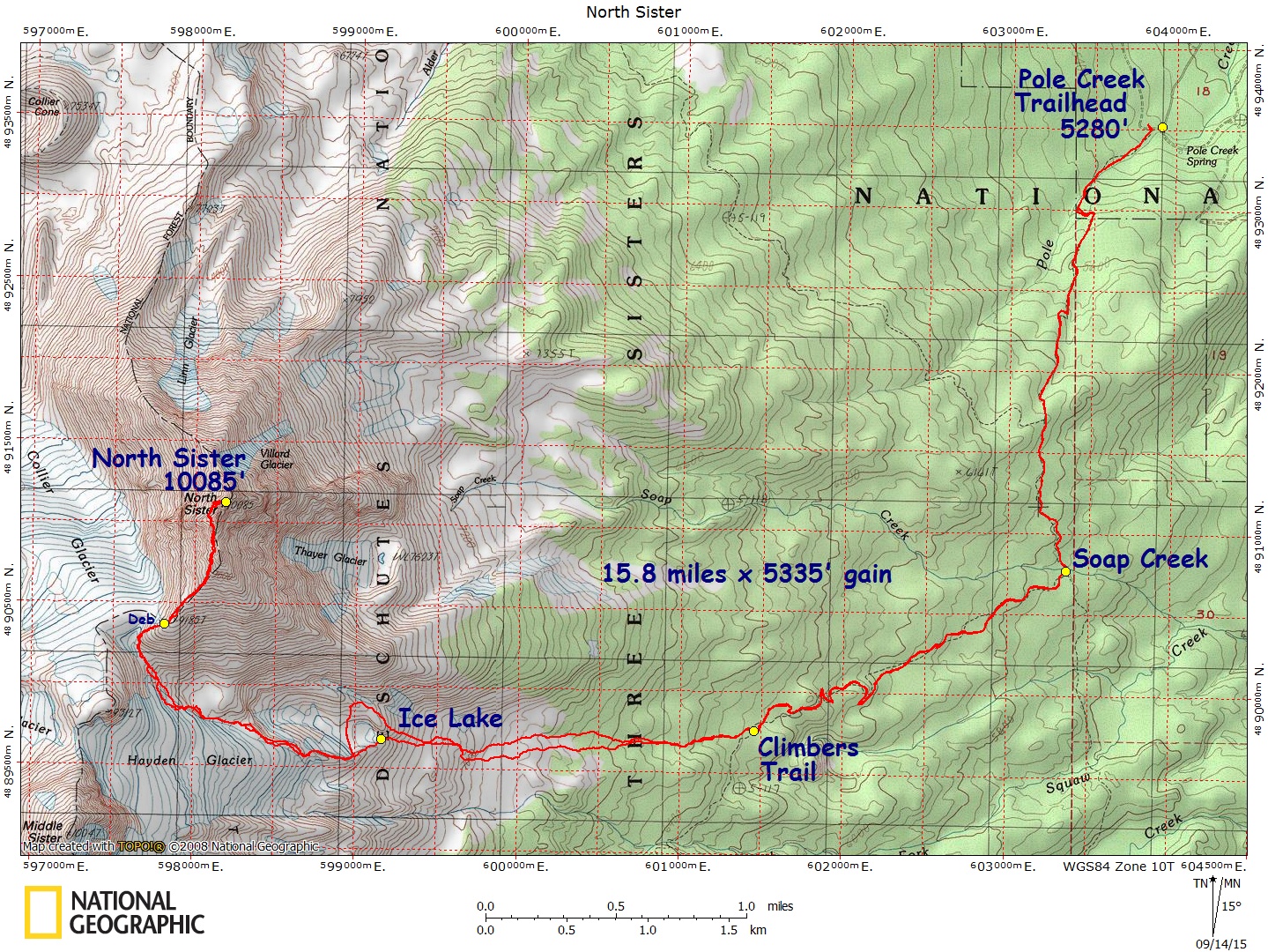
Onion Peak – Standard Route – Map – GPS Track
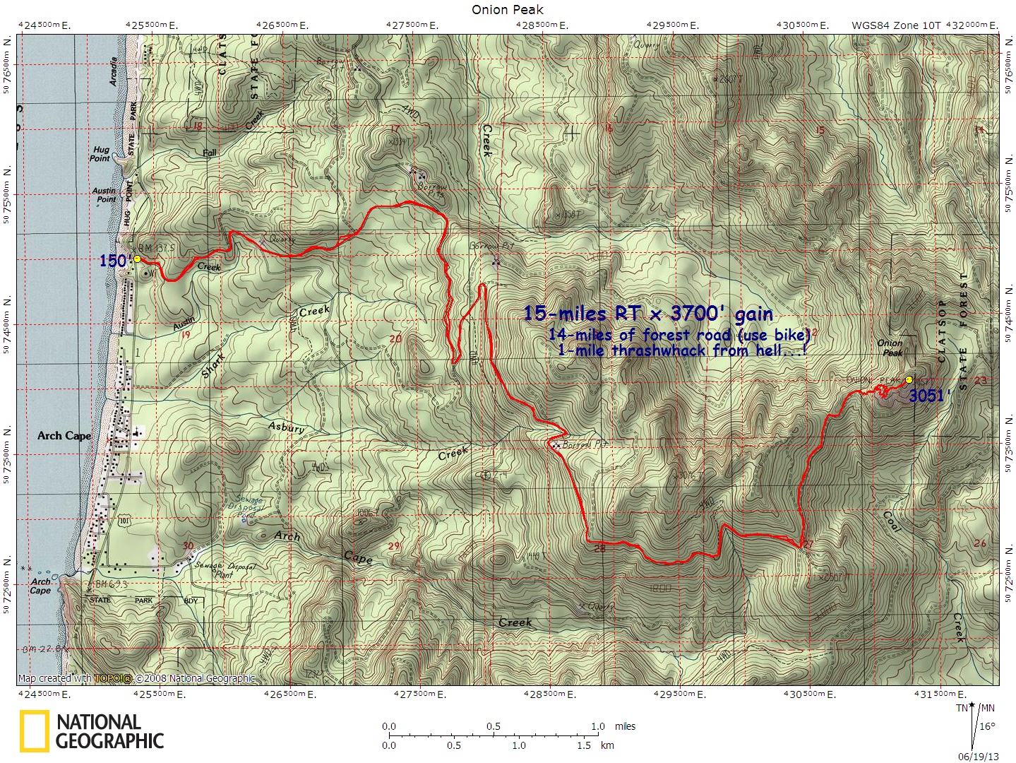
Onion Peak – NE Route – Map – GPS Track
Pechuck Lookout via Old Bridge Trailhead – Map – GPS Track
Pueblo Mountain – Map – GPS Track
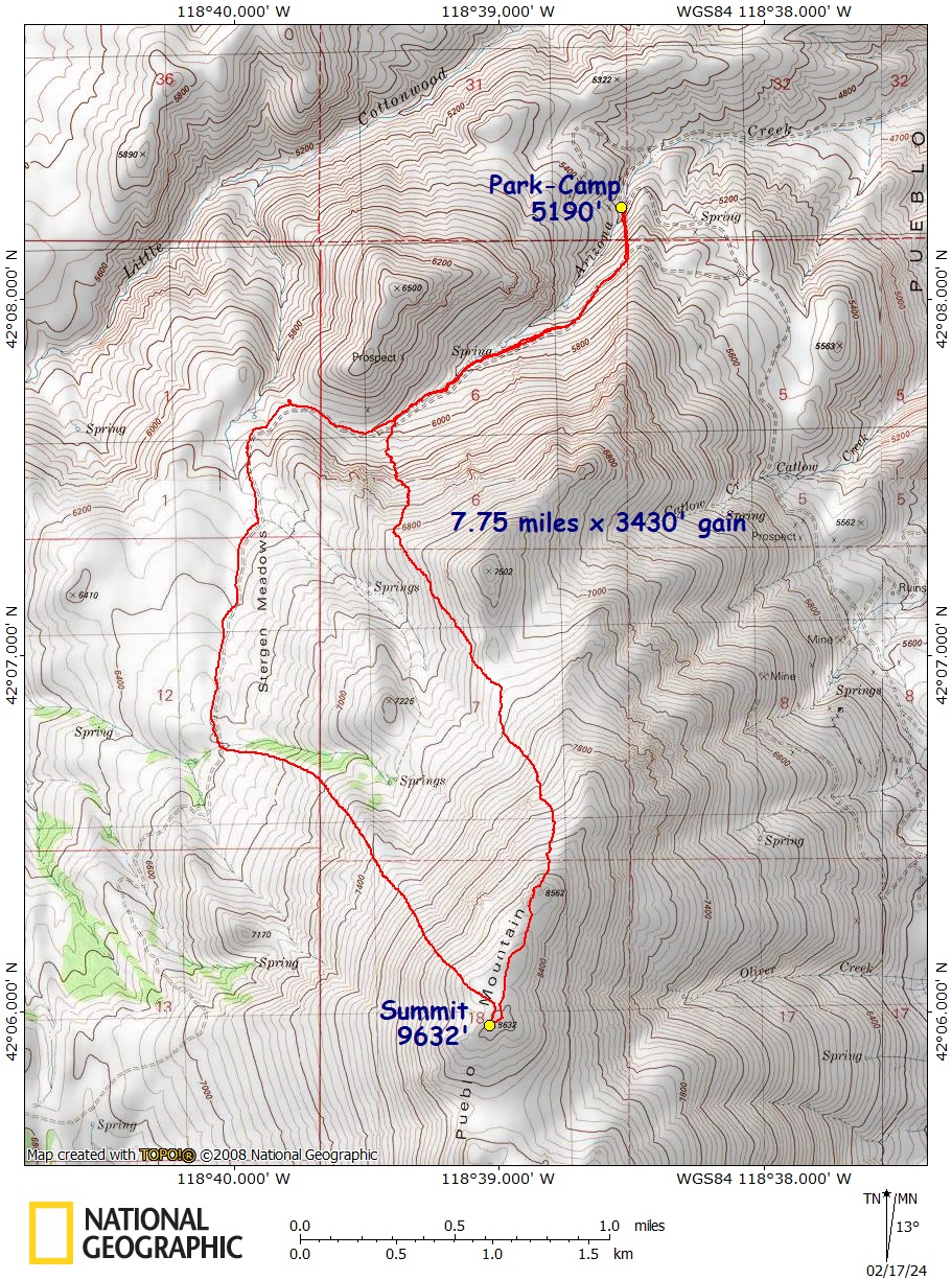
Ruckle Ridge / Ruckle Creek Loop – Map – GPS Track
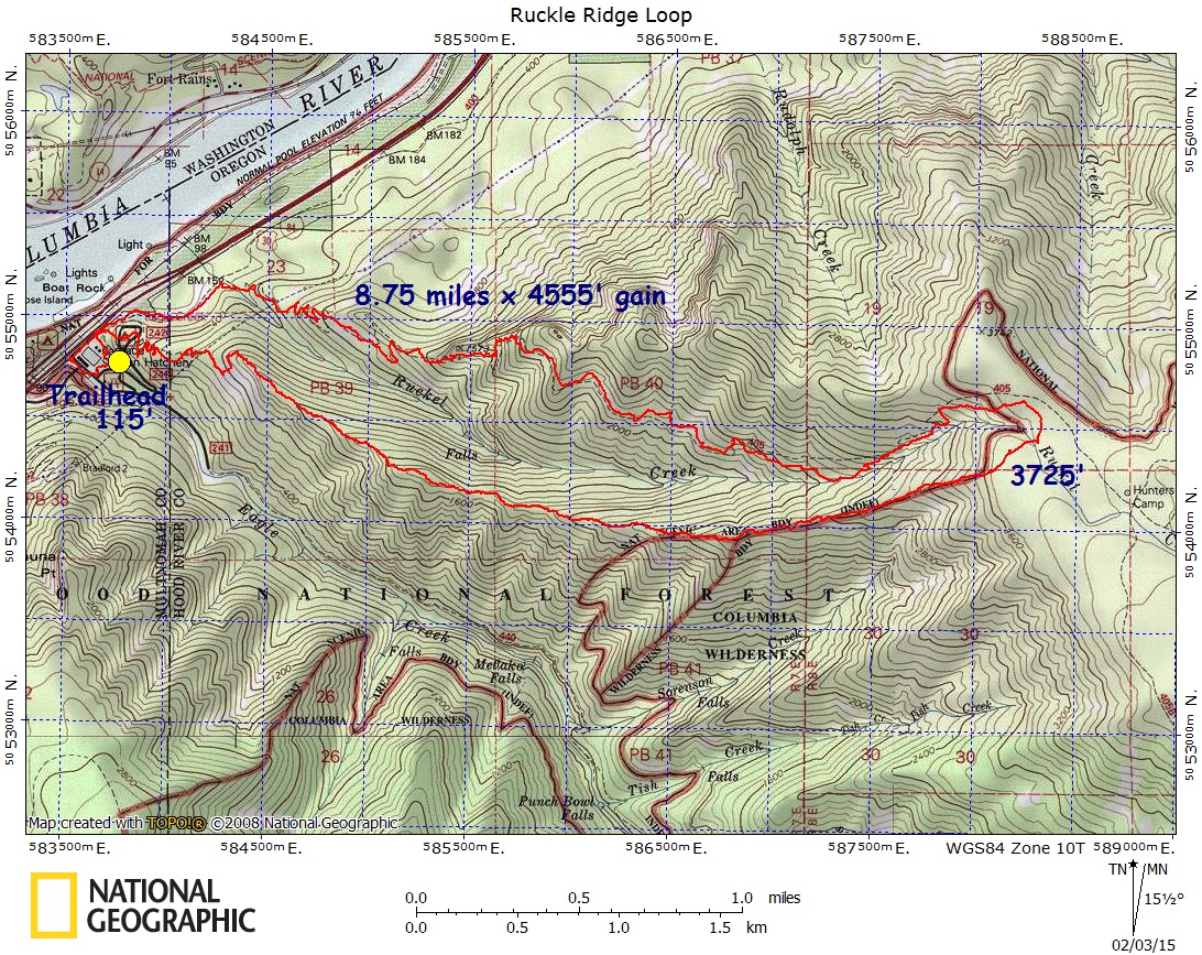
Ruckle Creek Canyoneer – Map – GPS Track
Sardine Mountain via Whitman Creek – Map – GPS Track
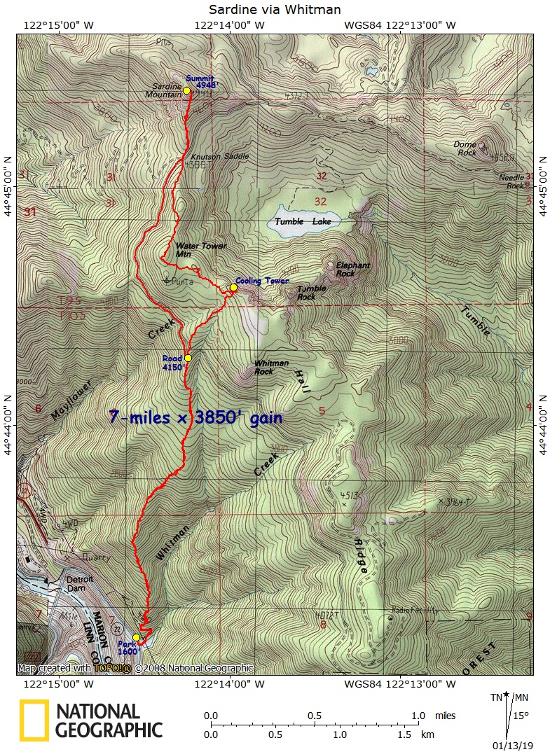
Sasquatch Rock – Map – GPS Track
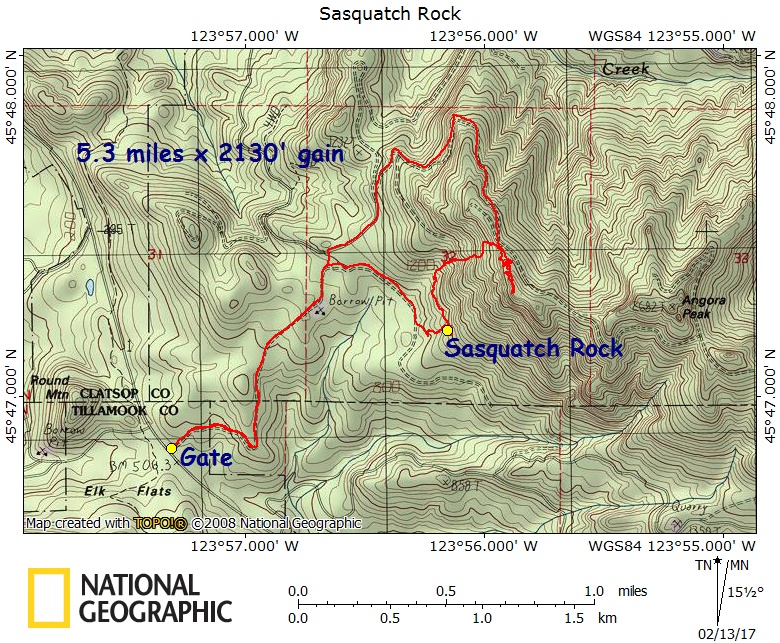
Schreiner Peak via Pansy Basin – Map – GPS Track
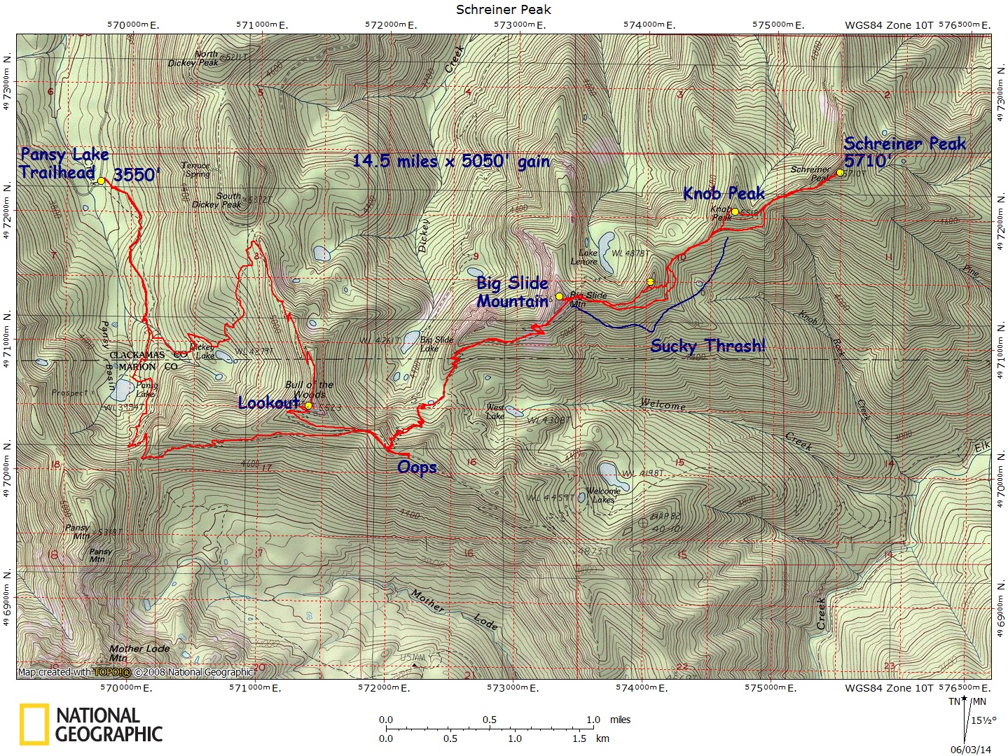
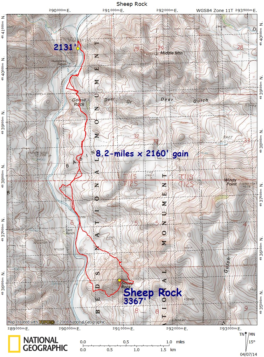
Sheep Rock – Eastern Oregon – Map – GPS Track
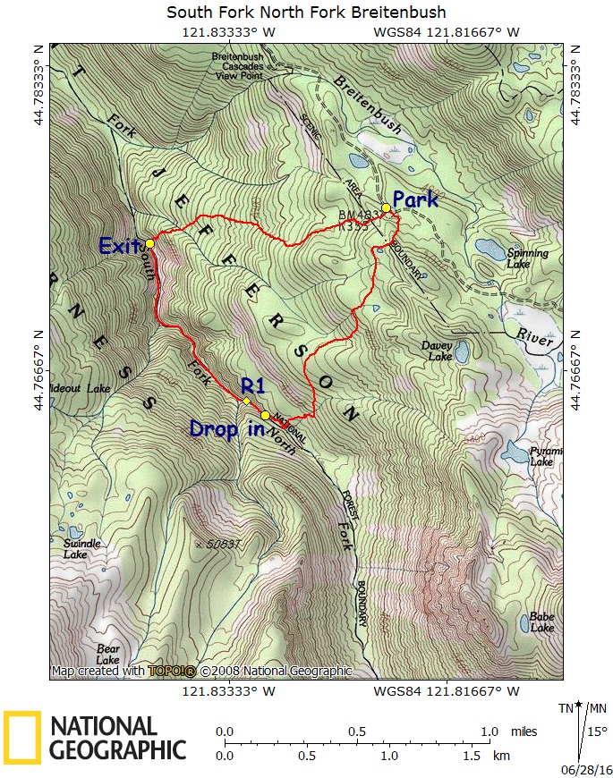
South Fork North Fork Breitenbush River Canyoneer – Map – GPS Track
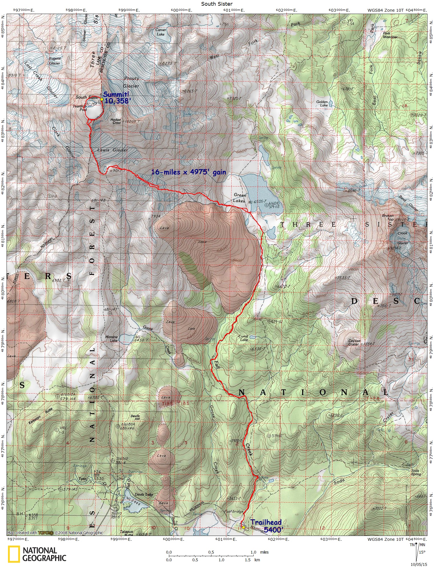
South Sister – via Green Lakes – Map – GPS Track
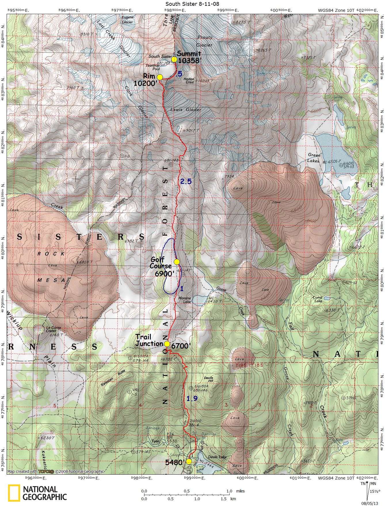
South Sister – via Devils Lake – Map – GPS Track
Sugarloaf Mountain – Map – GPS Track
Sutton Mountain – Map – GPS Track
Squaw Rock Loop – Map – GPS Track
Stahlman Point Loop – Map – GPS Track
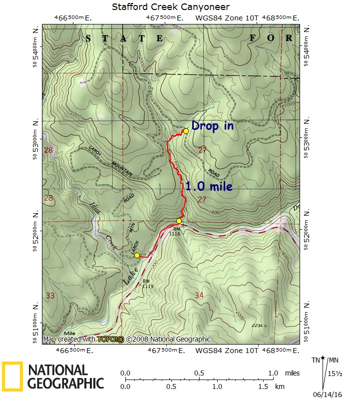
Stafford Creek Canyoneer – Map – GPS Track
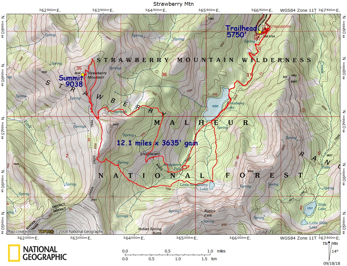
Strawberry Mountain – Map – GPS Track
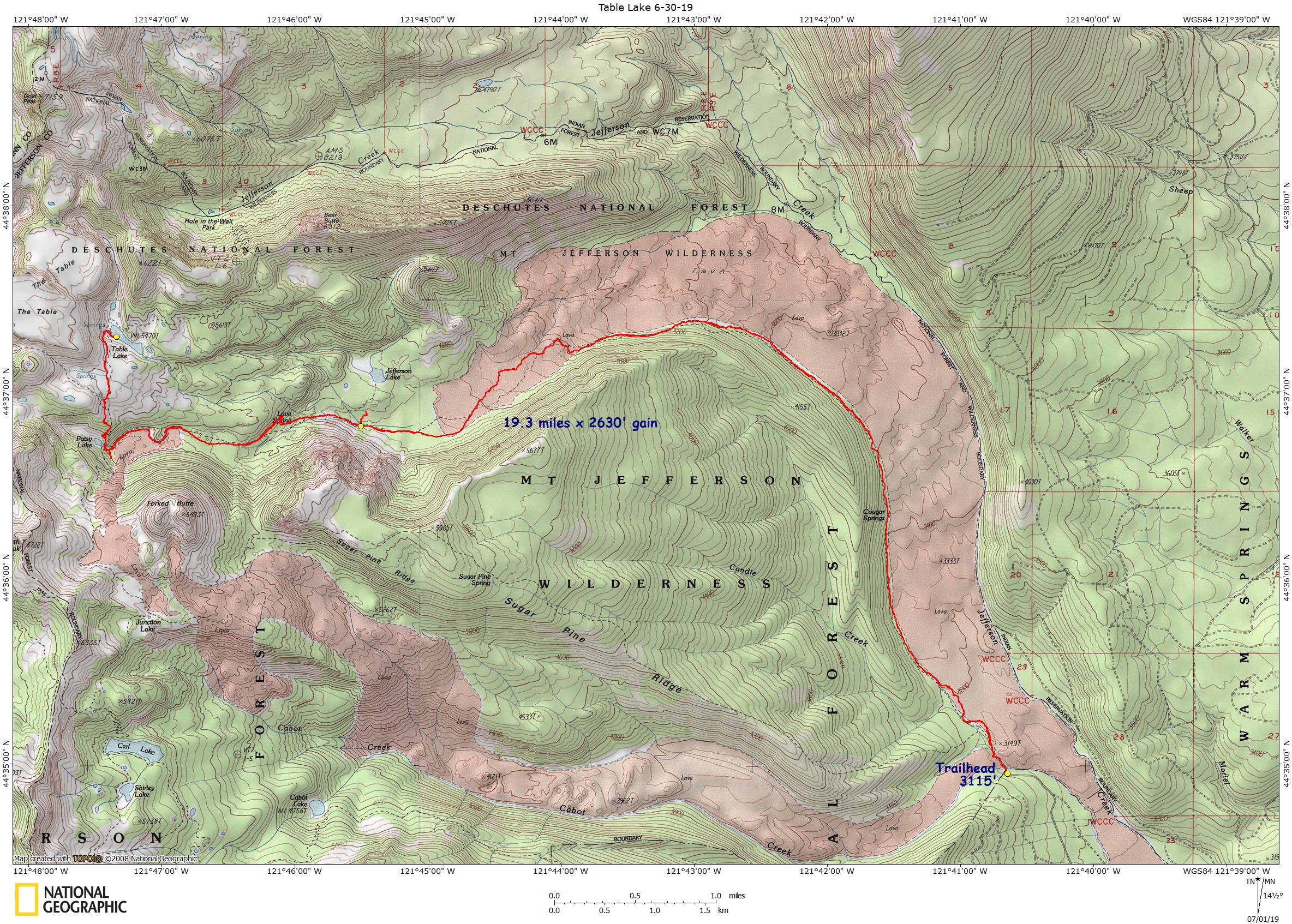
Table Lake (Jefferson Wilderness) – Map – GPS Track
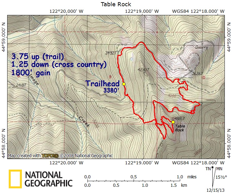
Table Rock to Pechuck Lookout – Map – GPS Track
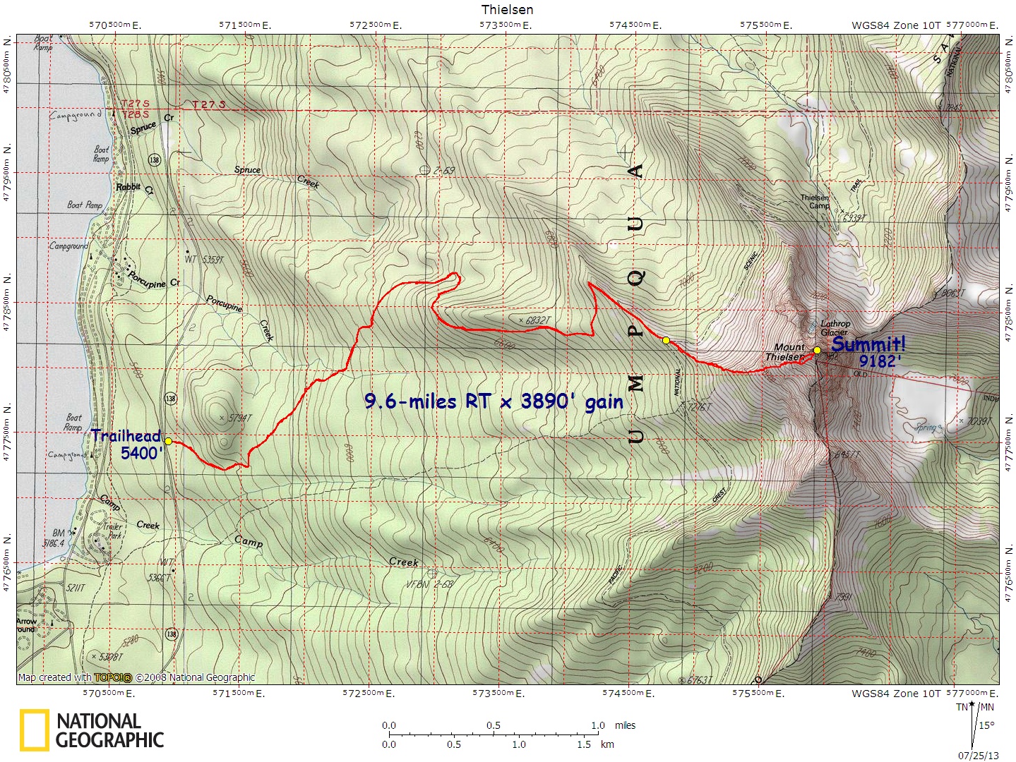
Thielsen, Mt., West Ridge – Map – GPS Track
Three Fingered Jack, PCT South Ridge – Map – GPS Track
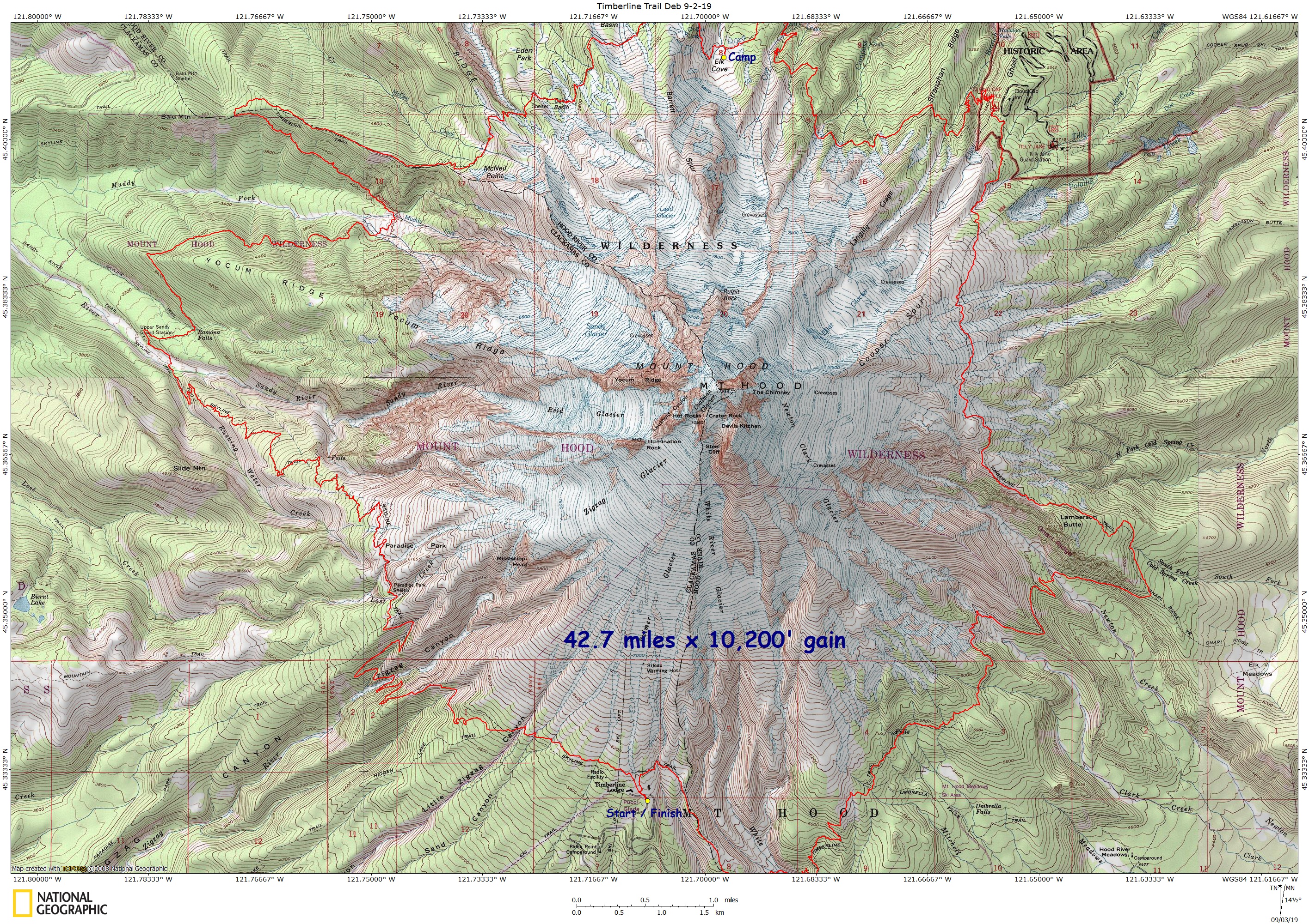
Timberline Trail (Full) – Map – GPS Track
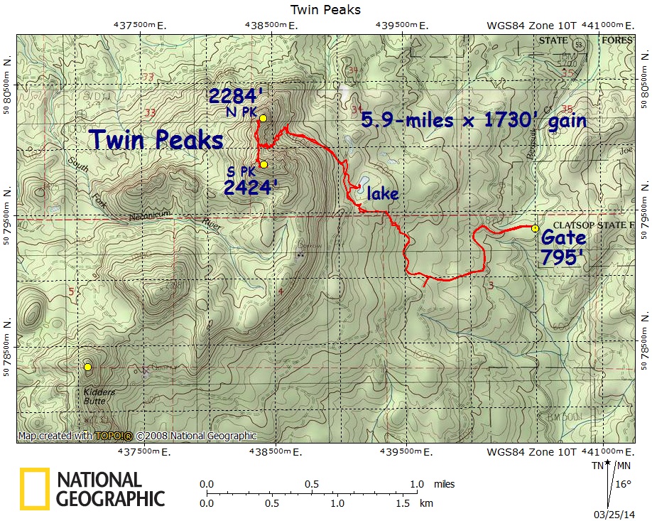
Twin Peaks, N Oregon Coast – Map – GPS Track
Waldo Lake Hike/Kayak Camp – Map – GPS Track
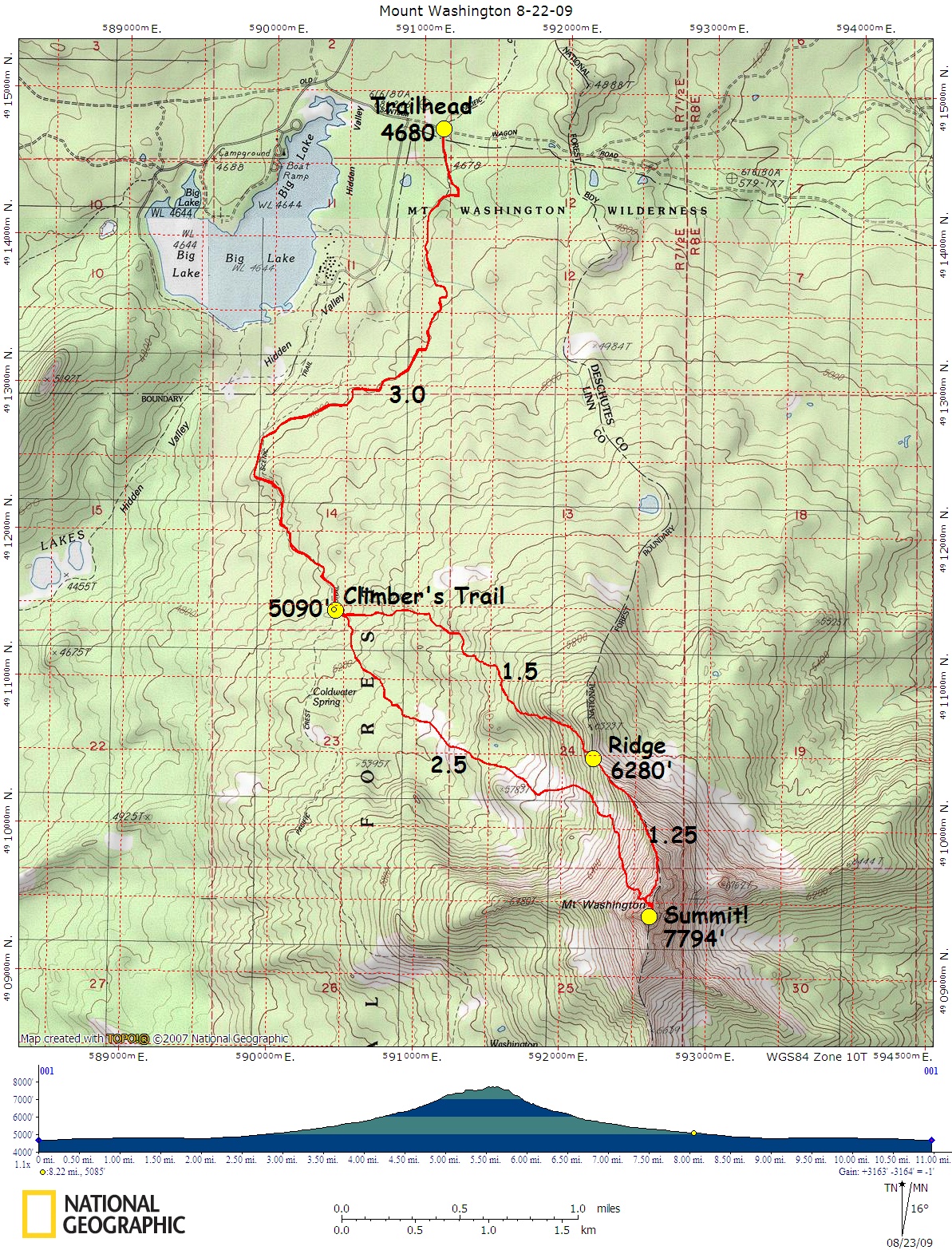
Washington, Mt., North Ridge – Map – GPS Track
Whetstone Jawbone Loop – Map – GPS Track
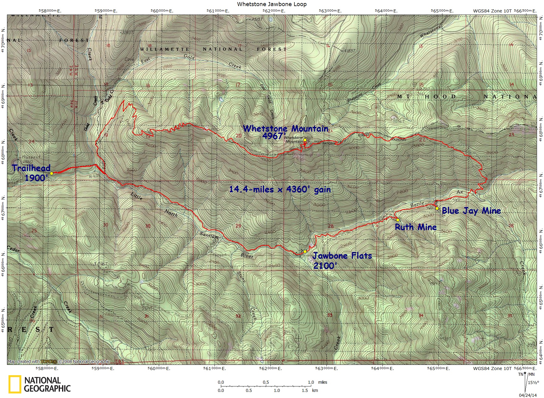
Yocum Ridge, Mount Hood – Map – GPS Track
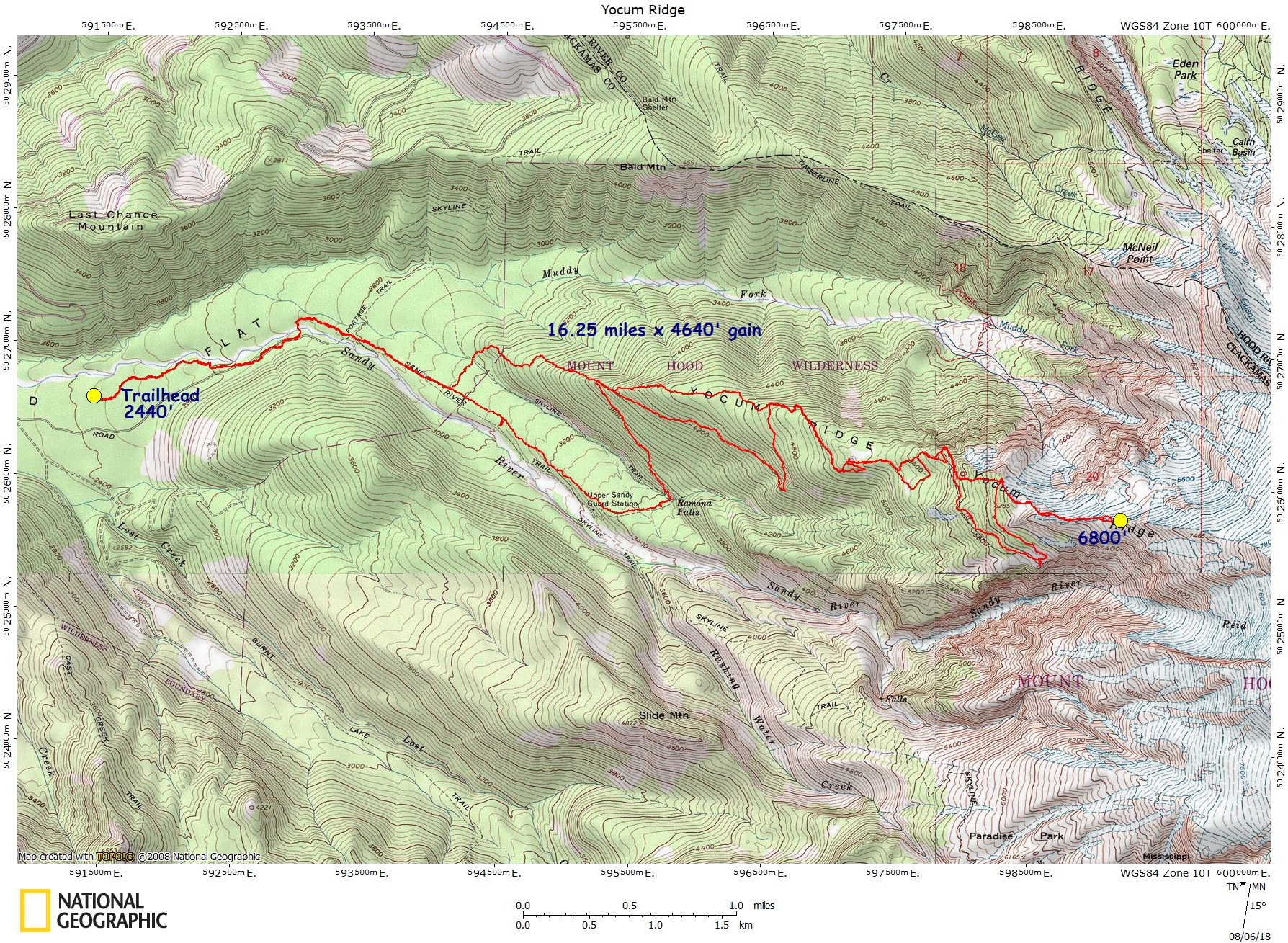
Yoran, Mount – Map – GPS Track
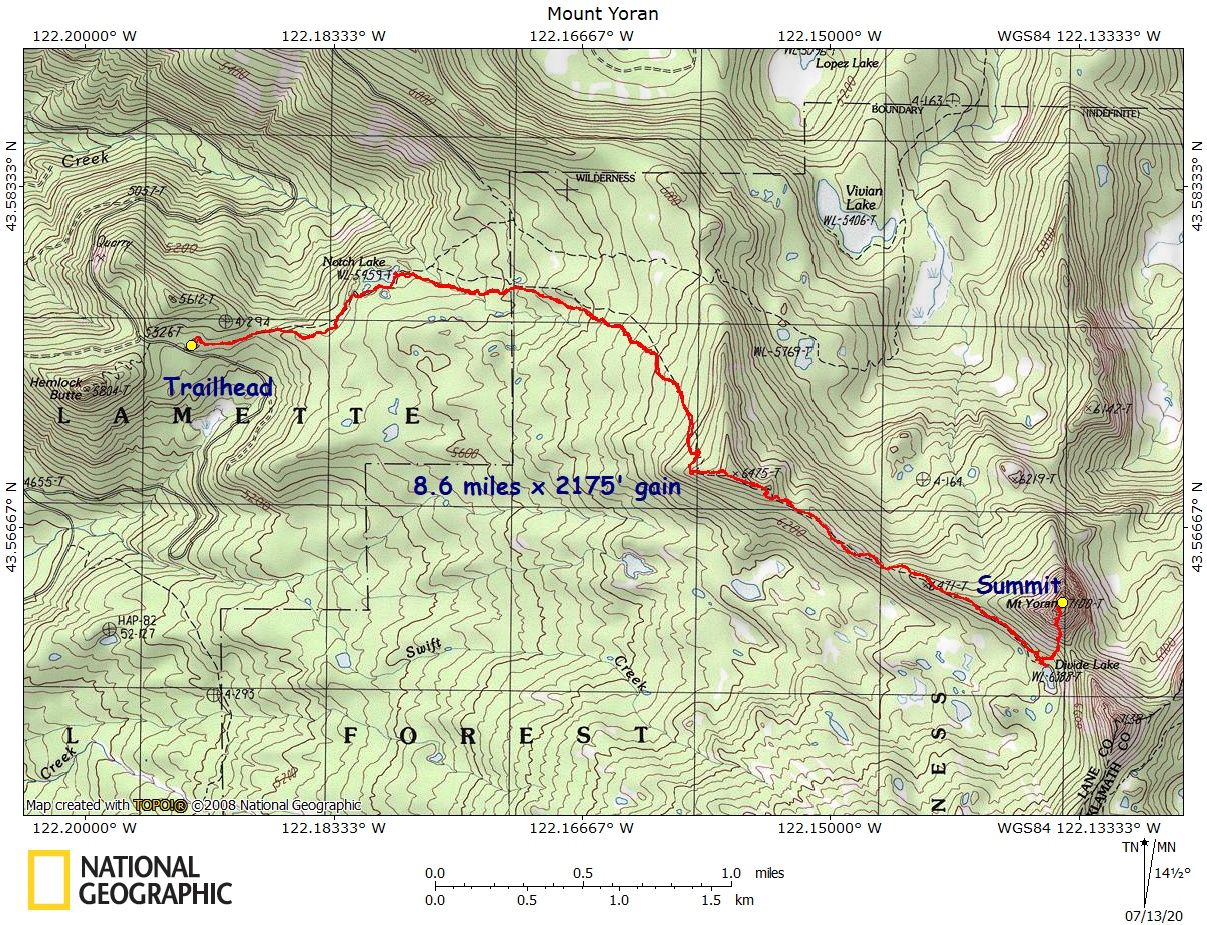
WASHINGTON – Maps & Real GPS Tracks
Adams, Mt., South Side – Map – GPS Track
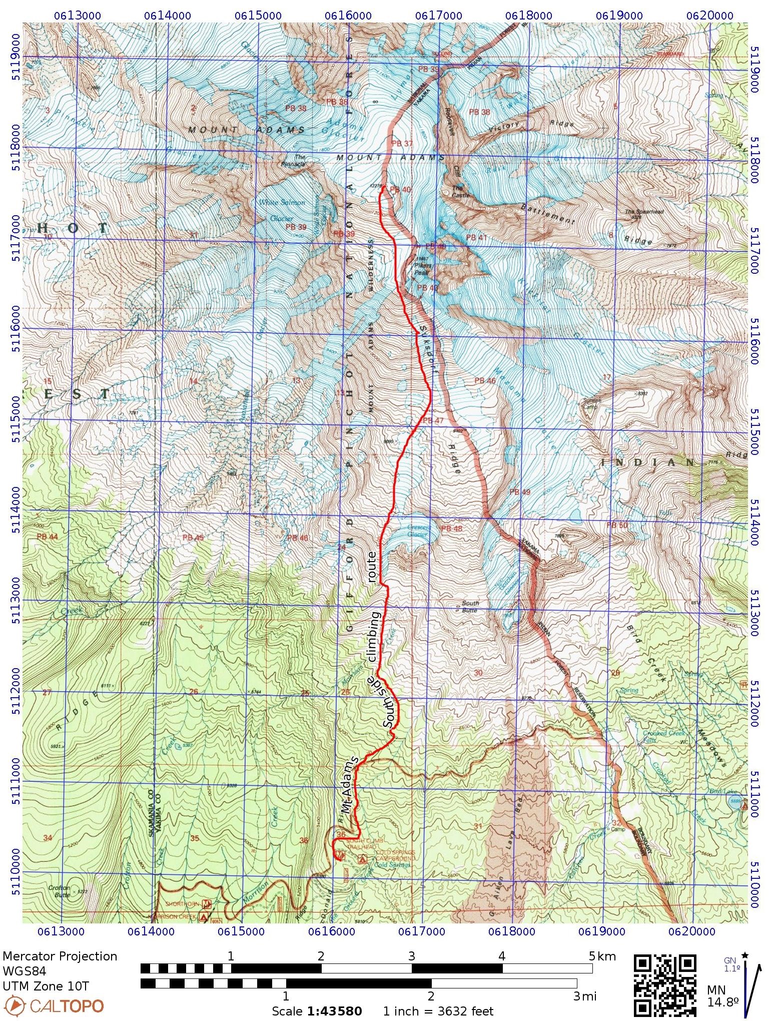
Baker, Mt., Colman Deming – Map – GPS Track
Baker, Mt., Easton – Map – GPS Track
Big Creek Canyoneer – Map – GPS Track
Big Horn, Goat Rocks – Map – GPS Track
Birkenfeld Mountain – Map – GPS Track
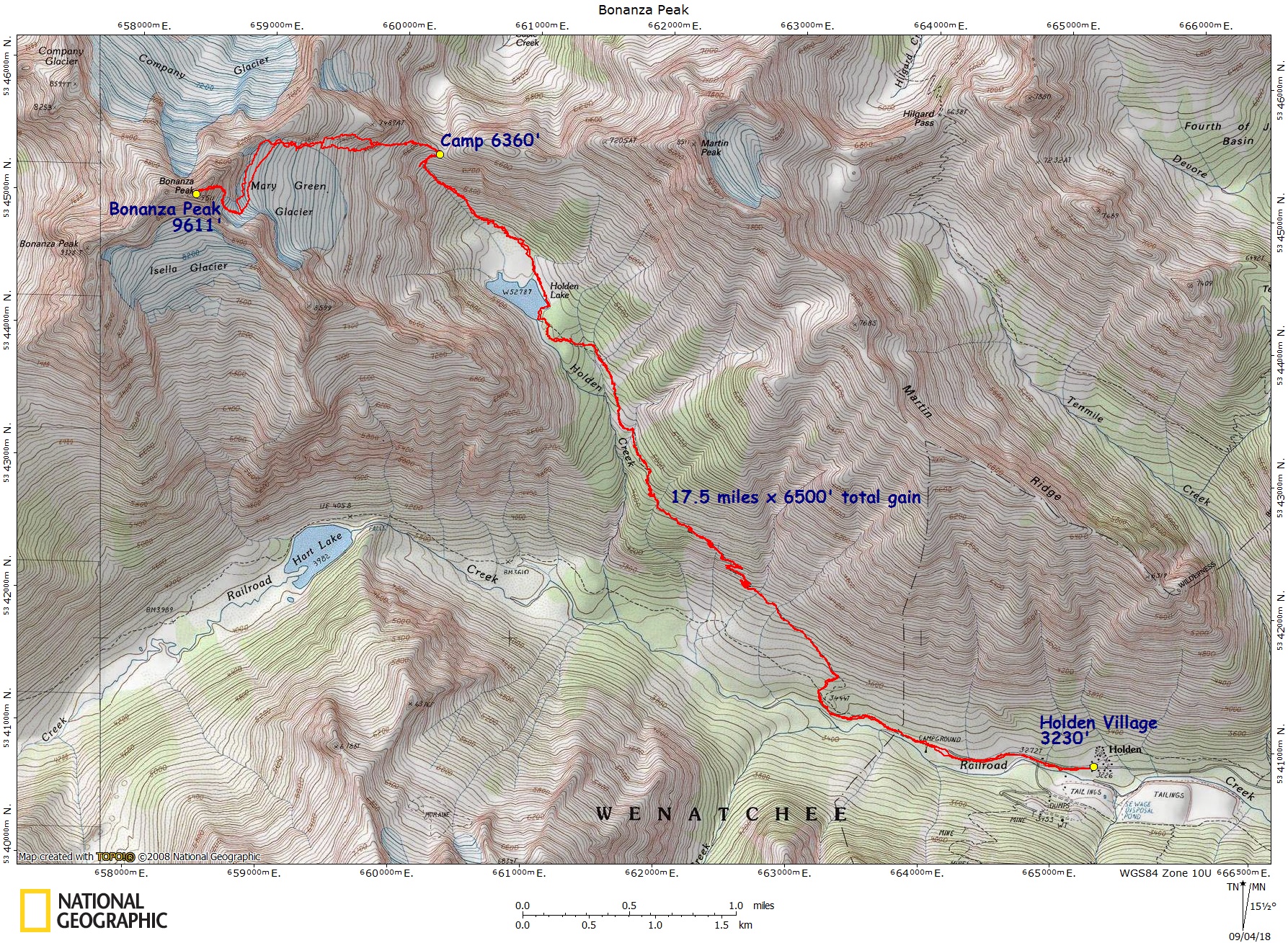
Bonanza Peak – Map – GPS Track
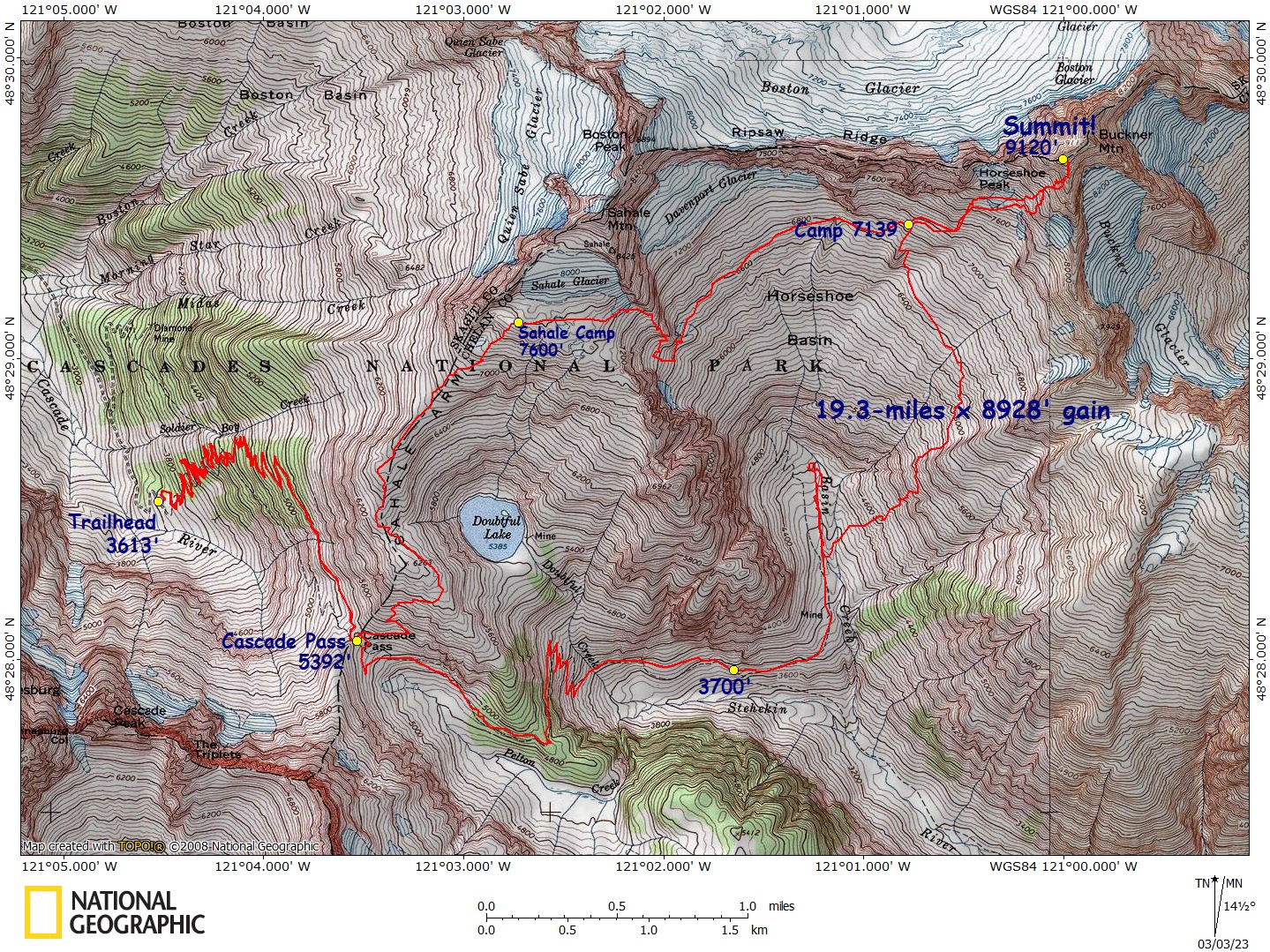
Buckner Mtn., Sahale Arm/Horseshoe Basin – Map – GPS Track
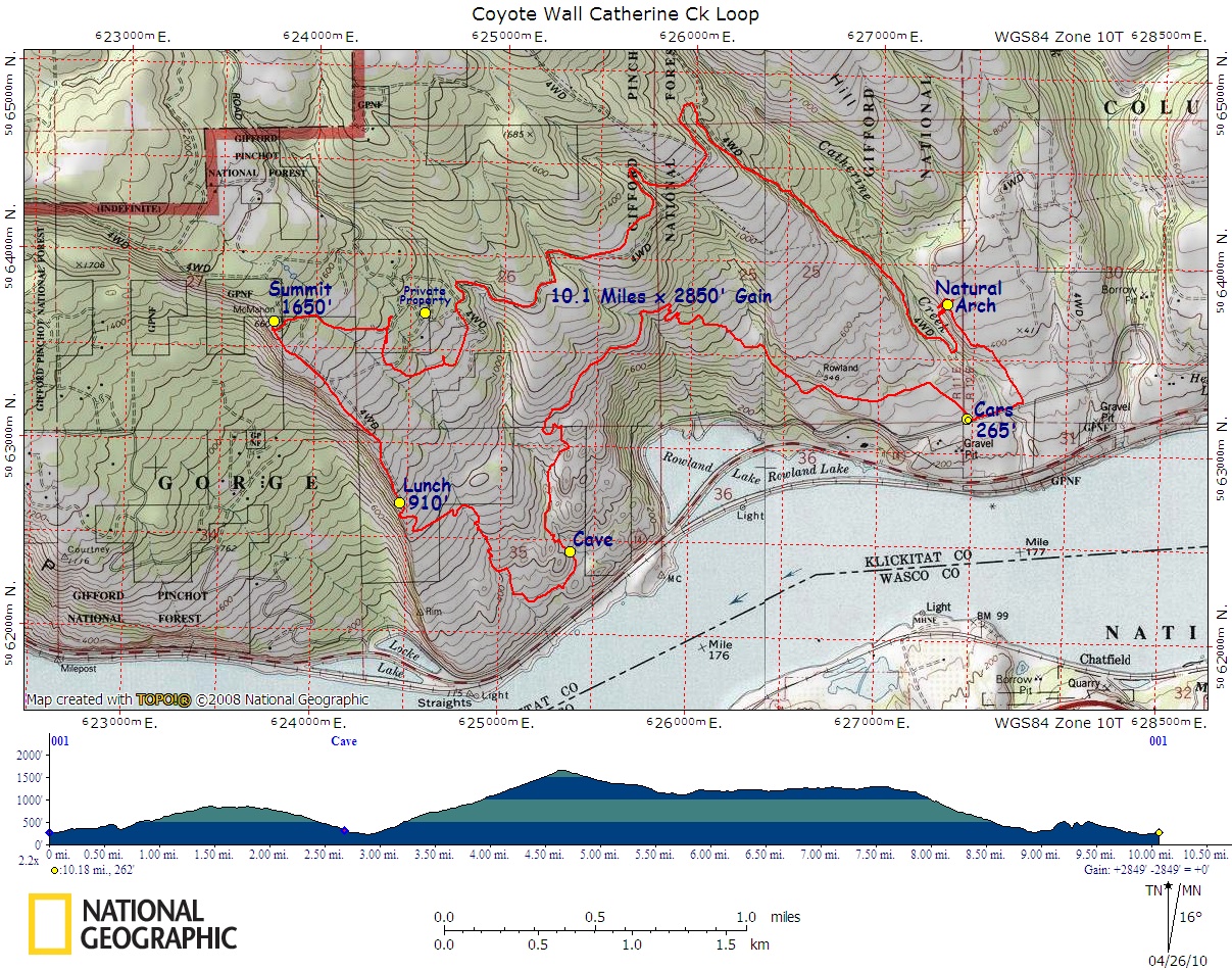
Catherine Creek Coyote Wall Loop – Map – GPS Track
Daniel, Mount – Map – GPS Track
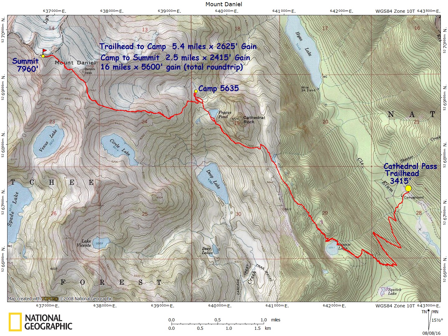
Deception, Mount / Royal Basin – Map – GPS Track
Del Campo / Gothic Peak – Map – GPS Track
Eldorado Peak, East Ridge – Map – GPS Track
Ellinor, Mt., Lower Trailhead – Map – GPS Track
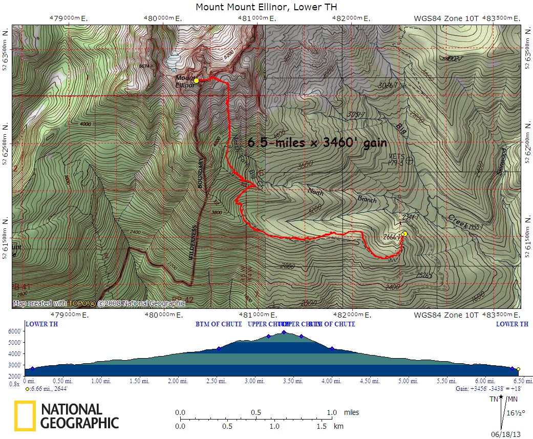
Ellinor, Mt., Upper Trailhed – Map – GPS Track
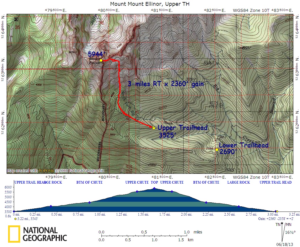
Enchantments Thru Hike – Map – GPS Track
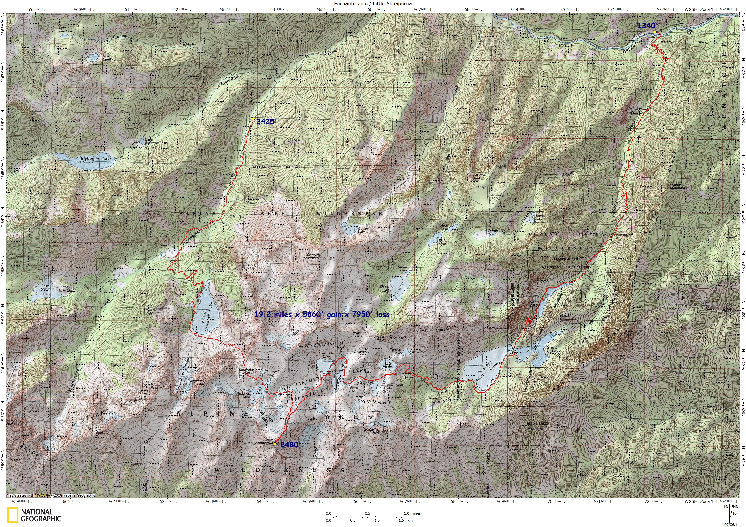
Forgotten, Mount – Map – GPS Track
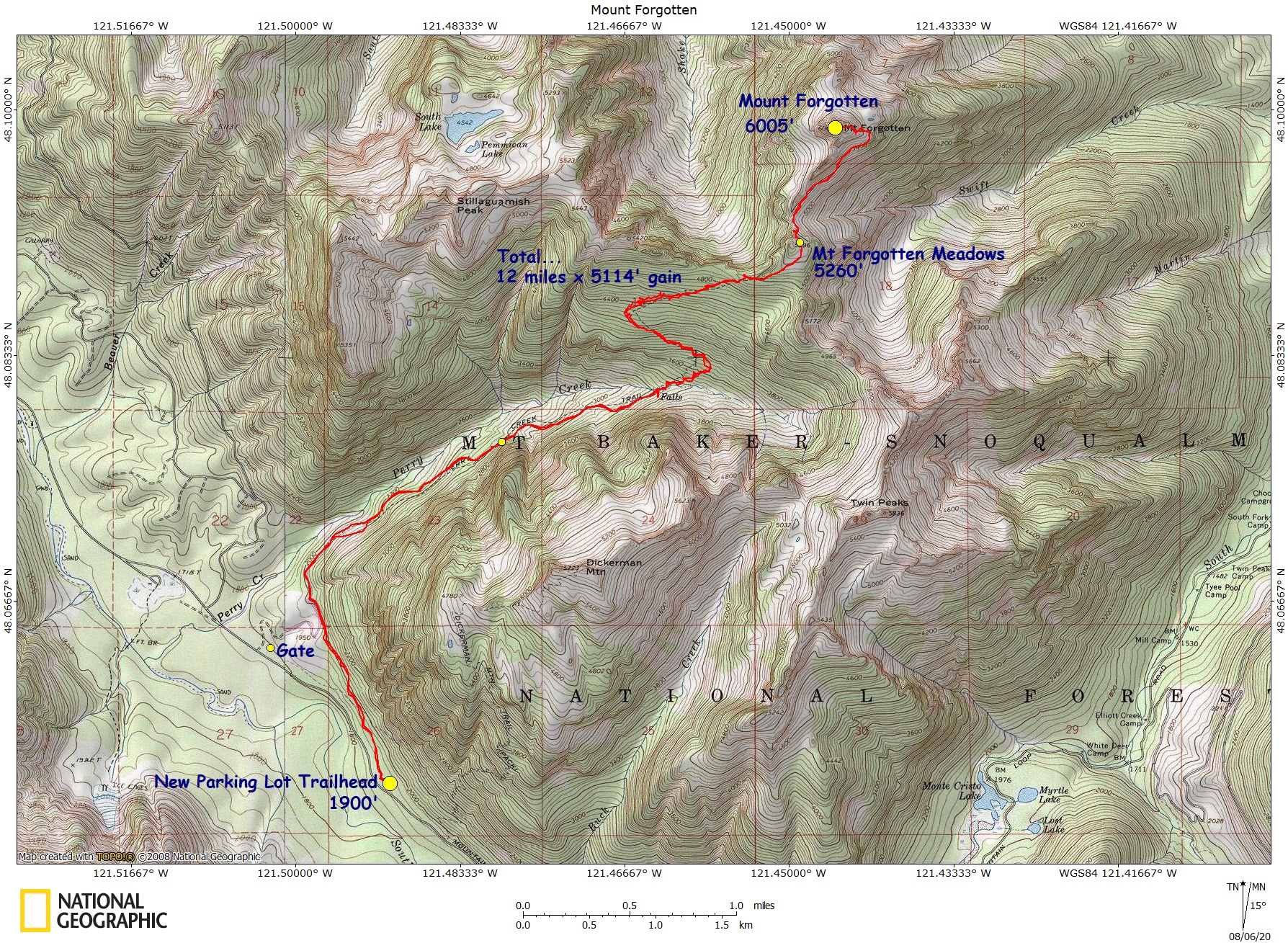
Gilbert Peak, Cispus Basin – Map – GPS Track
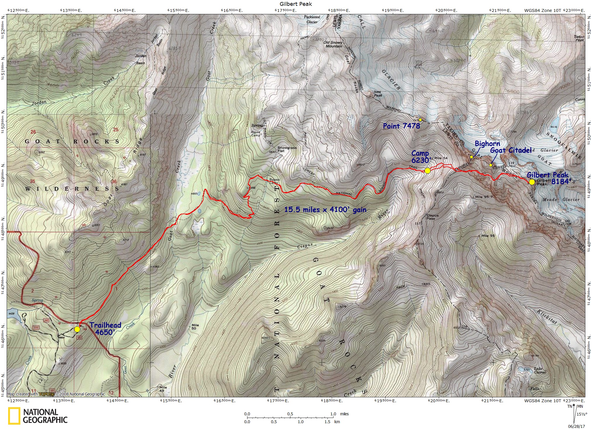
Gilbert Peak, Conrad Meadows-Klickton Divide – Map – GPS Track
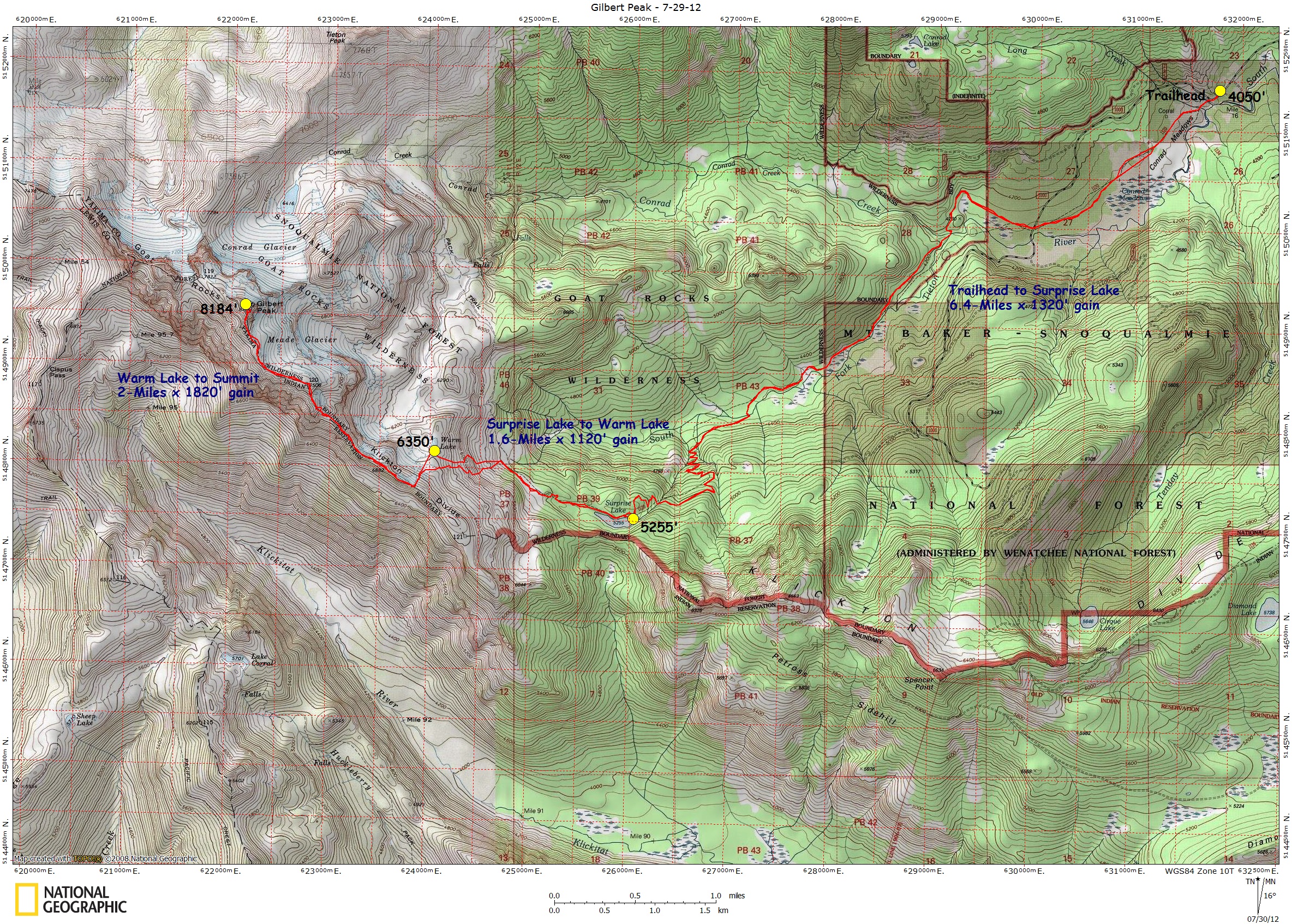
Glacier Peak, Whitechuck/Cool Glacier – Map – GPS Track
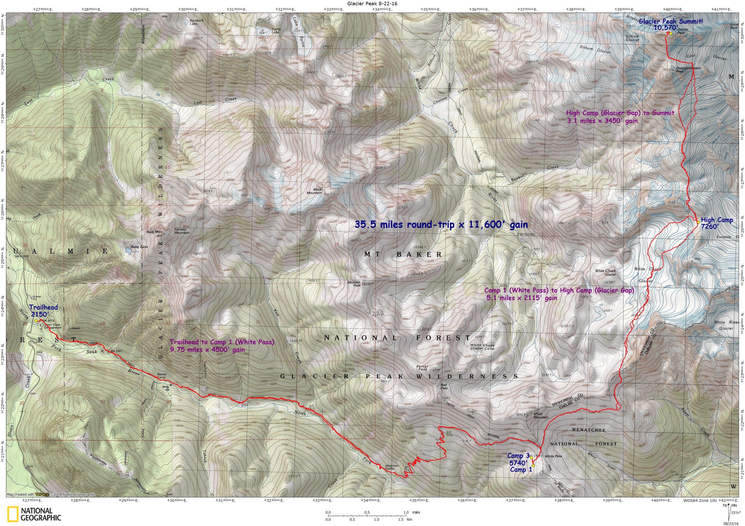
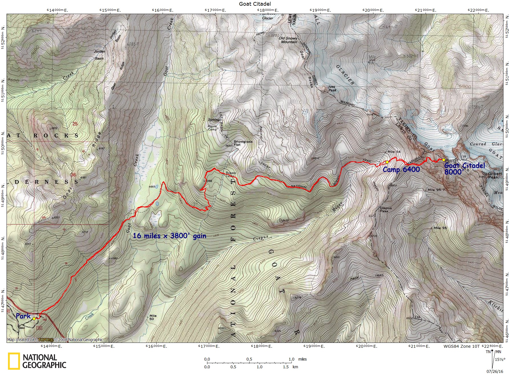
Goat Citadel, Goat Rocks – Map – GPS Track
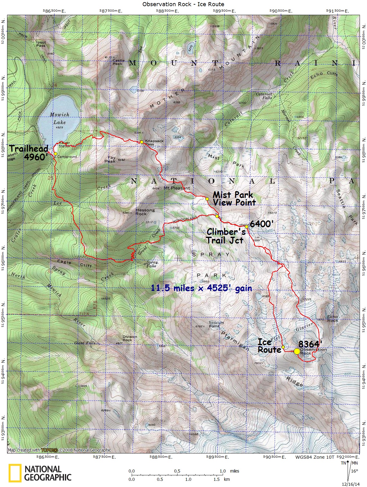
Observation Rock – The Ice Route – Map – GPS Track
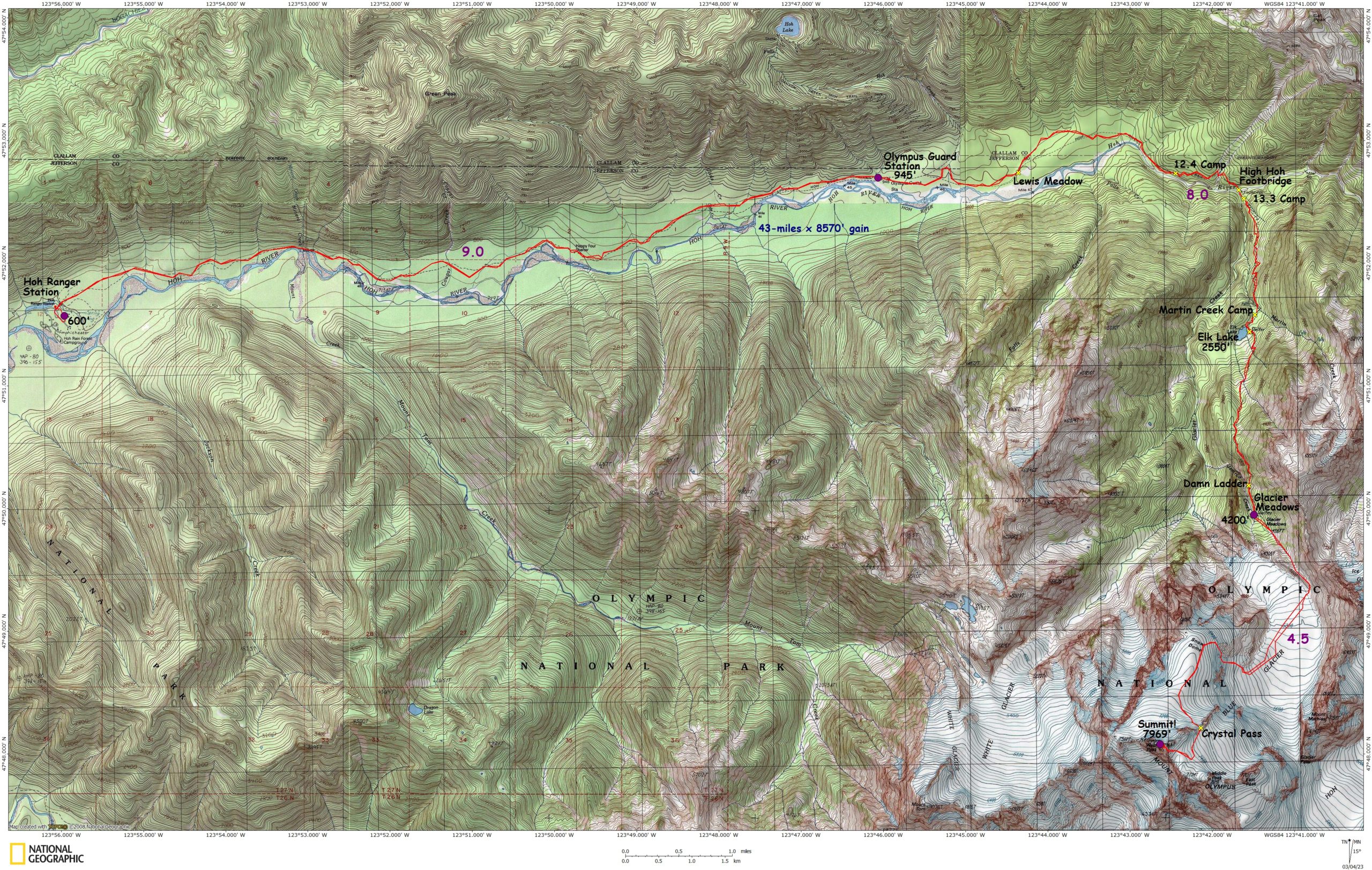
Olympus, MT., Blue Glacier – Map – GPS Track
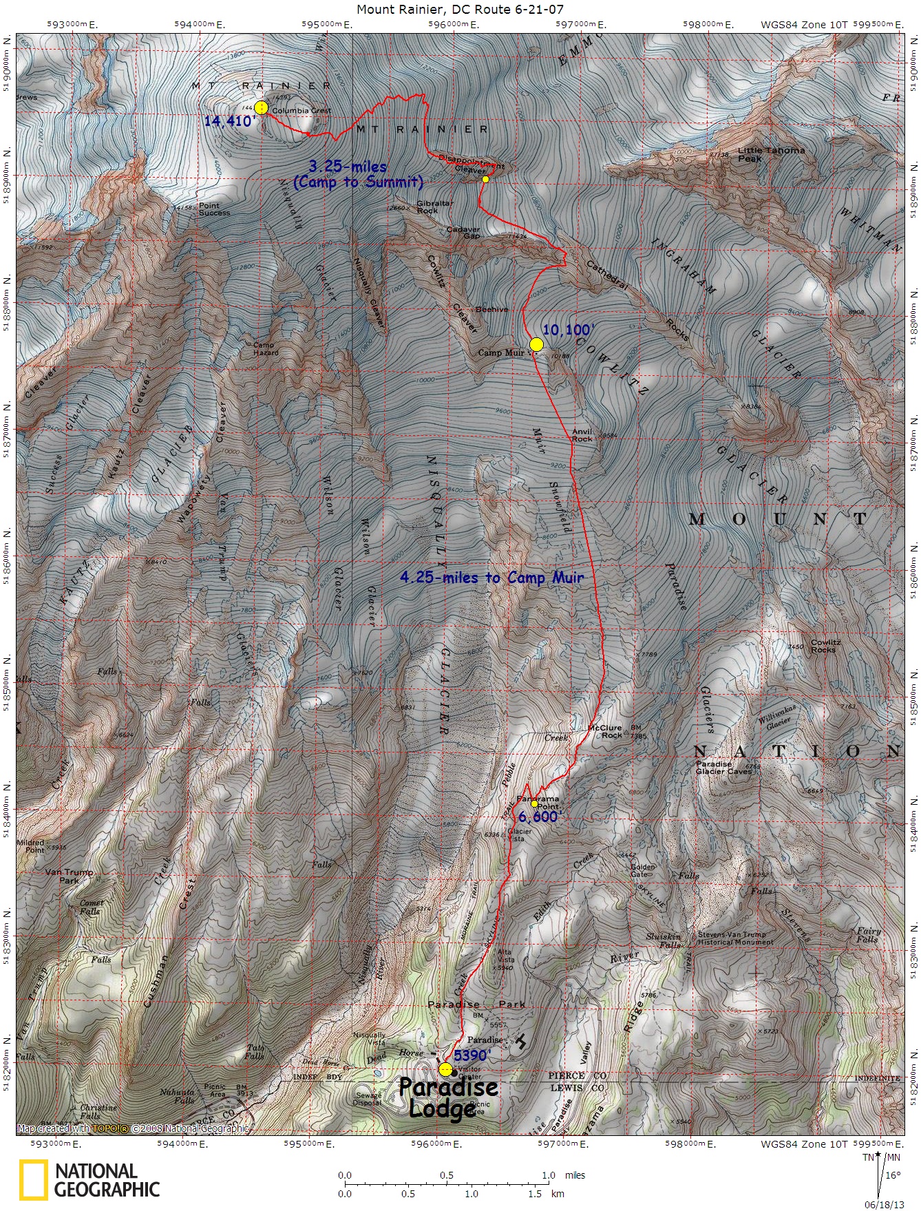
Rainier, Mt., DC Route – Map – GPS Track
Sahale Peak, Sahale Arm – Map – GPS Track
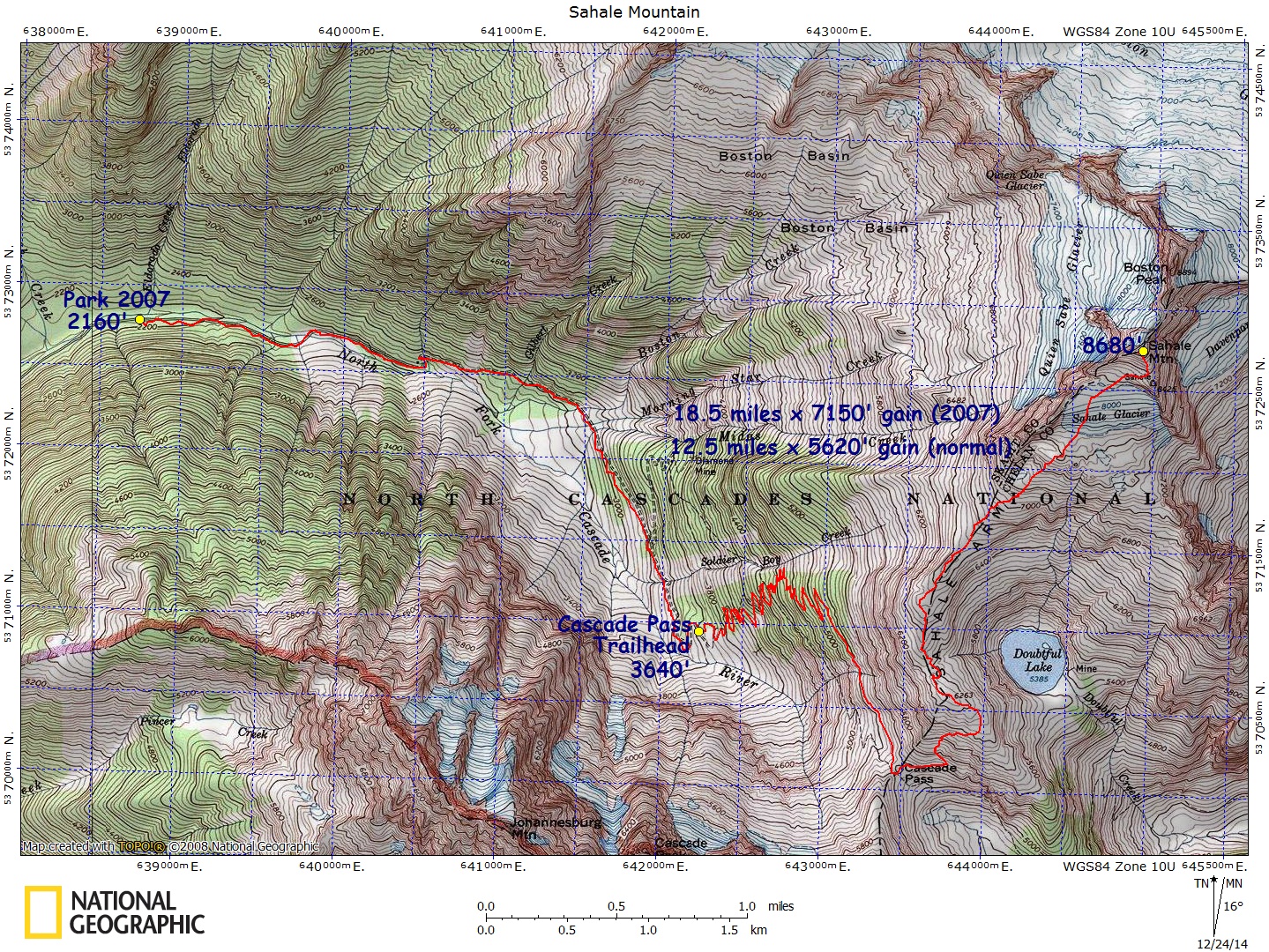
Saint Helens, Mt., Monitor Ridge – Map – GPS Track
Saint Helens, Mt. Worm Flows – Map – GPS Track
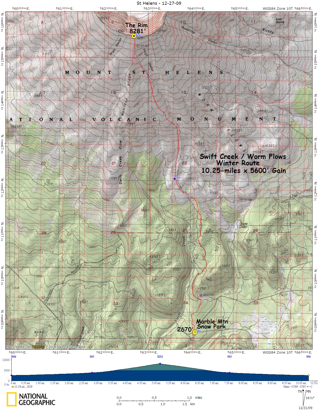
Shuksan, Sulfide Glacier – Map – GPS Track
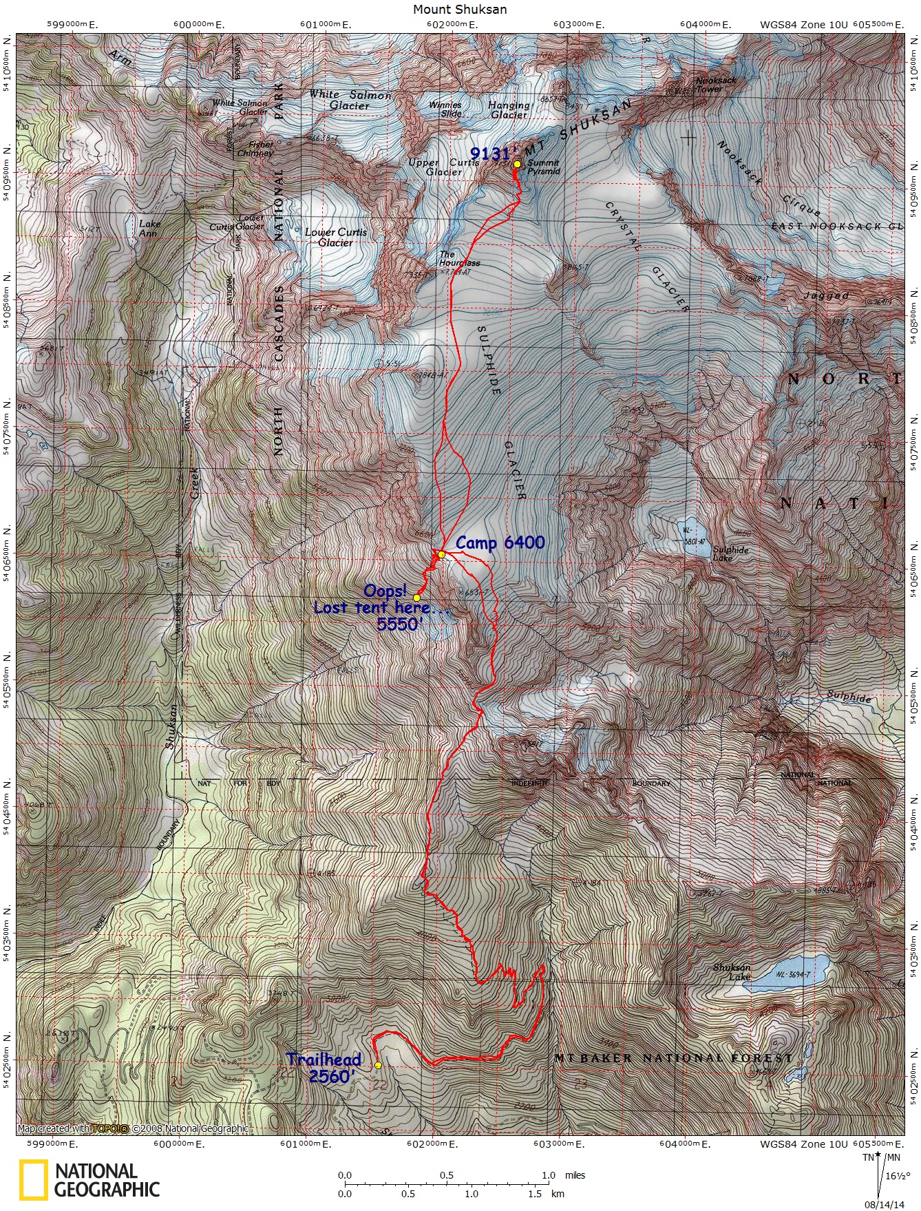
Shuksan, White Salmon Glacier – Map – GPS Track
Silver Star – Okanogan – Map – GPS Track
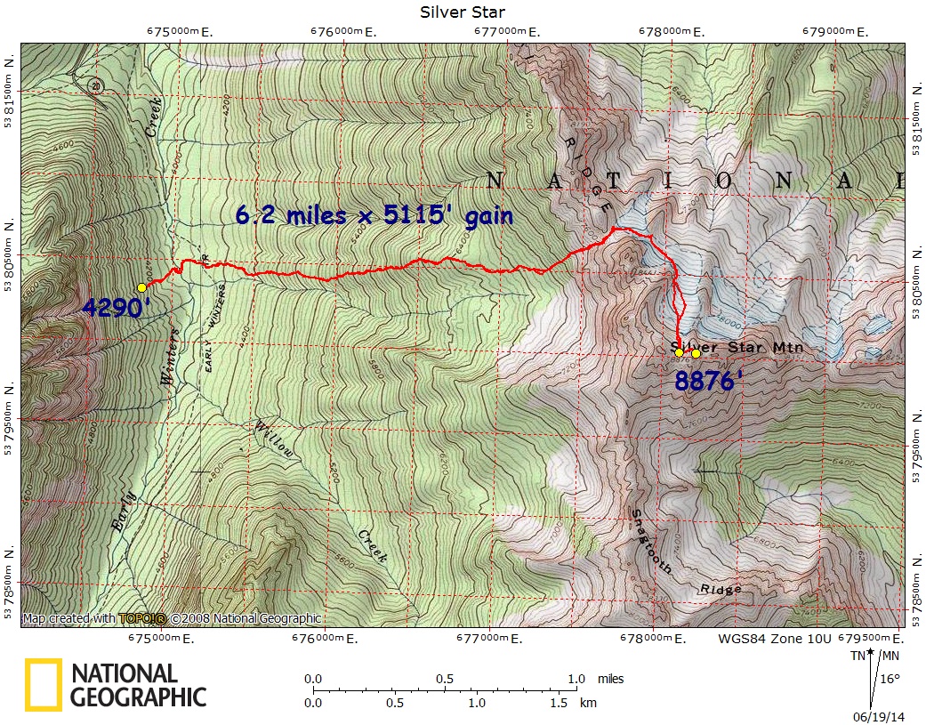
Sloan Peak, Corkscrew Route – Map – GPS Track
Stuart, Mount – Cascadian Couloir – Map – GPS Track
Stuart, Mount – West Ridge – Map – GPS Track
Thomson, Mt., West Ridge – Map – GPS Track
Three Fingers, North Peak – Map – GPS Track
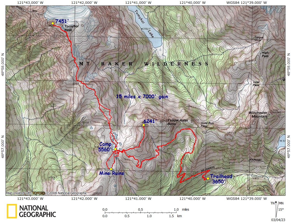
Tomyhoi Peak / Yellow Aster Butte – Map – GPS Track
Unicorn Peak – Map – GPS Track
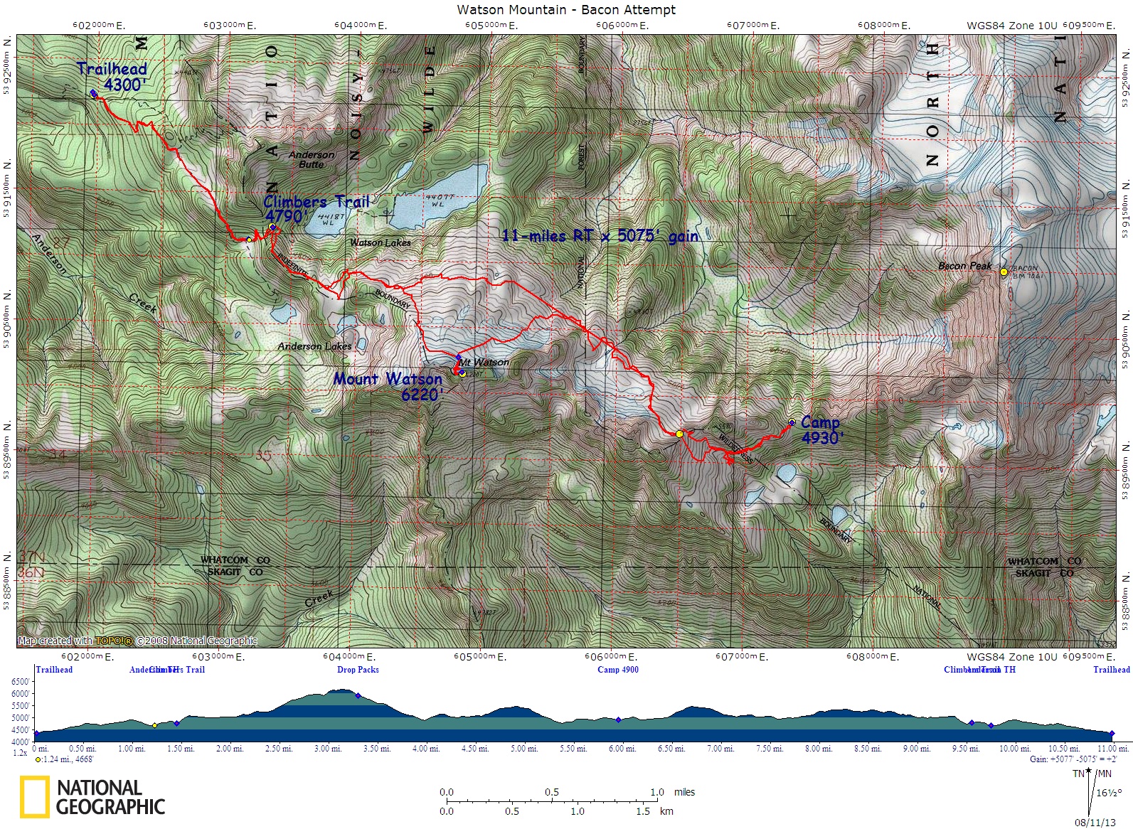
Watson, Mt., / Bacon Peak Attempt – Map – GPS Track
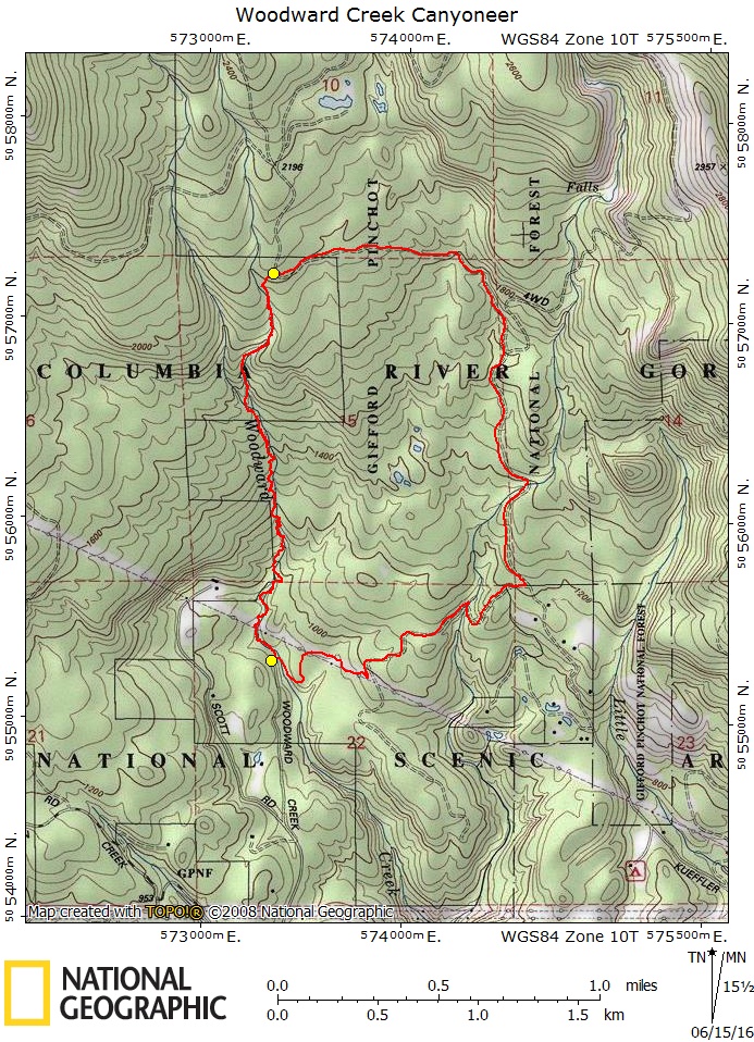
Woodward Creek Canyoneer – Map – GPS Track
CALIFORNIA – Maps & Real GPS Tracks
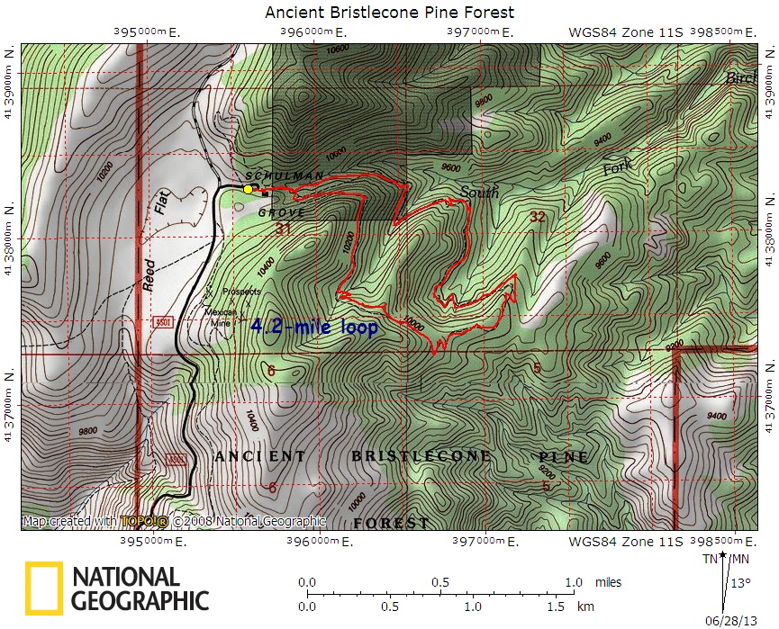
Ancient Bristlecone Forest, White Mountains – Map – GPS Track
Black Marble Mountain, Scramble – Map – GPS Route
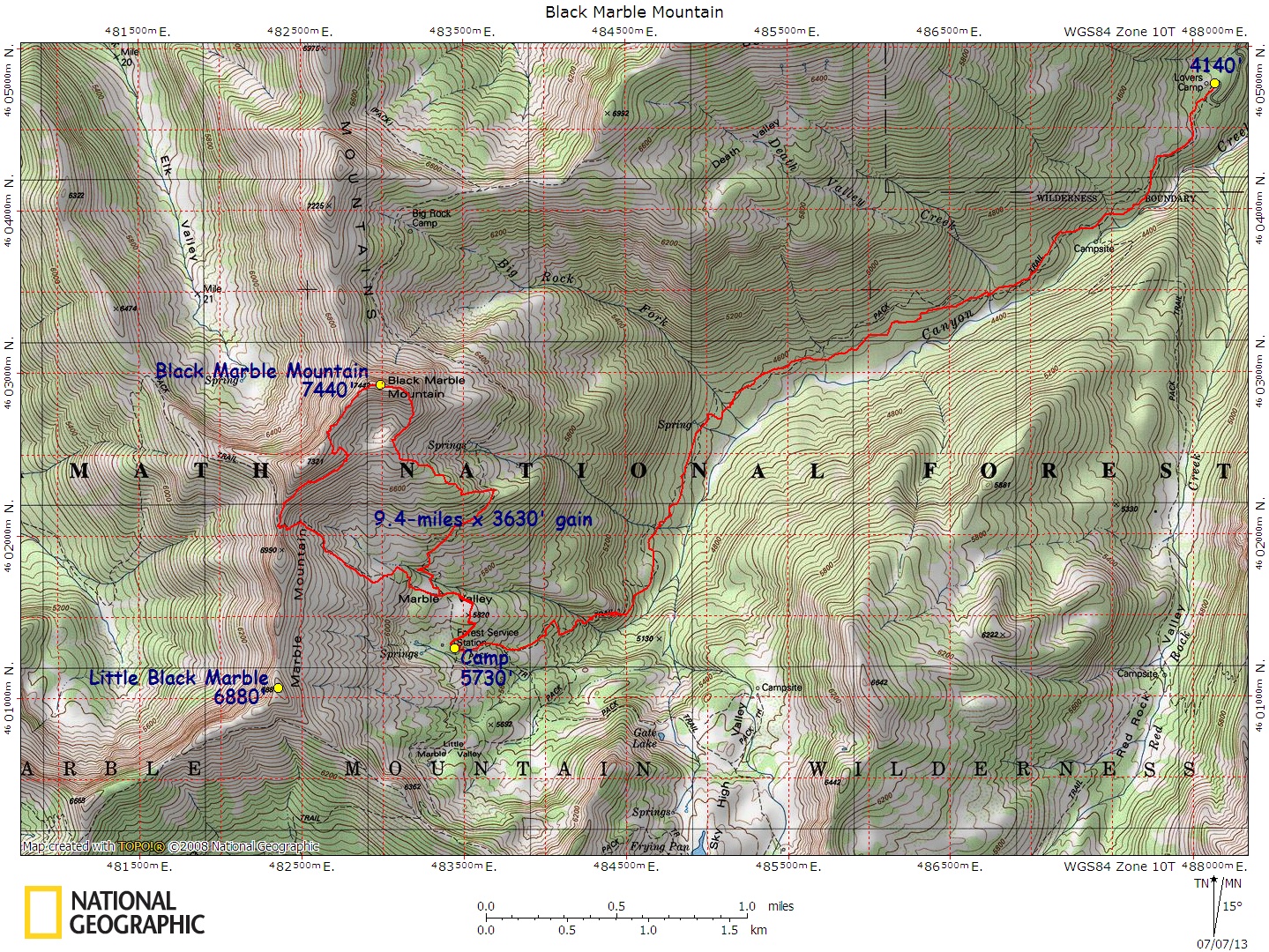
Ogre, Cosmic Wall – Map – GPS Track
Shasta, Mt., Avalanche Gulch – Map – GPS Track
White Mountain, Inyo National Forest – Map – GPS Track
Whitney, Mt., Mountaineer’s Route / Whitney Trail Loop – Map – GPS Track
Whitney, Mt., Mountaineers Route (there & back) – Map – GPS Track
WYOMING – Maps & Real GPS Tracks
Gannett Peak – Map – GPS Track
Grand Teton, Upper Exum Ridge – Map – GPS Track
Pingora Peak, Wind River Range – Map – GPS Track
MONTANA – Maps & Real GPS Tracks
Granite Peak, East Ridge via Froze to Death Plateau – Map – GPS Track
Trapper Peak – Map – GPS Track
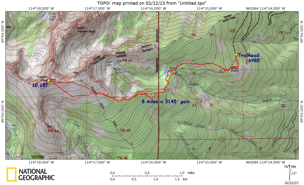
HAWAII – Maps & Real GPS Tracks
Haleakala Sea to Summit to Sea – Map – GPS Track
Warrior Trek, Maui – Map – GPS Track
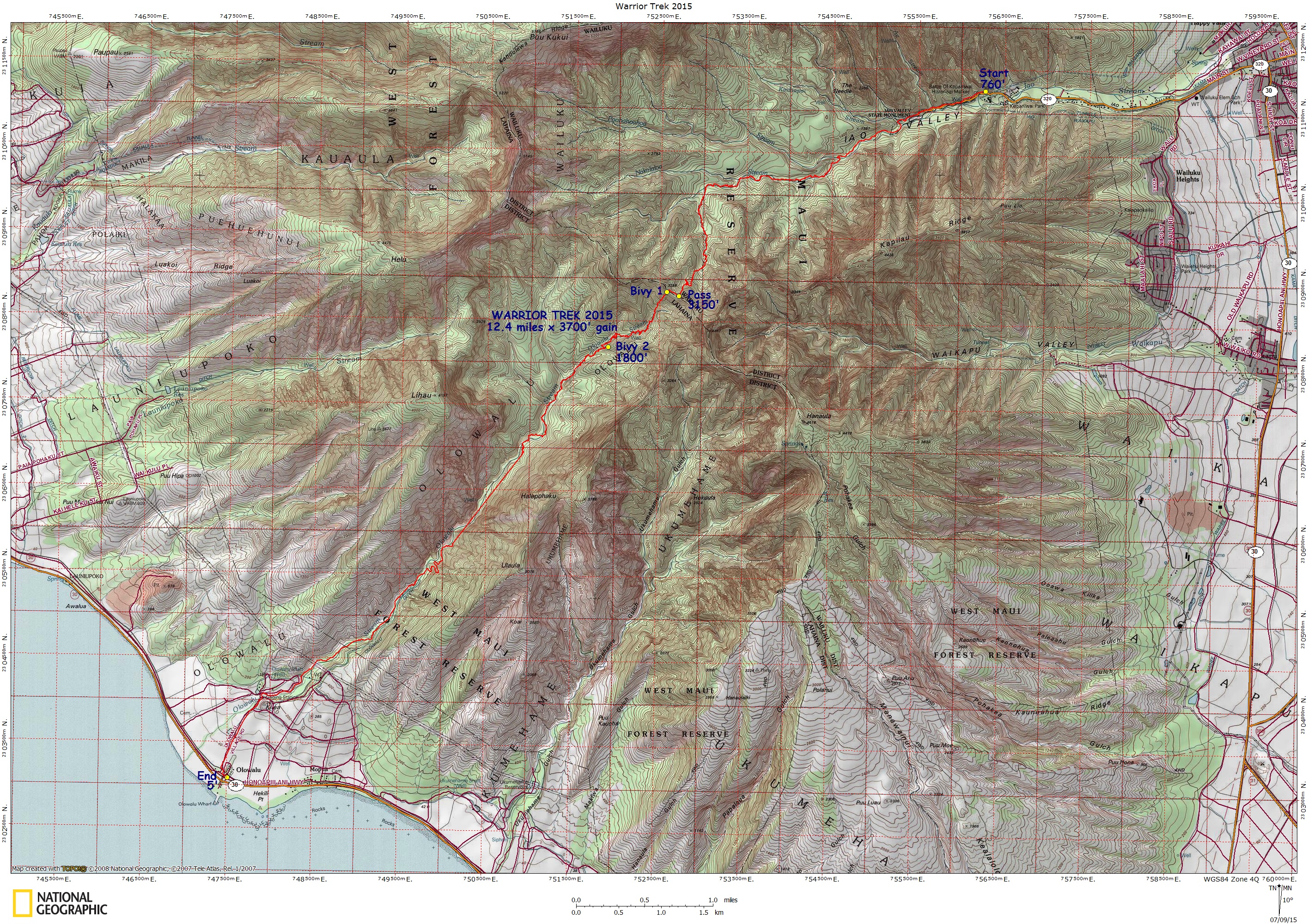
Ka’au Crater – Map – GPS Track
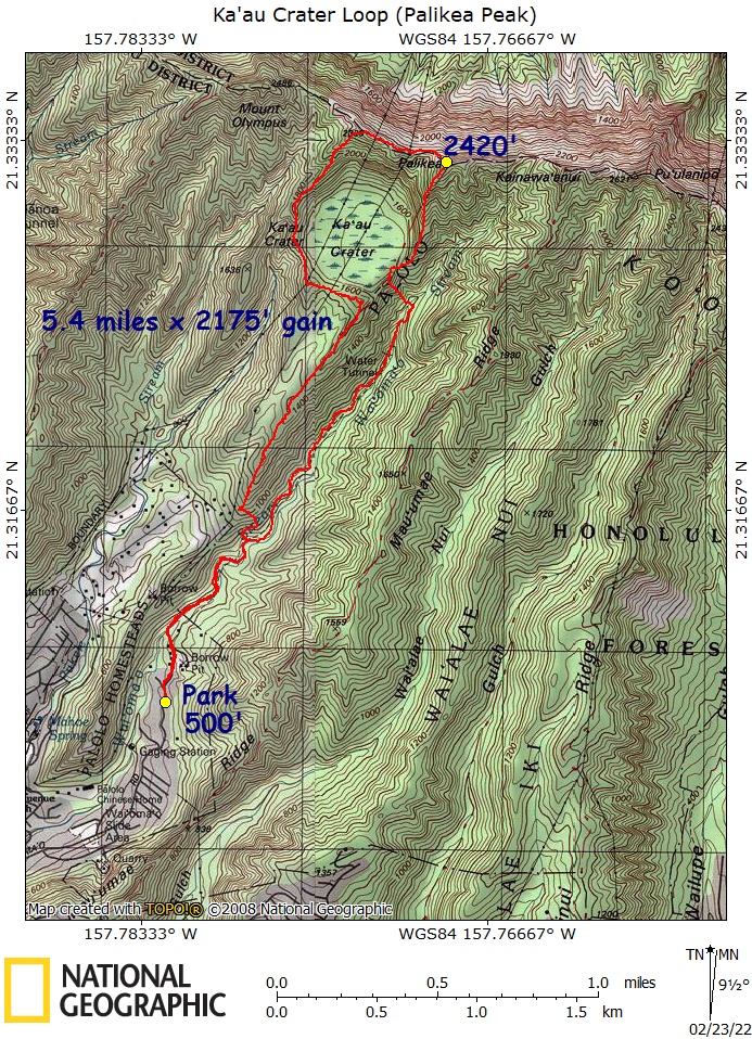
UTAH – Maps & Real GPS Tracks
Maze, The – Canyonlands National Park – Map – GPS Track
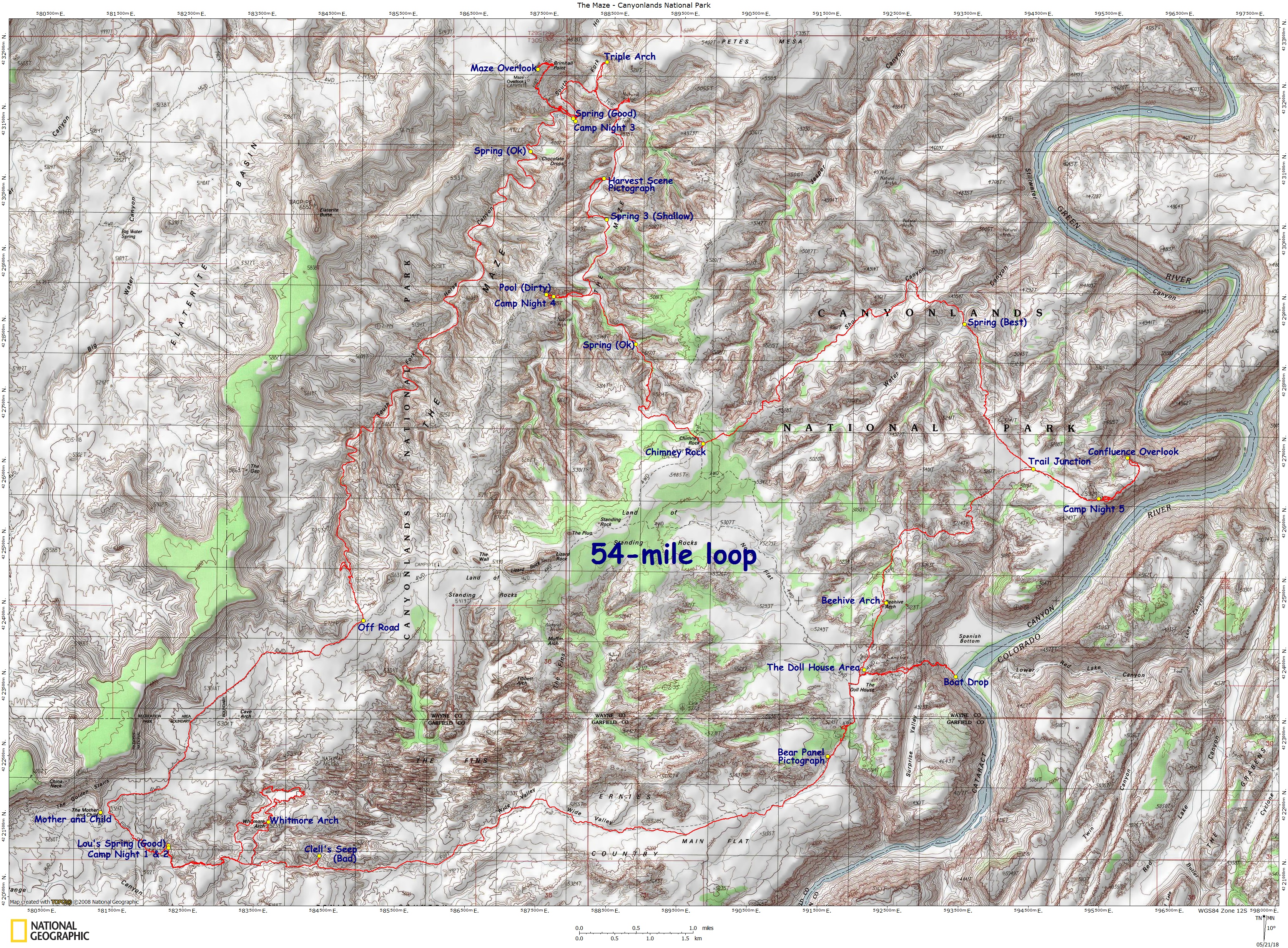
ARIZONA – Maps & Real GPS Tracks
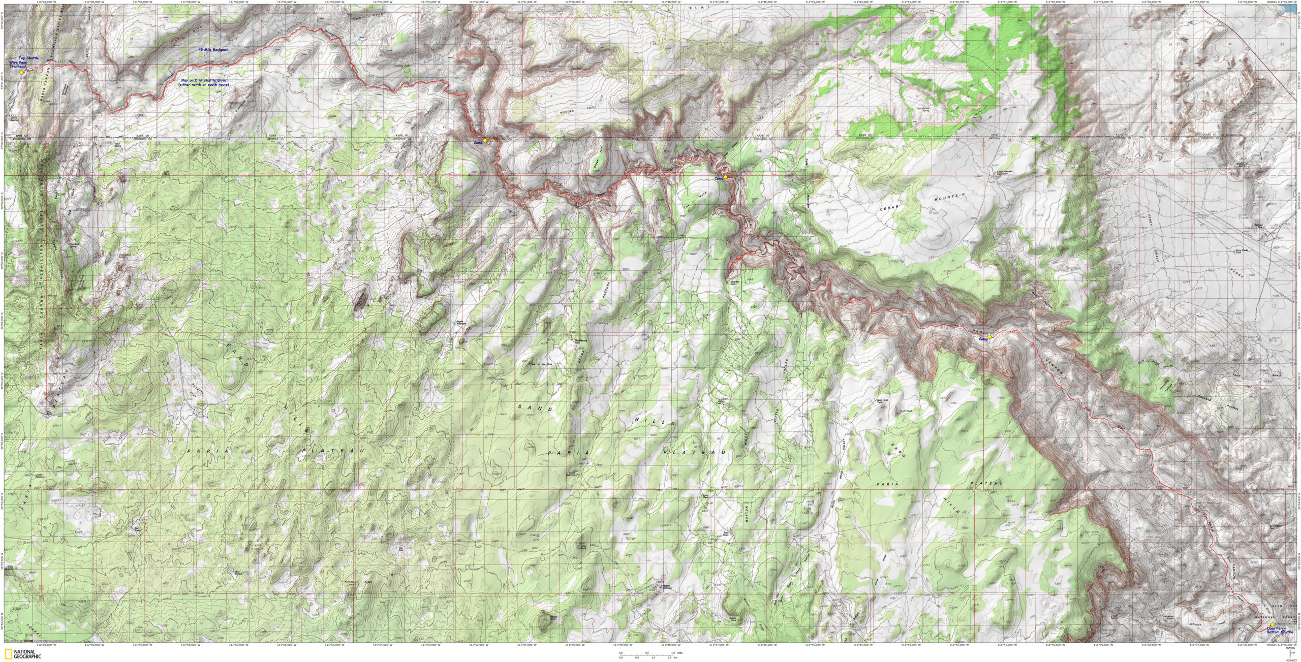
Paria Canyon Backpack – Map – GPS Track
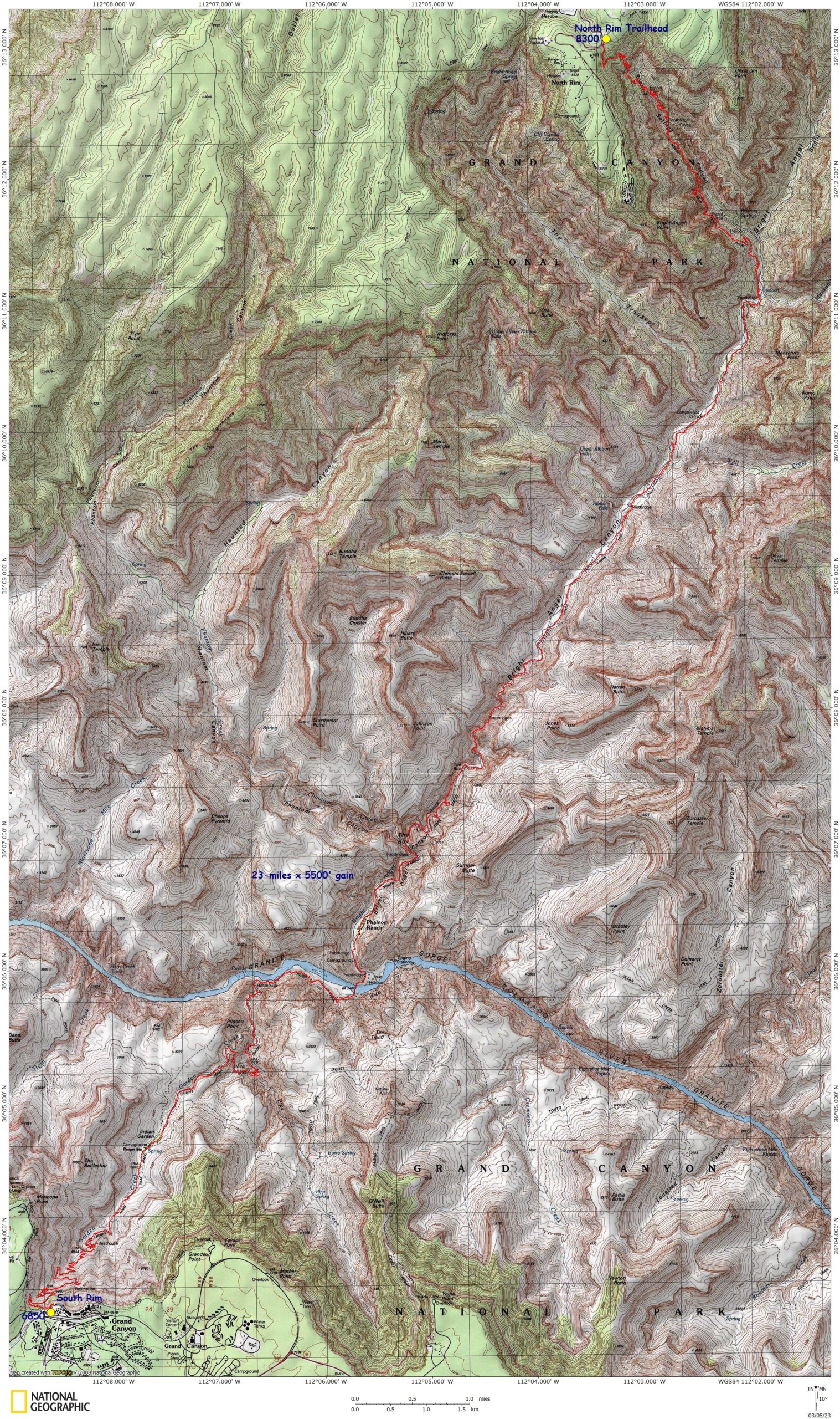
Grand Canyon Rim to Rim – Map – GPS Track
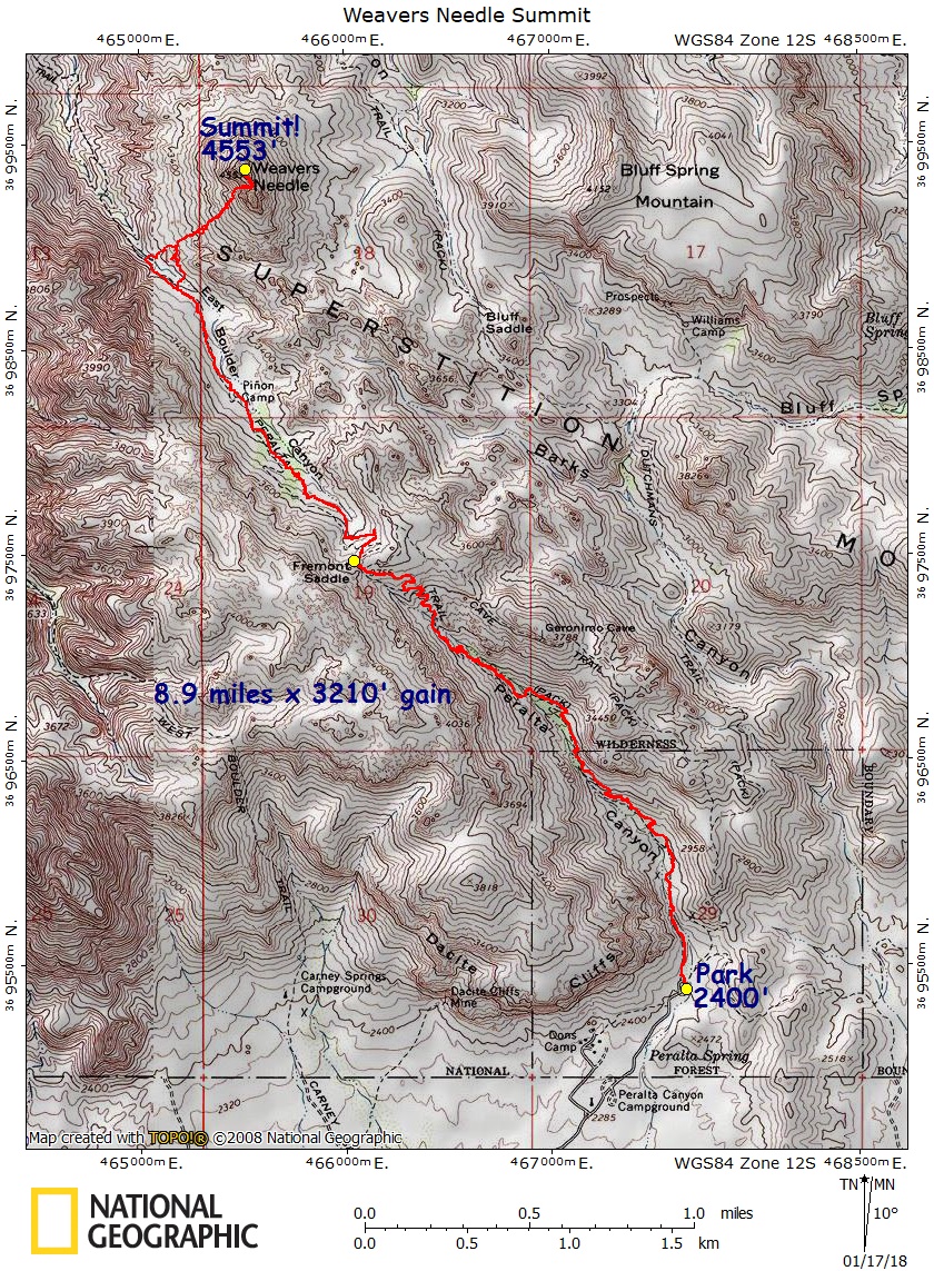
Weaver’s Needle – Map – GPS Track
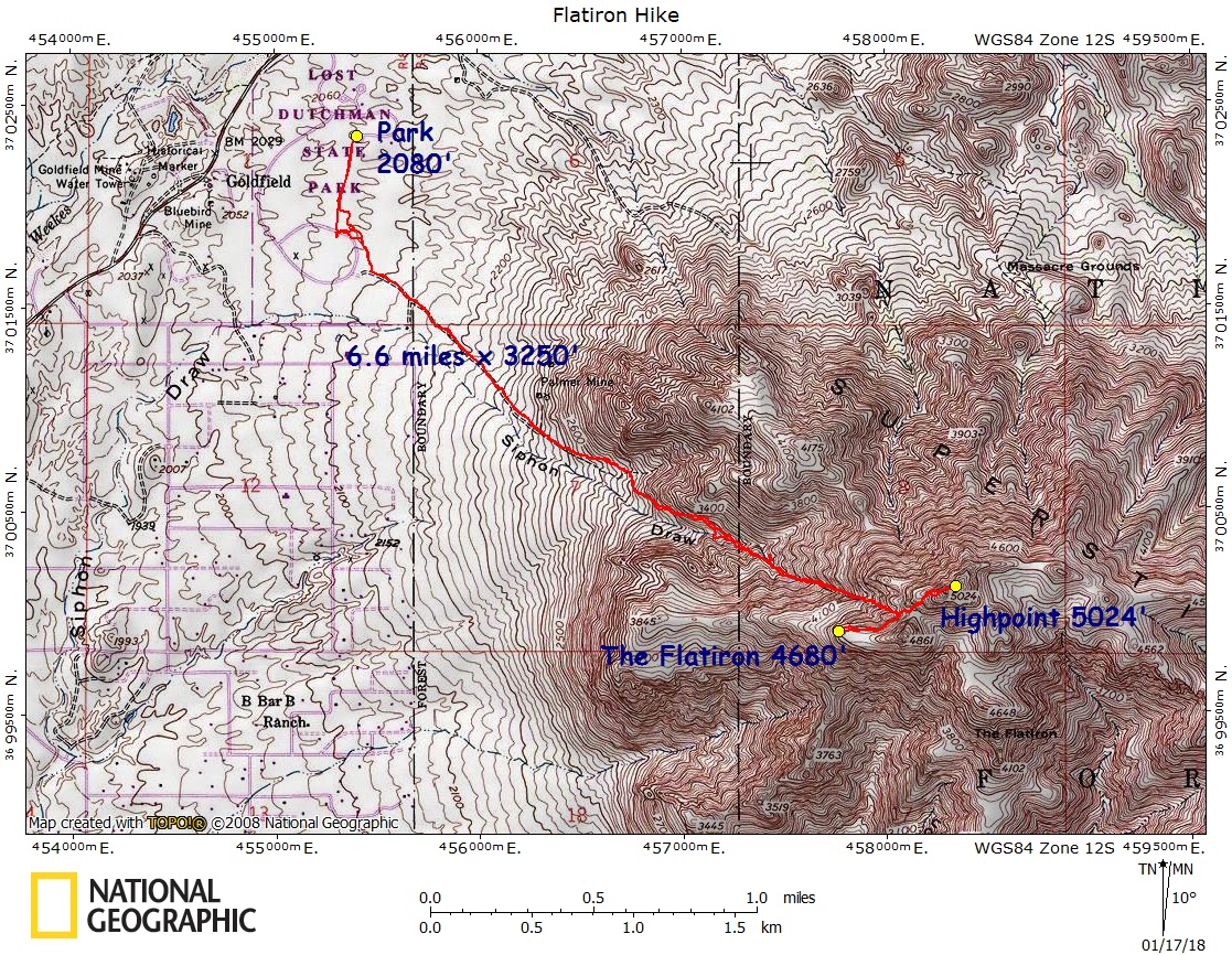
Flatiron Hike – Map – GPS Track
MISCELLANEOUS – Maps & Real GPS Tracks
Triple D Gorge Hike – Map – GPS Track
Mazama 16 Peaks challenge – GPS Tracks
Pingback: Alpine Lakes Wilderness Challenge Report - Seth Wolpin
Karl,
Found out about your site from the Mazamas ICS class, lecture on Navigation from John Godino. I am new to all this and was playing around with Gaia GPS on the cell phone and trying to download some GPX files. I can’t get your files off GPSfly.org. They download as a data file. I saw you had a post on the forum that asks the same question, but how do you take that downloaded data information and confert to a usable GPX?
This may be a bit late, but try downloading, and emailing to your self. Access the file from your phone, and open with Gaia.
Dude, you ROCK! Thanks for sharing!
Hi Carl,
I am a newbie. We recently climbed Mt. Shuksan and a bit frustrated because we lacked of route finding skills. I have a Garmin Inreach now so assume I have to download the the GPX file to somewhere first before I can drop it into my GPS map. Does it sound right?I am at work now and perhaps I can’t download anything. I will go home and try.